Barbuda
 | |
 | |
| Geography | |
|---|---|
| Location | Caribbean Sea |
| Coordinates | 17°37′N 61°48′W / 17.617°N 61.800°WCoordinates: 17°37′N 61°48′W / 17.617°N 61.800°W |
| Archipelago | Leeward Islands, Lesser Antilles |
| Area | 160.56 km2 (61.99 sq mi) |
| Highest elevation | 38 m (125 ft) |
| Highest point | Highlands |
| Administration | |
|
Antigua and Barbuda | |
| Largest settlement | Codrington (pop. 1,252) |
| Demographics | |
| Population | 1,638 (2011) |
| Pop. density | 10.2 /km2 (26.4 /sq mi) |
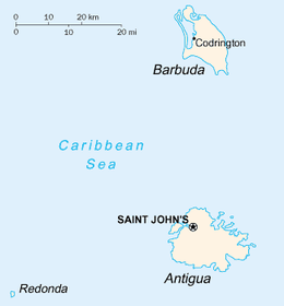
Barbuda is an island in the Eastern Caribbean, and forms part of the state of Antigua and Barbuda. It has a population of about 1,638 (at the 2011 Census), most of whom live in the town of Codrington.
Location
Barbuda is located north of Antigua, in the middle of the Leeward Islands. To the south are the islands of Montserrat and Guadeloupe, and to the west and north west are Nevis, St. Kitts, St. Barts, and St. Martin.
History
The Ciboney were the first to inhabit the island of Barbuda in 2400 BC, but Arawak and Carib Indians populated the island when Christopher Columbus landed on his second voyage in 1493. Early settlements by the Spanish and French were succeeded by the English, who formed a colony in 1666.
In 1685 Barbuda was leased to brothers Christopher and John Codrington, who had founded the town of Codrington. The Codrington family produced food on their land in Barbuda, and also transported slaves as labour for their sugarcane plantations on Antigua. There was more than one slave rebellion at Codrington during the 1740s, during which slaves rose against managers. All the slaves were freed in 1834.
Barbuda was for a time used by the Codringtons as a "nursery" for slaves.[1]
In 1719, Codrington and the island of Barbuda had its first census (of both people and livestock), conducted by Sir William Codrington (1715–1790).
The first map of Barbuda was made in the second half of the 18th century. At that time there were substantial buildings in the Highland area, a castle in Codrington, a fort at River, now known as the Martello Tower, and houses at Palmetto Point, Coco Point, and Castle Hill. The map shows eight catching pens for holding captured runaway slaves, indicating that this was a serious problem. There were several defensive cannon gun battery units around the island perimeter. There was a large plantation in the Meadow and Guava area and another large plantation in the Highlands area.
On November 1, 1981, the island gained its independence as an integral part of Antigua and Barbuda, a member of the Commonwealth of Nations. In a 1989 election the Barbuda Independence Movement received too few votes to qualify for a seat in the national parliament.
Points of interest
Barbuda is home to the Frigate Bird Sanctuary, which is located in the Codrington Lagoon. Other points of interest include Highland House (the 18th-century home of the Codrington family) and the Indian Cave, which contains ancient Amerindian petroglyphs.
Tourism
Barbuda's climate and geography is conducive to tourism. Many tourists are attracted by the island's beaches. Activities include a bird sanctuary, swimming, snorkeling, fishing, and caving. Only two operating resorts are located on the island, the rest are abandoned after poor management, difficult infrastructure and hurricane damage.[2]
Geography
The total land area is 160.56 km2. The capital and largest city is Codrington, with an estimated population of 1,000. The island is mostly coral limestone with little topographical variation. The "highlands" area on the eastern side of the island has hills rising to 125 ft (38 m), but the majority of the island is very flat, with many lagoons in the northwest corner.
Wildlife
The Antiguan racer It is among the rarest snakes in the world. The Lesser Antilles are home to four species of racers. All four have undergone severe range reductions; at least two subspecies are extinct and another, A. antiguae, now occupies only 0.1 per cent of its historical range.[3]
Griswold's ameiva (Ameiva griswoldi) is a species of lizard in the genus Ameiva. It is endemic to Antigua and Barbuda. It is found on both islands.
Climate
The climate is classified as tropical marine which means that there is little seasonal temperature variation. In January and February, the coolest months, the average daily high temperature is 27 °C (81 °F). While in July and August, the warmest months, the average daily high is 30 °C (86 °F).
References
- ↑ Barbudaful.net Retrieved 2009-01-23
- ↑ The Island of Barbuda Retrieved 2011-09-23
- ↑ Sajdaka, Richard A.; Henderson, Robert W. (1991). "Status of West Indian racers in the Lesser Antilles". Oyx. 25 (1): 33–38. Retrieved 12 June 2016.
External links
| Wikivoyage has a travel guide for Barbuda. |
| Wikimedia Commons has media related to Barbuda. |
 "Barbuda". Encyclopædia Britannica. 3 (11th ed.). 1911.
- Official site
| Parishes | ||
|---|---|---|
| Dependencies | ||