Baoshan, Yunnan
| Baoshan 保山市 | |
|---|---|
| Prefecture-level city | |
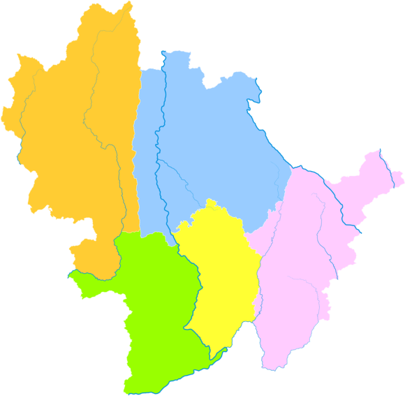
 Location of Baoshan in Yunnan | |
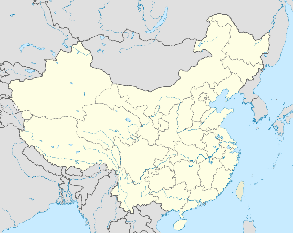 Baoshan Location in China | |
| Coordinates: 25°07′N 99°10′E / 25.117°N 99.167°E | |
| Country | People's Republic of China |
| Province | Yunnan |
| Admin HQ | Longyang |
| Area | |
| • Total | 19,040 km2 (7,350 sq mi) |
| Elevation | 1,677 m (5,502 ft) |
| Population (2010) | |
| • Total | 2,500,000 |
| • Density | 130/km2 (340/sq mi) |
| Time zone | China Standard (UTC+8) |
| Postal code | 678000 |
| Area code(s) | 0875 |
| Vehicle registration | 云M |
| Website |
baoshan |
![]() Baoshan (Chinese: 保山; pinyin: Bǎoshān, historically also Yongchang) is a prefecture-level city in western Yunnan province, People's Republic of China. Baoshan is the third biggest metropolitan area in Yunnan after Kunming and Qujing.
Baoshan (Chinese: 保山; pinyin: Bǎoshān, historically also Yongchang) is a prefecture-level city in western Yunnan province, People's Republic of China. Baoshan is the third biggest metropolitan area in Yunnan after Kunming and Qujing.
Demography
The prefecture has about 2.5 million inhabitants.
Administrative divisions
The city-prefecture of Baoshan has jurisdiction over five subdivisions - a district, one county-level city and three counties:
| Map | |||||
|---|---|---|---|---|---|
| Name | Hanzi | Hanyu Pinyin | Population (2003 est.) | Area (km²) | Density (/km²) |
| Longyang District | 隆阳区 | Lóngyáng Qū | 850,000 | 5,011 | 170 |
| Tengchong City | 腾冲市 | Téngchōng Shì | 610,000 | 5,845 | 104 |
| Shidian County | 施甸县 | Shīdiàn Xiàn | 330,000 | 2,009 | 164 |
| Longling County | 龙陵县 | Lónglíng Xiàn | 270,000 | 2,884 | 94 |
| Changning County | 昌宁县 | Chāngníng Xiàn | 340,000 | 3,888 | 87 |
Geography
It is located between the border of Myanmar and the Lancang river (Mekong). The Nujiang (Salween River) flows through the entire length of the prefecture, north to south.
Tempered by the low latitude and moderate elevation, Baoshan has a mild subtropical highland climate (Köppen Cwb), with short, mild, dry winters, and warm, rainy summers. Frost may occur in winter but the days still generally warm up to around 16 to 17 °C (61 to 63 °F), with a January average of 8.5 °C (47.3 °F). The warmest month is June, which averages 21.2 °C (70.2 °F). Nearly three-fourths of the annual rainfall occurs from June to October.
| Climate data for Baoshan (1971−2000) | |||||||||||||
|---|---|---|---|---|---|---|---|---|---|---|---|---|---|
| Month | Jan | Feb | Mar | Apr | May | Jun | Jul | Aug | Sep | Oct | Nov | Dec | Year |
| Record high °C (°F) | 21.7 (71.1) |
25.4 (77.7) |
26.7 (80.1) |
29.9 (85.8) |
32.2 (90) |
32.3 (90.1) |
30.9 (87.6) |
30.0 (86) |
29.7 (85.5) |
28.8 (83.8) |
25.2 (77.4) |
22.4 (72.3) |
32.3 (90.1) |
| Average high °C (°F) | 16.5 (61.7) |
18.0 (64.4) |
21.2 (70.2) |
23.7 (74.7) |
25.5 (77.9) |
25.5 (77.9) |
25.0 (77) |
25.7 (78.3) |
25.1 (77.2) |
23.4 (74.1) |
19.8 (67.6) |
17.3 (63.1) |
22.2 (72.0) |
| Daily mean °C (°F) | 8.5 (47.3) |
10.3 (50.5) |
13.4 (56.1) |
16.3 (61.3) |
19.5 (67.1) |
21.2 (70.2) |
21.0 (69.8) |
20.8 (69.4) |
19.6 (67.3) |
17.4 (63.3) |
13.0 (55.4) |
9.3 (48.7) |
15.9 (60.6) |
| Average low °C (°F) | 1.7 (35.1) |
3.3 (37.9) |
6.1 (43) |
9.9 (49.8) |
14.3 (57.7) |
18.1 (64.6) |
18.2 (64.8) |
17.8 (64) |
16.2 (61.2) |
13.2 (55.8) |
8.0 (46.4) |
3.2 (37.8) |
10.8 (51.5) |
| Record low °C (°F) | −3.8 (25.2) |
−2.6 (27.3) |
−1 (30) |
2.7 (36.9) |
7.4 (45.3) |
12.4 (54.3) |
13.1 (55.6) |
13.0 (55.4) |
10.7 (51.3) |
5.5 (41.9) |
0.7 (33.3) |
−2.3 (27.9) |
−3.8 (25.2) |
| Average precipitation mm (inches) | 15.7 (0.618) |
28.4 (1.118) |
38.2 (1.504) |
45.0 (1.772) |
69.9 (2.752) |
138.4 (5.449) |
157.4 (6.197) |
172.6 (6.795) |
147.5 (5.807) |
111.4 (4.386) |
51.1 (2.012) |
12.6 (0.496) |
988.2 (38.906) |
| Average precipitation days (≥ 0.1 mm) | 3.6 | 6.9 | 8.6 | 12.7 | 12.6 | 18.0 | 21.3 | 21.5 | 16.5 | 12.4 | 6.5 | 3.4 | 144.0 |
| Source: Weather China | |||||||||||||
Ethnic groups
Bulang
According to the Baoshan Ethnic Gazetteer (2006:337), ethnic Bulang are distributed in the following villages within Baoshan City.
- Shidian County
- Mulaoyuan 木老元乡: Mulaoyuan 木老元, Hazhai 哈寨, Dadi 大地, Longtang 龙塘
- Bailang Township 摆榔乡: Jici 鸡茨, Dazhong 大中, Jianshan 尖山
- Yaoguan Township 姚关乡: Duopo 陡坡
- Jiufang Township 酒房乡: Yakou 哑口
- Changning County
- Gengga Township 更嘎乡: Baicaolin 百草林, Dachushui 大出水
- Kasi Township 卡斯镇
- Xingu Village 新谷村: Guban 谷板, Zhongzhai 中寨
- Kasi Village 卡斯村: Shuanglong 双龙, Yingbaizhai 应百寨, Ergoudi 二沟地
De'ang
The Yaojing 尧净, a subgroup of the De'ang, are located in Baizhai 白寨, Laxian 拉线, and Dagoubian 大沟边 of Mangyan Village 芒颜村 and Shiti Village 石梯村 in Lujiang Township 潞江乡, Longyang District 隆阳区 (Baoshan Ethnic Gazetteer 2006:490-491).
Transport
Baoshan lies on the main road from Ruili on the Burmese border to Kunming. The Baoshan−Kunming section is completed highway, but the Ruili−Baoshan section remains incomplete.
Baoshan Airport (IATA Code: BSD) has daily flights to and from Kunming.
A railway line connecting the city via Dali to Kunming and the rest of China is under construction (2012).
See also
- Three Parallel Rivers of Yunnan Protected Areas - Unesco World Heritage Site
- Gaoligong Mountain
External links
- Baoshan City Official Site
- Baoshan Travel and Tourism Bureau (zh, en, ja)
- Baoshan News Network
- Baoshan profile
- Baoshan map
Yunnan topics | |
|---|---|
| General | |
| Geography | |
| Education | |
| Culture | |
| Cuisine |
|
| Visitor attractions | |
| |