Baldwin, Georgia
| Baldwin, Georgia | |
|---|---|
| City | |
|
Willingham Avenue in Baldwin | |
| Motto: "The Hub of Development in Northeast Georgia" | |
 Location in Banks County and the state of Georgia | |
| Coordinates: 34°29′27″N 83°33′10″W / 34.49083°N 83.55278°W | |
| Country | United States |
| State | Georgia |
| Counties | Habersham, Banks |
| Area | |
| • Total | 4.9 sq mi (12.7 km2) |
| • Land | 4.9 sq mi (12.7 km2) |
| • Water | 0 sq mi (0 km2) |
| Elevation | 1,529 ft (466 m) |
| Population (2010) | |
| • Total | 3,279 |
| • Density | 668/sq mi (258.0/km2) |
| Time zone | Eastern (EST) (UTC-5) |
| • Summer (DST) | EDT (UTC-4) |
| ZIP code | 30511 |
| Area code(s) | 706 |
| FIPS code | 13-04980[1] |
| GNIS feature ID | 0354438[2] |
| Website |
www |

Baldwin is a city in Banks and Habersham counties in the U.S. state of Georgia. As of the 2010 census, the city had a population of 3,279.[3]
Baldwin is located on U.S. Route 441 just south of Georgia State Route 365. Baldwin sits astride the Eastern Continental Divide, which separates waters flowing southeastward toward the Savannah River and the Atlantic Ocean from waters flowing southwestward toward the Chattahoochee River and the Gulf of Mexico. City Hall sits in Habersham County. Baldwin borders the bigger city of Cornelia, which has the Habersham Chamber of Commerce. Nearby in Demorest is Piedmont College. Also nearby is Lake Russell, a recreation area in Chattahoochee National Forest. The Habersham County airport is in Baldwin. The biggest employer is Fieldale Corporation, a large chicken processing company.
Geography
Baldwin is located in northeastern Georgia at 34°29′27″N 83°33′10″W / 34.490757°N 83.552643°WCoordinates: 34°29′27″N 83°33′10″W / 34.490757°N 83.552643°W.[4]
According to the United States Census Bureau, the city has a total area of 4.9 square miles (12.7 km2), all of it land.[5]
Demographics
| Historical population | |||
|---|---|---|---|
| Census | Pop. | %± | |
| 1900 | 130 | — | |
| 1910 | 280 | 115.4% | |
| 1920 | 193 | −31.1% | |
| 1930 | 319 | 65.3% | |
| 1940 | 402 | 26.0% | |
| 1950 | 490 | 21.9% | |
| 1960 | 698 | 42.4% | |
| 1970 | 772 | 10.6% | |
| 1980 | 1,080 | 39.9% | |
| 1990 | 1,439 | 33.2% | |
| 2000 | 2,425 | 68.5% | |
| 2010 | 3,279 | 35.2% | |
| Est. 2015 | 3,286 | [6] | 0.2% |
As of the census[1] of 2000, there were 2,425 people, 845 households, and 583 families residing in the city. The population density was 674.9 people per square mile (260.8/km²). There were 912 housing units at an average density of 253.8 per square mile (98.1/km²). The racial makeup of the city was 83.22% White, 3.71% African American, 0.33% Native American, 2.43% Asian, 0.82% Pacific Islander, 6.89% from other races, and 2.60% from two or more races. Hispanic or Latino of any race were 25.86% of the population.
There were 845 households out of which 36.6% had children under the age of 18 living with them, 51.2% were married couples living together, 12.4% had a female householder with no husband present, and 30.9% were non-families. 26.2% of all households were made up of individuals and 8.6% had someone living alone who was 65 years of age or older. The average household size was 2.71 and the average family size was 3.26.
In the city the population was spread out with 26.2% under the age of 18, 13.5% from 18 to 24, 29.4% from 25 to 44, 16.3% from 45 to 64, and 14.6% who were 65 years of age or older. The median age was 30 years. For every 100 females there were 97.3 males. For every 100 females age 18 and over, there were 90.1 males.
The median income for a household in the city was $29,299, and the median income for a family was $33,011. Males had a median income of $25,409 versus $21,823 for females. The per capita income for the city was $14,059. About 20.0% of families and 26.4% of the population were below the poverty line, including 32.5% of those under age 18 and 33.8% of those age 65 or over.
History
Our History
The City of Baldwin, Georgia was incorporated by an act of the Georgia General Assembly on December 17, 1896 on some 250 acres along the Banks / Habersham County line and resting on the Appalachian Continental Divide. It was originally known as Stonepile because of a large pile of stones that once stood in the center of town. The stone structure was erected and left behind by the Cherokee Indians who once roamed these lands in abundance. The stone piling’s significance to the Cherokee and why they left it remains a mystery and is now forever lost.
The land, which later became the location for the City of Baldwin, was purchased from the Cherokee Indians in 1804 by the State of Georgia in an effort to take in Wofford’s Settlement along Nancytown Creek. This land was a four-mile strip known as the Hawkins Line (sometimes called the “Four-Mile Purchase Line”). The Hawkins Line served as the established boundary between Georgia and the Cherokee Nation from 1804 to 1818.
During the early years of industrialization, many communities “sprung-up” around major resting areas for trains and their passengers- known as Depots. As a result, many small towns were established along the rail lines and received their names from prominent railroad officials. Baldwin was named after Joseph A. Baldwin, an Atlanta-Charlotte Air Line Railroad official who helped to construct much of Georgia’s vast rail network, one of which passed through this area.
Our Present and Future
Today, Baldwin’s city limits contains some 4.5 square miles split between Banks and Habersham County. It is located along two major arterial routes: US Highway 441 and State Highway 365- both of which are divided 4-lane highways. On the west side of town, State Route 365 becomes Interstate 985 approximately ½-mile south of the city limits.
Its frontage and relatively flat lands offer excellent opportunity for industrial and retail growth and development. On the eastside of town, US 441 offers some the most amazing vistas as you “lookout” across rolling mountains and picturesque valleys. Its landscape offers excellent opportunity for tourism-based businesses including convention centers, hotels, retail shops and restaurants. Baldwin is also home to the Habersham County Airport. The airport offers a 5,500-feet paved runway at 1,447 feet above sea level. It serves as the gateway airport to the Georgia Mountains with its central location in the foothills of the Blue Ridge Mountains.
These local business resources- along with the expansive beauty of our local natural resources- make Baldwin an ideal location for new business investments from the manufacturing and industrial sectors. More importantly, whether you’re an American based operation or an international corporation, Baldwin will make a great home for your new Corporate Headquarters. The City of Baldwin takes pride in being “The Hub of Development in Northeast Georgia.”
Current Statistical Data
According to Baldwin City Census 2010 results, the population of the area was approximately 3,279 people. This represents a population growth in the past decade of 35.2%.
In 2000, the median age for Baldwin residents was 30.5 years. The average household size was 2.71 persons and the average family size was 3.26 persons. The median household income was $29,299.
Just over sixty percent of Baldwin’s population is a high school graduate or higher. Twelve and half percent have a bachelor’s degree or higher.
The City of Baldwin also has a diverse workforce.
- •21.3% of our workforce is in management, professional and related occupations.
- •15.7% are in service occupations.
- •19.2% are in sales and office occupations.
- •1.5% are in agricultural occupations.
- •12.1% are in construction, extraction and maintenance occupations.
- •30.2% are in production, transportation and material moving occupations.
Baldwin’s cost of living is very reasonable with a COL index of 82.9 against a U.S. average of 100.0. Crime rates in Baldwin have decreased 53% since 2003, with zero violent crimes in 2009 (the latest reported figures). Baldwin’s crime index for 2009 was 77.0 against the U.S. average of 319.1 (a higher number equates to more crimes committed).
Baldwin is centrally located to three major hospitals:
- Habersham County Medical Center
- Stephens County Hospital
- Northeast Georgia Medical Center
Baldwin also has convenient access to a number of colleges and universities.
- University of Georgia (Athens, GA)
- University of North Georgia (Gainesville, GA & Dahlonega, GA)
- Brenau University (Gainesville, GA)
- Athens Technical College (Athens, GA)
- Georgia Gwinnett College (Gwinnett, GA)
- Piedmont College (Demorest, GA)
- Clemson University ( Clemson, SC)
- Tri-County Technical College (Pendleton, SC)
- North Georgia Technical College (Clarkesville, GA)
Planning for the Future
The City of Baldwin is committed to planning for the future. By understanding where we have been and knowing where we are today we can ensure a better future for the next generation. In 2007, the City of Baldwin began efforts to develop its Comprehensive Plan Update. This document provides three key planning elements: A Community Assessment with supporting data, a Community Participation Plan and a Community Agenda. The Assessment provides an overview of current conditions in the city and identifies key challenges being faced by our community.
The Community Participation Plan establishes a process for ensuring active public participation and involvement in developing a community vision, setting goals for the future and establishing the community’s agenda for the next decade. Finally, the Community Agenda serves as the City’s action plan for carrying out this new vision, achieving the goals and objectives as defined in the plan and it serves as a tool for measuring our success during the implementation phase.
External links
References
- 1 2 "American FactFinder". United States Census Bureau. Archived from the original on 2013-09-11. Retrieved 2008-01-31.
- ↑ "US Board on Geographic Names". United States Geological Survey. 2007-10-25. Retrieved 2008-01-31.
- ↑ http://factfinder2.census.gov/faces/tableservices/jsf/pages/productview.xhtml?pid=DEC_10_SF1_GCTP2.ST13&prodType=table
- ↑ "US Gazetteer files: 2010, 2000, and 1990". United States Census Bureau. 2011-02-12. Retrieved 2011-04-23.
- ↑ "Geographic Identifiers: 2010 Demographic Profile Data (G001): Baldwin city, Georgia". U.S. Census Bureau, American Factfinder. Retrieved October 29, 2013.
- ↑ "Annual Estimates of the Resident Population for Incorporated Places: April 1, 2010 to July 1, 2015". Retrieved July 2, 2016.
- ↑ "Census of Population and Housing". Census.gov. Archived from the original on May 11, 2015. Retrieved June 4, 2015.
Municipalities and communities of Banks County, Georgia, United States | ||
|---|---|---|
| Cities | 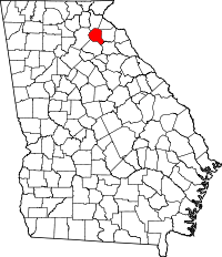 | |
| Towns | ||
| Unincorporated communities | ||
| Footnotes | ‡This populated place also has portions in an adjacent county or counties | |
Municipalities and communities of Habersham County, Georgia, United States | ||
|---|---|---|
| Cities | 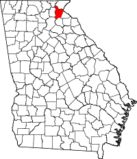 | |
| Towns | ||
| CDP | ||
| Unincorporated communities | ||
| Footnotes | ‡This populated place also has portions in an adjacent county or counties | |