Bahir Dar
| Bahir Dar ባሕር ዳር (Amharic) Bahar Dar | |
|---|---|
| City | |
|
The Bahir Dar city center | |
 Bahir Dar Location within Ethiopia | |
| Coordinates: 11°36′N 37°23′E / 11.600°N 37.383°E | |
| Country | Ethiopia |
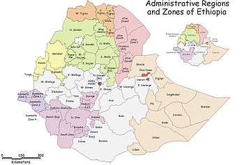
| Region | Amhara |
| Woreda | Bahir Dar |
| Area | |
| • Total | 28 km2 (11 sq mi) |
| Elevation | 1,800 m (5,900 ft) |
| Population (2012) | |
| • Total | 348,429 |
| • Density | 12,000/km2 (32,000/sq mi) |
| Time zone | EAT (UTC+3) |
| Area code(s) | (+251) 58 |

Bahir Dar or Bahar Dar (Amharic: ባሕር ዳር?, Baḥər Dar, "sea shore") is a city in north-western Ethiopia. It is the capital of the Amhara Region (kilil).
Administratively, Bahir Dar is a Special Zone, a designation in between a chartered city (astedader akabibi, a first-tier division, like a kilil) such as Addis Ababa and Dire Dawa, and cities like Debre Marqos and Dessie, which are organized as districts (woredas).
Bahir Dar is one of the leading tourist destinations in Ethiopia, with a variety of attractions in the nearby Lake Tana and Blue Nile river. The city is known for its wide avenues lined with palm trees and a variety of colorful flowers. In 2002 it was awarded the UNESCO Cities for Peace Prize for addressing the challenges of rapid urbanization.[1]
Geography
Bahir Dar is situated on the southern shore of Lake Tana, the source of the Blue Nile (or Abay), in what was previously the Gojjam province. The city is located approximately 578 km north-northwest of Addis Ababa, having a latitude and longitude of 11°36′N 37°23′E / 11.600°N 37.383°ECoordinates: 11°36′N 37°23′E / 11.600°N 37.383°E and an elevation of about 1,800 metres (5,906 feet) above sea level.
Climate
| Climate data for Bahir Dar (1981–2010) | |||||||||||||
|---|---|---|---|---|---|---|---|---|---|---|---|---|---|
| Month | Jan | Feb | Mar | Apr | May | Jun | Jul | Aug | Sep | Oct | Nov | Dec | Year |
| Record high °C (°F) | 37 (99) |
36 (97) |
36 (97) |
38 (100) |
38 (100) |
32 (90) |
30 (86) |
29 (84) |
29 (84) |
35 (95) |
35 (95) |
33 (91) |
38 (100) |
| Average high °C (°F) | 29 (84) |
31 (88) |
32 (90) |
32 (90) |
32 (90) |
29 (84) |
26 (79) |
25 (77) |
26 (79) |
27 (81) |
28 (82) |
28 (82) |
28.8 (83.8) |
| Average low °C (°F) | 8 (46) |
9 (48) |
11 (52) |
13 (55) |
13 (55) |
13 (55) |
13 (55) |
13 (55) |
12 (54) |
12 (54) |
10 (50) |
8 (46) |
11.3 (52.1) |
| Record low °C (°F) | 8 (46) |
8 (46) |
9 (48) |
5 (41) |
6 (43) |
10 (50) |
9 (48) |
8 (46) |
7 (45) |
7 (45) |
9 (48) |
6 (43) |
5 (41) |
| Average rainfall mm (inches) | 2 (0.08) |
2 (0.08) |
12 (0.47) |
28 (1.1) |
80 (3.15) |
205 (8.07) |
396 (15.59) |
375 (14.76) |
211 (8.31) |
87 (3.43) |
12 (0.47) |
6 (0.24) |
1,416 (55.75) |
| Average rainy days (≥ 0.1 mm) | 1 | 1 | 2 | 3 | 10 | 18 | 28 | 28 | 20 | 10 | 3 | 1 | 125 |
| Source #1: World Meteorological Organisation[2] | |||||||||||||
| Source #2: National Meteorology Agency (records)[3] | |||||||||||||
History
Imperial era
Bahir Dar's origins date to at least the sixteenth or seventeenth century; Pedro Páez is credited with erecting several buildings in this city, one of which is "a solid, two-storey stone structure, with an outside staircase" and can be seen in the compound of the present-day Giyorgis church.[4]
The next mention of Bahir Dar is from the mid-19th century, as the camping spot for the army of Emperor Tewodros II. Here his army suffered from cholera, forcing the Emperor to move his troops to Begemder. Despite the loss of life on the journey, by the time they reached Begemder, the army was free of the illness.[5] Arthur J. Hayes spent a few days in Bahir Dar in early February 1903, which he described as a village surrounded by a marsh of papyrus plants; nearby were "two or three huts" inhabited by the Weyto, an ethnic group which were considered outcasts by the Amhara, yet "proud of their isolation." Hayes also visited the local church, dedicated to Saint George, which was decorated with murals of the saint in combat and returned victoriously.[6]
During the Italian invasion, an Italian column moved from Gondar on 23 April 1937 and, after a rapid march, occupied Bahar Dar. The city was bombed by the Royal Air Force on 21–22 October 1940, and although the action made little damage it was a boost to Arbegnoch morale. After months of skirmishing with the British advance, the Italian garrison under the command of Colonel Torelli was recalled to Gondar by General Guglielmo Nasi, and began to evacuate the city on 27 April 1941.[5] One of Emperor Haile Selassie's palaces was located near the city, and the Emperor considered moving the national capital to the town.
On 15 June 1961 the Emperor inaugurated the new 226-meter-long highway bridge over the Abay, situated at about 3 km from Bahir Dar.[5]
Revolutionary and republican era
A Polytechnic Institute, built by the Soviet Union at a cost of Ethiopian Birr 2.9 million, opened in 1963, with courses in agricultural mechanics, industrial chemistry, electrical technology, wood-working and processing technology, textile technology and metal technology. Designed to accommodate 1,000 students, at the start in September the school had 21 Ethiopian teachers and 250 students of 8th grade level; by 1968 it had 619 students in four grades, with 51 teachers of whom 23 were expatriates.[5] During the Ethiopian Civil War, May 1988 the 603rd corp of the Third Revolutionary Army (TLA) made its headquarters at Bahir Dar. On 3–4 March 1990, the TLA abandoned Bahir Dar in disarray, blowing up the nearby bridge with several hundred soldiers which stopped the TPLF/EPRDF forces from occupying the city. However, the Ethiopian People's Revolutionary Democratic Front (EPRDF) claimed they had too few effectives in the area to capture the town at that time, and the Derg army reoccupied Bahir Dar a few days later.[5] The EPRDF gained permanent control of the city around 1810 hours on 23 February 1991, as one of the objectives of Operation Tewodros.[7]
The city, in honor of the Millennium celebrations, hosted a National Investment Bazaar and Trade Fair on 6–9 January 2007. Mulat Gezahegn, head of the Trade, Industry and Investment Promotion Coordination Office, told journalists that more than 150 local and foreign companies participated.[8]
Population
Demographics

Based on the 2007 Census conducted by the Central Statistical Agency of Ethiopia (CSA), Bahir Dar Special Zone has a total population of 221,991, of whom 108,456 are men and 113,535 women; 180,174 or 81.16% are urban inhabitants, the rest of population are living at rural kebeles around Bahir Dar. At the town of Bahir Dar there are 155,428 inhabitants; the rest of urban population is living at Meshenti, Tis Abay and Zege towns which are part of Bahir Dar Special Zone. As Philip Briggs notes, Bahir Dar "is not only one of the largest towns in Ethiopia, but also one of the fastest growing – the western outskirts have visibly expanded since the first edition of this guide was published in 1994."[9]
Ethnic and linguistic composition
The three largest ethnic groups reported in Bahir Dar Special Zone were the Amhara (96.23%), the Tigrayan (1.11%), and the Oromo (1.1%); all other ethnic groups made up 1.56% of the population. Amharic was spoken as a first language by 96.78%, and 1.01% spoke Oromiffa; the remaining 2.21% spoke all other primary languages reported. The 1994 national census reported a total population for Bahir Dar of 96,140 in 20,857 households, of whom 45,436 were men and 50,704 women. The three largest ethnic groups reported in the city were the Amhara (93.21%), the Tigrayan (3.98%), and the Oromo (0.7%); all other ethnic groups made up 2.11% of the population. Amharic was spoken as a first language by 95.52%, and 2.93% spoke Tigrinya; the remaining 1.55% spoke all other primary languages reported.
Religions

89.72% of the population said they practiced Ethiopian Orthodox Christianity, 8.47% were Muslim, and 1.62% were Protestants.[10]
The 1994 national census reported 87.53% practiced Ethiopian Orthodox Christianity, and 11.47% of the population said they were Muslim.[11]
The Ethiopian Catholics, who practice the Alexandrian Rite in Geez language, have a cathedral in the city, which is the episcopal see since 2015 of the Ethiopic Catholic Diocese of Bahir Dar–Dessie, one of the suffragan eparchies (dioceses) of the Ethiopian Catholic Archeparchy of Addis Abeba, a Metropolitanate sui juris.
Sites and culture


The city offers a small daily market and a very extensive weekly market. There are some music clubs in the city.
The Blue Nile Falls (Tis Issat) are located about 30 km to the south. Nowadays the amount of water running through the falls is being reduced and regulated, since the construction of a hydroelectric power dam. Nevertheless, the Blue Nile Falls are still one of the main tourist attractions of Bahir Dar, especially during the rainy season when the water level rises and the falls become greater.
Education
Bahir Dar is home to a number of universities and colleges. The most prominent of all is the Bahir Dar University, which projects an enrollment of over 40,000 students in the academic year beginning in October 2012.[12] Bahir Dar University is home to more than 40,000 students.
As part of political initiatives and development efforts in Africa, renewed interest in the higher education in Ethiopia has been the focus of partnerships between governmental and private funders. The Ethiopian university system has been noted as one of the “fastest growing” systems in the twenty-first century. [13]
Bahir Dar University, one of the largest universities in Ethiopia, has an enrollment of 45,000 students in 65 undergraduate and 67 graduate programs. A Council of Ministers regulation combined the Bahir Dar Polytechnic and Bahir Dar Teachers’ College in 2000 to establish the university. Supporting the country’s objective to attain a “middle income status” by 2025, a research priority has produced eleven research centers. within the university. [14]
As part of the US AID objective IR 3.2: Improved workforce skills development, an identified strategy of “…enhancing university partnerships with U.S. Universities to strengthen the capacity of Ethiopian Universities.” Primary and secondary education goals are supported by the university through teacher education programs designed to improve literacy rates, supporting employment and higher education opportunities for citizens.[15] Degrees in science and health support the effort to address Ethiopia’s inclusion as one of 57 countries on the health workforce crisis list. [16]
Alkan University College is located in Bahir Dar. The Institute of Land Administration was founded and located in Bahir Dar in 2006.
Transportation
_AN0457027.jpg)
Air transportation in Bahir Dar is served by the Bahir Dar Airport (ICAO code HABD and IATA BJR). Also known as the Ginbot Haya Airport, it has paved runways. Ethiopian Airlines operates daily flights through the facility, linking Bahir Dar and the capital, as well as with Gondar to the northwest. In December 2014 a new domestic airline TNA started flights to Bahir Dar but only on Mondays and Fridays.
Additionally, the city is also connected through roads (and buslines) to these cities. The most common and convenient way of traveling in Bahir Dar is cycling. Auto rickshaws and share taxis also provide transportation in the city. Intercity bus service is provided by the Selam Bus Line Share Company and Sky Bus Transport System which operates daily to and from the capital.
Sports
Association football is the most popular sport in Bahir Dar. The 60,000-capacity Bahir Dar Stadium and the 15,000-capacity Bahir Dar University Stadium are the main sports venues.
Twin towns – Sister cities
Bahir Dar is twinned with:
See also
- Ethiopian Airlines Flight 604 – an aircraft accident at the airport in 1988
Notes
- ↑ UNESCO Cities for Peace Prize, 2002
- ↑ "World Weather Information Service – Bahir Dar". World Meteorological Organization. Retrieved 27 July 2016.
- ↑ "Climate of City: Bahir Dar". National Meteorology Agency. Retrieved 27 July 2016.
- ↑ Richard Pankhurst, The Ethiopians (Oxford: Blackwell, 2001), p. 103
- 1 2 3 4 5 "Local History in Ethiopia" The Nordic Africa Institute website (accessed 12 February 2008)
- ↑ Hayes, The Source of the Blue Nile (London, 1905), pp. 142–144, 153. A photo Hayes took of the interior during his stay is published facing p. 154.
- ↑ Gebru Tareke, The Ethiopian Revolution: War in the Horn of Africa (New Haven: Yale University, 2009), p. 302
- ↑ "Bahirdar City to host trade fair marking Millennium celebrations" WIC (last accessed 30 November 2006)
- ↑ Philip Briggs, Guide to Ethiopia, third edition (Old Saybrook: Globe Pequot Press, 2003), p. 181. ISBN 1-84162-035-1
- ↑ Census 2007 Tables: Amhara Region Archived 14 November 2010 at the Wayback Machine., Tables 2.1, 2.4, 2.5, 3.1, 3.2 and 3.4.
- ↑ 1994 Population and Housing Census of Ethiopia: Results for Amhara Region, Vol. 1, part 1 Archived 15 November 2010 at the Wayback Machine., Tables 2.1, 2.11, 2.14, 2.17 (accessed 6 April 2009)
- ↑ "Bahir Dar University to enroll 40,000 students in regular, continuing and distance education." Capitalethiopia (capitalethiopia.com)
- ↑ Fischer, Karin. "Africa Attracts Renewed Attention From American Universities (pdf)". The Chronicle of Higher Education.
- ↑ O'Keeffe, Paul (2014-05-22). "Ethiopia crackdown on student protests taints higher education success". The Guardian. ISSN 0261-3077. Retrieved November 5, 2016.
- ↑ [usaid.gov "Country Development Cooperation Strategy 2011 – 2015, US Aid/Ethiopia."] Check
|url=value (help). Retrieved November 5, 2016. - ↑ "Ethiopia Visit | Hotels | Top Attractions | National Parks | Weather | Videos". ethiovisit.com. Retrieved November 5, 2016.
- ↑ "Sister Cities International (SCI)". Sister-cities.org. Retrieved 21 April 2013.
External links
| Wikivoyage has a travel guide for Bahir Dar. |
| Wikimedia Commons has media related to Bahar Dar. |
Zones of the Amhara Region | ||
|---|---|---|
| Current zones | ||
| Special woredas | ||