Bad Kreuznach (district)
| Bad Kreuznach | ||
|---|---|---|
| District | ||
| ||
 | ||
| Country |
| |
| State | Rhineland-Palatinate | |
| Capital | Bad Kreuznach | |
| Area | ||
| • Total | 863.72 km2 (333.48 sq mi) | |
| Population (31 December 2015)[1] | ||
| • Total | 156,821 | |
| • Density | 180/km2 (470/sq mi) | |
| Time zone | CET (UTC+1) | |
| • Summer (DST) | CEST (UTC+2) | |
| Vehicle registration | KH | |
| Website | kreis-badkreuznach.de | |
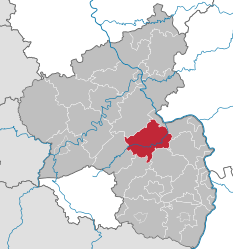
Bad Kreuznach is a district in Rhineland-Palatinate, Germany. It is bounded by (from the north and clockwise) the districts of Rhein-Hunsrück, Mainz-Bingen, Alzey-Worms, Donnersbergkreis, Kusel and Birkenfeld.
History
The region is full of medieval castles, especially along the Nahe River. Best known is the Kyrburg of Kirn, built in the 12th century and sitting in state above the river.
In 1815 the district of Kreuznach was established by the Prussian government. In 1932 it was merged with the district of Meisenheim. The name of the district officially changed from Kreuznach to Bad Kreuznach in 1969.
Geography
The district is located in the hilly country between the mountain chains of the Hunsrück in the north and the North Palatine Uplands in the south. The main axis of the district is the Nahe River, which enters the territory in the west, runs through Kirn, Bad Sobernheim and Bad Kreuznach, and leaves to the northeast.
The region formed by this district and the adjoining Birkenfeld district is known as the Naheland. The banks of the lower Nahe are used for vineyards. Away from the stream there are sparsely populated forests crisscrossed by the narrow affluents of the Nahe River.
Coat of arms
 |
The coat of arms displays:
|
Towns and municipalities
| Verband-free towns |
|---|
| Verbandsgemeinden | |||
|---|---|---|---|
|
[seat: Bad Kreuznach]
[seat: Bad Kreuznach] |
|
| |
| 1seat of the Verbandsgemeinde; 2town | |||
References
- ↑ "Gemeinden in Deutschland mit Bevölkerung am 31. Dezember 2015" (PDF). Statistisches Bundesamt (in German). 2016.
External links
| Wikimedia Commons has media related to Landkreis Bad Kreuznach. |
- Official website (German)
- Naheland touristical website (German, English)
- www.KH-lokal.de - local community with more than 1.800 links to homepages of Bad Kreuznach (district)
- A flickr-group with fotos of Bad Kreuznach (district)
Coordinates: 49°50′N 7°50′E / 49.83°N 7.83°E