Avon, Ohio
| Avon, Ohio | |
|---|---|
| City | |
 Location of Avon, Ohio | |
 Location of Avon in Lorain County | |
| Coordinates: 41°27′2″N 82°1′18″W / 41.45056°N 82.02167°WCoordinates: 41°27′2″N 82°1′18″W / 41.45056°N 82.02167°W | |
| Country | United States |
| State | Ohio |
| County | Lorain |
| Government | |
| • Mayor | Bryan Jensen |
| • Councilman, At-Large | Craig WItherspoon |
| Area[1] | |
| • Total | 20.87 sq mi (54.05 km2) |
| • Land | 20.81 sq mi (53.90 km2) |
| • Water | 0.06 sq mi (0.16 km2) |
| Elevation[2] | 670 ft (203 m) |
| Population (2010)[3] | |
| • Total | 21,193 |
| • Estimate (2012[4]) | 21,772 |
| • Density | 1,018.4/sq mi (393.2/km2) |
| Time zone | Eastern (EST) (UTC-5) |
| • Summer (DST) | EDT (UTC-4) |
| ZIP code | 44011 |
| Area code(s) | 440 |
| FIPS code | 39-03352[5] |
| GNIS feature ID | 1064365[2] |
| Website | http://www.cityofavon.com/ |
Avon is a city in Lorain County, Ohio, United States. The population was 21,193 at the 2010 census.
History
In the 1600s, what is now Avon, Avon Lake, Bay Village, and Westlake were all once one territory. This territory was inhabited by Natives, such as the Wyandots, Ottawas, and Eries, who lived in wigwams or simple-stone dwellings. They settled, traded, fought, and later moved elsewhere.
In the 1700s, the French and English colonial powers who lived here did the same activities as the Natives.
Township Number 7 in Range 16 of the Western Reserve received its first permanent American settlers during 1814 from Montgomery County, New York, led by Wilbur Cahoon.[lower-alpha 1] The township was administered by Dover township and was part of Cuyahoga County. In 1818, Township Number 7 was organized and named "Xeuma", then later renamed "Troy Township". In 1824, Lorain County was created, and the name of Troy Township was changed to Avon Township. An Avon post office was established in 1825. The entire township was incorporated into a village in 1917, and became the City of Avon in 1961.[7]
Geography
According to the United States Census Bureau, the city has a total area of 20.87 square miles (54.05 km2), of which 20.81 square miles (53.90 km2) is land and 0.06 square miles (0.16 km2) is covered by water.[1]
Demographics
| Historical population | |||
|---|---|---|---|
| Census | Pop. | %± | |
| 1920 | 1,460 | — | |
| 1930 | 1,826 | 25.1% | |
| 1940 | 2,118 | 16.0% | |
| 1950 | 2,773 | 30.9% | |
| 1960 | 6,002 | 116.4% | |
| 1970 | 7,214 | 20.2% | |
| 1980 | 7,241 | 0.4% | |
| 1990 | 7,337 | 1.3% | |
| 2000 | 11,446 | 56.0% | |
| 2010 | 21,193 | 85.2% | |
| Est. 2015 | 22,544 | [8] | 6.4% |
| Sources:[9][10][11][5][12] | |||
2010 census
As of the census[3] of 2010, 21,193 people, 7,584 households, and 5,750 families resided in the city. The population density was 1,018.4 inhabitants per square mile (393.2/km2). There were 8,007 housing units at an average density of 384.8 per square mile (148.6/km2). The racial makeup of the city was 92.4% White, 2.3% African American, 0.1% Native American, 3.1% Asian, 0.7% from other races, and 1.4% from two or more races. Hispanics or Latinos of any race were 3.4% of the population.
Of the 7,584 households, 42.9% had children under the age of 18 living with them, 65.2% were married couples living together, 7.9% had a female householder with no husband present, 2.7% had a male householder with no wife present, and 24.2% were not families. About 20.6% of all households were made up of individuals, and 8.9% had someone living alone who was 65 years of age or older. The average household size was 2.76 and the average family size was 3.23.
The median age in the city was 38.4 years; 30.5% of residents were under the age of 18; 4.1% were between the ages of 18 and 24; 27.3% were from 25 to 44; 25.4% were from 45 to 64; and 12.6% were 65 years of age or older. The gender makeup of the city was 48.4% male and 51.6% female.
Of the city's population over the age of 25, 49.4% hold a bachelor's degree or higher.[13]
2000 census
As of the census[5] of 2000, 11,446 people, 4,088 households, and 3,143 families lived in the city. The population density was 548.4 people per mi2 (211.8/km2). The 4,291 housing units averaged 205.6 per mi2 (79.4/km2). The racial makeup of the city was 97.02% White, 0.72% African American, 0.17% Native American, 1.03% Asian, 0.24% from other races, and 0.81% from two or more races. Hispanics or Latinos of any race were 1.28% of the population.

Of 4,088 households, 37.9% had children under the age of 18 living with them, 67.7% were married couples living together, 6.4% had a female householder with no husband present, and 23.1% were not families. About 19.7% of all households were made up of individuals, and 6.8% had someone living alone who was 65 years of age or older. The average household size was 2.72 and the average family size was 3.15.
In the city, the population was distributed as 27.6% under the age of 18, 4.7% from 18 to 24, 31.5% from 25 to 44, 23.8% from 45 to 64, and 12.4% who were 65 years of age or older. The median age was 38 years. For every 100 females, there were 94.9 males. For every 100 females age 18 and over, there were 92.6 males.
The median income for a household in the city was $66,747, and for a family was $75,951. Males had a median income of $53,973 versus $31,660 for females. The per capita income for the city was $28,334. About 1.0% of families and 1.9% of the population were below the poverty line, including 0.9% of those under age 18 and 2.5% of those age 65 or over.
Sports
All Pro Freight Stadium, opened June 3, 2009, is home to the Frontier League baseball team the Lake Erie Crushers. The Crushers won the 2009 Frontier League championship.
Avon is also home of the Avon Eagles, their high school sports team, who were state runners-up in football in 2011.
Notable people
- Al "Bubba" Baker, former NFL player
- Gene Hickerson, professional football Hall of Fame
- Chris Loschetter, professional bowler on the PBA Tour
- Alex Ramirez, outfielder for Yomiuri Giants of Nippon Professional Baseball, two-time MVP winner
- Connie Schultz, 2005 Pulitzer Prize-winning author and syndicated columnist.
- Harrison Williams, investor, entrepreneur, and multi-millionaire
Footnotes
- ↑ The Wilbur Cahoon House is listed in the U.S. National Register of Historic Places, reference №: 78002104[6]
References
- 1 2 "US Gazetteer files 2010". United States Census Bureau. Archived from the original on 2012-01-24. Retrieved 2013-01-06.
- 1 2 "US Board on Geographic Names". United States Geological Survey. 2007-10-25. Retrieved 2008-01-31.
- 1 2 "American FactFinder". United States Census Bureau. Retrieved 2013-01-06.
- ↑ "Population Estimates". United States Census Bureau. Archived from the original on 2013-06-17. Retrieved 2013-06-17.
- 1 2 3 "American FactFinder". United States Census Bureau. Archived from the original on 2013-09-11. Retrieved 2008-01-31.
- ↑ National Park Service (2009-03-13). "National Register Information System". National Register of Historic Places. National Park Service.
- ↑ About Avon Ohio avonohiohomes.com, retrieved June 26, 2014.
- ↑ "Annual Estimates of the Resident Population for Incorporated Places: April 1, 2010 to July 1, 2015". Retrieved July 2, 2016.
- ↑ "Population: Ohio" (PDF). 1930 US Census. U.S. Census Bureau. Retrieved 28 November 2013.
- ↑ "Number of Inhabitants: Ohio" (PDF). 18th Census of the United States. U.S. Census Bureau. Retrieved 22 November 2013.
- ↑ "Ohio: Population and Housing Unit Counts" (PDF). U.S. Census Bureau. Retrieved 22 November 2013.
- ↑ "Incorporated Places and Minor Civil Divisions Datasets: Subcounty Population Estimates: April 1, 2010 to July 1, 2012". U.S. Census Bureau. Archived from the original on 17 June 2013. Retrieved 25 November 2013.
- ↑ http://quickfacts.census.gov/qfd/states/39/3903352.html
 |
Sheffield Lake | Avon Lake | Bay Village | |
| Sheffield | |
Westlake | ||
| ||||
| | ||||
| Elyria | North Ridgeville | North Olmsted |
External links
| Wikivoyage has a travel guide for Avon (Ohio). |
Municipalities and communities of Lorain County, Ohio, United States | ||
|---|---|---|
| Cities | 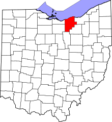 | |
| Villages | ||
| Townships | ||
| CDPs |
| |
| Unincorporated communities | ||
| Ghost town | ||
| Footnotes | ‡This populated place also has portions in an adjacent county or counties | |