Augrabies Falls National Park
| Augrabies Falls National Park | |
|---|---|
|
IUCN category II (national park) | |
|
The Augrabies Falls | |
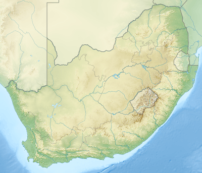 Location of the park | |
| Location | Northern Cape, South Africa |
| Nearest city | Upington |
| Coordinates | 28°35′28″S 20°20′18″E / 28.59111°S 20.33833°ECoordinates: 28°35′28″S 20°20′18″E / 28.59111°S 20.33833°E |
| Area | 820 km2 (320 sq mi) |
| Established | 1966 |
| Governing body | South African National Parks |
| http://www.sanparks.org/parks/augrabies/ | |

Augrabies Falls National Park is a national park located around the Augrabies Falls, about 120 km west of Upington[1] in the Northern Cape Province, South Africa. It was established in 1966.[2]
The Augrabies Falls National Park covers an area of 820 km²[3] and stretches along the Orange River. The area is very arid. The waterfall is about 60 metres high[4] and is awe-inspiring when the river is in flood. The gorge below the falls averages about 240 m deep and runs for 18 kilometres. The gorge provides an impressive example of erosion into a granitic basement.
The original Khoikhoi people named the waterfall Ankoerebis, meaning the "place of big noises".[5] The Trekboers who later settled in the area derived the name Augrabies. The name is sometimes spelt Aughrabies. There are many deposits of alluvial diamonds along the Orange River and legend has it that the biggest cache of diamonds in the world lies in the swirl-hole eroded into the granite at the foot of the waterfall by the thundering waters.[6]
The most characteristic plant in the park is the giant aloe (Aloe dichotoma) known locally as the quiver tree or kokerboom.[7] It is perfectly adapted to the dry semi-desert rocky areas found in the Nama-Karoo, able to withstand the extreme temperatures and the infertile soil. This tree, which grows up to five metres high, gets its name from the fact that the Bushmen (San) used the soft branches to make quivers for their arrows. The eye-catching silhouette of the quiver tree is typical of this part of Northern Cape landscape. When the tree flowers in the winter flocks of birds are attracted to their copious nectar, and baboons can be seen tearing the flowers apart to get the sweet liquor.
A prominent landmark in the park is Moon Rock, a large exfoliation dome measuring around 700 metres (2,300 ft) by 100 metres (330 ft) and 30 metres (98 ft) high.[1][8]
See also
References
- 1 2 Tony Pinchuck; Barbara McCrea; Donald Reid (2002). South Africa. Rough Guides. p. 323. ISBN 978-1-85828-853-6.
- ↑ Heather Du Plessis (1 January 2000). Tourism Destinations Southern Africa. Juta and Company Ltd. ISBN 978-0-7021-5272-6.
- ↑ "Augrabies Falls National Park (South African media online)". http://sanparks.africamediaonline.com/. Retrieved 30 July 2015. External link in
|website=(help) - ↑ "Augrabies Falls National Park". SA Places. Retrieved 30 July 2015.
- ↑ "Augrabies Falls National Park". Retrieved 30 July 2015.
- ↑ "Encounter South Africa: Augrabies Falls". Retrieved 30 July 2015.
- ↑ "Augrabies Falls, Northern Cape". Retrieved 30 July 2015.
- ↑ African Protected Area Conservation and Science (1997). "Popups on Moon Rock, Augrabies Falls National Park". Koedoe. 40 (2): 75–84. doi:10.4102/koedoe.v40i2.274. ISSN 0075-6458. Retrieved 12 July 2010.
External links
![]() Media related to Augrabies Falls National Park at Wikimedia Commons
Media related to Augrabies Falls National Park at Wikimedia Commons
| Wikivoyage has a travel guide for Augrabies Falls National Park. |