Auburn, Fond du Lac County, Wisconsin
| Auburn, Wisconsin | |
|---|---|
| Town | |
 Location of Auburn, Wisconsin | |
| Coordinates: 43°35′15″N 88°12′49″W / 43.58750°N 88.21361°WCoordinates: 43°35′15″N 88°12′49″W / 43.58750°N 88.21361°W | |
| Country | United States |
| State | Wisconsin |
| County | Fond du Lac |
| Area | |
| • Total | 35.8 sq mi (92.6 km2) |
| • Land | 35.2 sq mi (91.1 km2) |
| • Water | 0.6 sq mi (1.5 km2) |
| Elevation[1] | 968 ft (295 m) |
| Population (2000) | |
| • Total | 2,075 |
| • Density | 59.0/sq mi (22.8/km2) |
| Time zone | Central (CST) (UTC-6) |
| • Summer (DST) | CDT (UTC-5) |
| Zip code | 53010 (small portions of) nearby Kewaskum, Wisconsin's zip code 53040 |
| Area code(s) | 920 262 |
| FIPS code | 55-03750[2] |
| GNIS feature ID | 1582730[1] |
Auburn is a town in Fond du Lac County, Wisconsin, United States. The population was 2,075 at the 2000 census. The unincorporated communities of New Fane and New Prospect are located within Auburn. The ghost town of New Cassel was also located in Auburn.
Geography
According to the United States Census Bureau, the town has a total area of 35.8 square miles (92.6 km²), of which, 35.2 square miles (91.1 km²) of it is land and 0.6 square miles (1.5 km²) of it (1.59%) is water.
Demographics
As of the census[2] of 2000, there were 2,075 people, 732 households, and 603 families residing in the town. The population density was 59.0 people per square mile (22.8/km²). There were 758 housing units at an average density of 21.5 per square mile (8.3/km²). The racial makeup of the town was 97.98% White, 0.05% African American, 1.06% Native American, 0.14% Asian, 0.10% Pacific Islander, 0.34% from other races, and 0.34% from two or more races. Hispanic or Latino of any race were 0.96% of the population.
There were 732 households out of which 38.7% had children under the age of 18 living with them, 75.8% were married couples living together, 3.4% had a female householder with no husband present, and 17.5% were non-families. 13.0% of all households were made up of individuals and 4.0% had someone living alone who was 65 years of age or older. The average household size was 2.83 and the average family size was 3.11.
In the town the population was spread out with 26.5% under the age of 18, 6.9% from 18 to 24, 31.6% from 25 to 44, 25.3% from 45 to 64, and 9.8% who were 65 years of age or older. The median age was 37 years. For every 100 females there were 106.9 males. For every 100 females age 18 and over, there were 106.4 males.
The median income for a household in the town was $57,986, and the median income for a family was $60,174. Males had a median income of $38,464 versus $24,844 for females. The per capita income for the town was $21,013. About 1.0% of families and 1.3% of the population were below the poverty line, including none of those under age 18 and 5.1% of those age 65 or over.
References
- 1 2 "US Board on Geographic Names". United States Geological Survey. 2007-10-25. Retrieved 2008-01-31.
- 1 2 "American FactFinder". United States Census Bureau. Archived from the original on September 11, 2013. Retrieved 2008-01-31.
Municipalities and communities of Fond du Lac County, Wisconsin, United States | ||
|---|---|---|
| Cities | 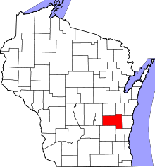 | |
| Villages | ||
| Towns | ||
| CDPs | ||
| Unincorporated communities |
| |
| Ghost towns | ||
| Footnotes | ‡This populated place also has portions in an adjacent county or counties | |