Atsuta-ku, Nagoya
| Atsuta 熱田区 | |
|---|---|
| Ward | |
| Atsuta Ward | |
|
Atsuta Shrine | |
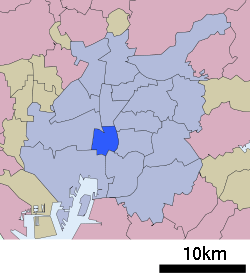 Location of Atsuta-ku in Nagoya | |
 Atsuta
| |
| Coordinates: 35°07′41″N 136°54′40″E / 35.12806°N 136.91111°ECoordinates: 35°07′41″N 136°54′40″E / 35.12806°N 136.91111°E | |
| Country | Japan |
| Region |
Tōkai region Chūbu region |
| Prefecture | Aichi |
| Area | |
| • Total | 8.13 km2 (3.14 sq mi) |
| Population (November 2011) | |
| • Total | 64,847 |
| • Density | 7,980/km2 (20,700/sq mi) |
| Time zone | Japan Standard Time (UTC+9) |
| - Tree | Round Leaf Holly (Ilex rotunda) |
| - Flower | Japanese iris [1] |
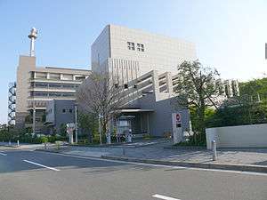
| Phone number | 052-961-1111 |
| Address | 3-1-15 Jingu, Atsuta-ku, Nagoya-shi, Aichi-ken 460-8508 |
| Website |
www |

Atsuta (熱田区 Atsuta-ku) is one of the 16 wards of the city of Nagoya in Aichi Prefecture, Japan. As of 2011, the ward had an estimated population of 64,847 and a population density of 7,980 persons per km². The total area was 8.13 km².
Geography
Atsuta Ward is located near the geographic center of Nagoya city.
Surrounding municipalities
History
The area of present-day Atsuta Ward was known since ancient times for its association with Atsuta Shrine. Atsuta Town in Aichi District was incorporated with the establishment of the municipality system in the early Meiji period. It was annexed to the city of Nagoya, initially as part of Minami Ward, and became Atsuta Ward in 1937.
Economy
Atsuta Ward is a major commercial center due to its proximity to the center of Nagoya metropolis. The rolling stock manufacturer Nippon Sharyo has its headquarters in the ward.
Education
Transportation
Railroads
- Central Japan Railway Company - Tōkaidō Main Line
- Meitetsu - Nagoya Main Line - Tokoname Line
- Nagoya Municipal Subway – Meijō Line
- Nagoya Municipal Subway – Meikō Line
Highways
- Japan National Route 1
- Japan National Route 19
- Japan National Route 22
- Japan National Route 154
- Japan National Route 19
- Japan National Route 247
Local attractions
- Atsuta Shrine – well known Shinto shrine
Noted people from Atsuta-ku, Nagoya
- Minamoto no Yoritomo – Kamakura-period warlord and Shogun
- Noriyuki Haga –motorcycle racer
- Yukiko Okada – Idol Singer
- Tamaasuka Daisuke – Sumo wrestler
References
| Wikimedia Commons has media related to Atsuta-ku, Nagoya. |
| Wards of Nagoya | ||
|---|---|---|
| Core cities | ||
| Special cities | ||
| Cities | ||
| Aichi District | ||
| Ama District | ||
| Chita District | ||
| Kitashitara District | ||
| Nishikasugai District | ||
| Niwa District | ||
| Nukata District | ||