Assenede
| Assenede | |||
|---|---|---|---|
| Municipality | |||
|
Assenede old town hall | |||
| |||
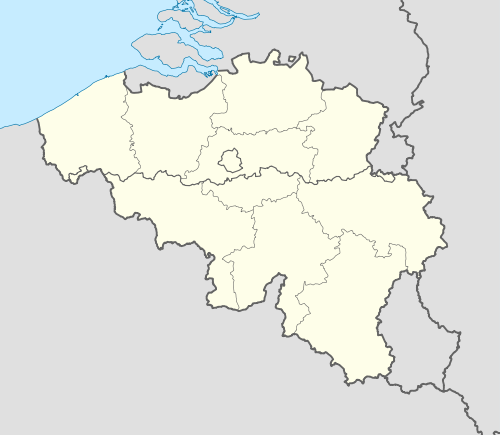 Assenede Location in Belgium | |||
|
Location of Assenede in East Flanders  | |||
| Coordinates: 51°14′N 03°45′E / 51.233°N 3.750°ECoordinates: 51°14′N 03°45′E / 51.233°N 3.750°E | |||
| Country | Belgium | ||
| Community | Flemish Community | ||
| Region | Flemish Region | ||
| Province | East Flanders | ||
| Arrondissement | Eeklo | ||
| Government | |||
| • Mayor | Philippe De Coninck | ||
| • Governing party/ies | Samenplus | ||
| Area | |||
| • Total | 87.22 km2 (33.68 sq mi) | ||
| Population (1 January 2016)[1] | |||
| • Total | 14,083 | ||
| • Density | 160/km2 (420/sq mi) | ||
| Postal codes | 9960, 9961, 9968 | ||
| Area codes | 09 | ||
| Website | www.assenede.be | ||


Assenede (Dutch pronunciation: [ˈɑsəneːdə]) is a municipality located in the Belgian province of East Flanders. The municipality comprises the towns of Assenede proper, Bassevelde, Boekhoute and Oosteeklo. On January 1, 2006 Assenede had a total population of 13,552. The total area is 87.22 km² which gives a population density of 155 inhabitants per km².
History
Assenede is one of the oldest villages in Flanders, the earliest mention of Assenede date back to as early as the 10th century.Rob Melchers,in 'De Beaufort' a thesis that is commercialised has done an enormous research on this matter and states that the year 963 is a first appearance in historic writings, but he is not the only source for this.
Local historic research is done by the amateursring"Twee Ambachten",local people without any high level education, but they did manage to unearth some important old settlements in the 'Gezusterspolder' an around het 'Holleken' here to dig up a crashed ww2 Messerschmidt aeroplane.
About the naming they came up with the statement under this.
"Ethnologically there is no consensus about the name Assenede. According to some sources the name comes from "essen aan de Ede". The "es" means "ash" and "Ede" was a medium size stream."
This is doubtful, dubious and probably untrue as there is no 'Ede' in Assenede,and could not be found or located on old maps or writings,furthermore,around the year 963 or a bit earlier the name Assenede was written as "Asnethe";....and 'Ede' cannot be derived from this.
Geography
Assenede is divided into two different types of soil, to the west most of the land is pure sand and called "Houtland"(woodland),and the side towards the northeast is mainly polder of the marsh-type because Assenede and Boekhoute were bordering the sea during the medieval years.The harbor in Assenede disappeared around 1500 but a smal canal called the 'Vliet' maintained some access to the Boekhouter 's harbor that existed much longer,and was present to around 1946.The last polderdyke was closed after that year.
The 'Vliet' is still present and can be found on Google earth, along with some big creeks that are wash-outs from the fight with the sea.
The creeks are nature reserves.
-

Border stone on the Belgian-Dutch border.
-

Assenede kerkpui
-

Church and kiosk in Bassevelde
-

War memorial in Oosteeklo
References
- ↑ Population per municipality as of 1 January 2016 (XLS; 397 KB)
External links
 Media related to Assenede at Wikimedia Commons
- (Dutch) Official website
- http://freepages.genealogy.rootsweb.ancestry.com/~noemeetjesland/meetjesland/ons_meetjesland/1980_1/St_Janskapel_in_St_Albertpolder.htm
 |
Sluis (NL-ZE) | Terneuzen (NL-ZE) | | |
| Sint-Laureins Kaprijke |
|
Terneuzen (NL-ZE) Zelzate | ||
| ||||
| | ||||
| Evergem |
