Arsuk
| Arsuk | |
|---|---|
|
Arsuk under the Kuunnaat mountain | |
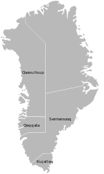
 Location within Greenland | |
| Coordinates: 61°10′30″N 48°27′00″W / 61.17500°N 48.45000°WCoordinates: 61°10′30″N 48°27′00″W / 61.17500°N 48.45000°W | |
| State |
|
| Constituent country |
|
| Municipality |
|
| First Settled | 1500 B.C.E. |
| Founded | 1805 |
| Government[1] | |
| • Mayor | Lars Albrechtsen |
| Population (2010) | |
| • Total | 156 |
| Time zone | UTC-03 |
| Postal code | 3940 Paamiut |

Arsuk is a village in the Sermersooq municipality in southwestern Greenland. It had 156 inhabitants in 2010.[2] The name of the settlement means the beloved place in the Greenlandic language.[3] The village is served by the communal all-purpose Pilersuisoq store.
Geography
Arsuk is located at the southern end of the Sermersooq municipality, on the coast of Labrador Sea near the mouth of the Arsuk Fjord in the southeast.[3] It is north of Cape Desolation, where the coastline of southwestern Greenland turns to the east approximately 30 km (18.6 mi) to the south of the settlement at the wide mouth of Alanngorsuaq Fjord. The 1,418 m (4,652.2 ft)[4] Kuunnaat mountain rises on the mainland directly to the north of the village.
History

The region was first settled by people of the Saqqaq culture arriving from the north.[3] The area was resettled by the Norse between the 10th century and the 14th century. Thule people were the second southbound Inuit migration, to arrive in the region in the 15th century,[3] with the area permanently settled since then.
The discovery of cryolite in Ivittuut in the inner parts of Arsuk Fjord attracted the interest of the Danes during the colonial era, leading to the formal foundation of the settlement in 1805.[4] The timber Lutheran church was built in 1830.[4]
The mines closed in 1987,[3] with the Ivittuut settlement abandoned soon thereafter, leaving Arsuk on the economic periphery despite its tourism potential.
Transport
Arsuk is a port of call for the Arctic Umiaq Line coastal ship, linking the village with Paamiut in the north (6.5 hours), and Qaqortoq in the southeast (9.5 hours),[5] both towns serviced by Air Greenland.[6]
Population
Most towns and settlements in southern Greenland exhibit negative growth patterns over the last two decades, with many settlements rapidly depopulating. Arsuk has been losing population for almost every year in the last two decades. It lost more than half of its population relative to the 1990 levels, over 10% relative to the 2000 levels.[7] The sharp decline in the 1990s was due to the mine closure and loss of employment. The weak growth in the late 2000s and stabilization of the population level prevented Arsuk from sharing the fate of Qassimiut, which lost more than two thirds of the population and is headed for abandonment − and that of Kangerluarsoruseq in the same municipality, which has already been abandoned in 2009.[7]

References
| Wikimedia Commons has media related to Arsuk. |
- ↑ Sermersooq Municipality (Danish)
- ↑ Statistics Greenland Archived July 21, 2011, at the Wayback Machine. (Danish)
- 1 2 3 4 5 arsukfjorden.gl (Danish) − frames required
- 1 2 3 O'Carroll, Etain (2005). Greenland and the Arctic. Lonely Planet. pp. 139–140. ISBN 1-74059-095-3.
- ↑ Arctic Umiaq Line Timetable 2009
- ↑ Air Greenland booking
- 1 2 3 Statistics Greenland Archived July 21, 2011, at the Wayback Machine.