Arrondissement of Saint-Quentin
| Saint-Quentin | |
|---|---|
| Arrondissement of France | |
 | |
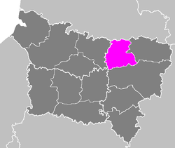 Location of Saint-Quentin in Picardy | |
| Country | France |
| Region | Hauts-de-France |
| Department | Aisne |
| Communes | 126 |
| Subprfecture | Saint-Quentin |
| Area¹ | |
| • Total | 1,071 km2 (414 sq mi) |
| Population (2013) | |
| • Total | 130,944 |
| • Density | 120/km2 (320/sq mi) |
| ¹ French Land Register data, which exclude lakes, ponds, and glaciers larger than 1 km² as well as the estuaries of rivers. | |
The arrondissement of Saint-Quentin is an arrondissement of France in the Aisne department in the Hauts-de-France region. It has 126 communes.
Composition
Cantons
The cantons of the arrondissement of Saint-Quentin are:
- Bohain-en-Vermandois
- Ribemont
- Saint-Quentin-1
- Saint-Quentin-2
- Saint-Quentin-3
Communes
The communes of the arrondissement of Saint-Quentin, and their INSEE codes are:
| 1. Alaincourt (02009) | 2. Annois (02019) | 3. Artemps (02025) |
| 4. Attilly (02029) | 5. Aubencheul-aux-Bois (02030) | 6. Aubigny-aux-Kaisnes (02032) |
| 7. Beaurevoir (02057) | 8. Beauvois-en-Vermandois (02060) | 9. Becquigny (02061) |
| 10. Bellenglise (02063) | 11. Bellicourt (02065) | 12. Benay (02066) |
| 13. Berthenicourt (02075) | 14. Bohain-en-Vermandois (02095) | 15. Bony (02100) |
| 16. Brancourt-le-Grand (02112) | 17. Bray-Saint-Christophe (02117) | 18. Brissay-Choigny (02123) |
| 19. Brissy-Hamégicourt (02124) | 20. Castres (02142) | 21. Caulaincourt (02144) |
| 22. Cerizy (02149) | 23. Chevresis-Monceau (02184) | 24. Châtillon-sur-Oise (02170) |
| 25. Clastres (02199) | 26. Contescourt (02214) | 27. Croix-Fonsomme (02240) |
| 28. Cugny (02246) | 29. Dallon (02257) | 30. Douchy (02270) |
| 31. Dury (02273) | 32. Essigny-le-Grand (02287) | 33. Essigny-le-Petit (02288) |
| 34. Estrées (02291) | 35. Fayet (02303) | 36. Fieulaine (02310) |
| 37. Flavy-le-Martel (02315) | 38. Fluquières (02317) | 39. Fonsommes (02319) |
| 40. Fontaine-Notre-Dame (02322) | 41. Fontaine-Uterte (02323) | 42. Fontaine-lès-Clercs (02320) |
| 43. Foreste (02327) | 44. Francilly-Selency (02330) | 45. Fresnoy-le-Grand (02334) |
| 46. Gauchy (02340) | 47. Germaine (02343) | 48. Gibercourt (02345) |
| 49. Gouy (02352) | 50. Gricourt (02355) | 51. Grugies (02359) |
| 52. Happencourt (02367) | 53. Hargicourt (02370) | 54. Harly (02371) |
| 55. Hinacourt (02380) | 56. Holnon (02382) | 57. Homblières (02383) |
| 58. Itancourt (02387) | 59. Jeancourt (02390) | 60. Joncourt (02392) |
| 61. Jussy (02397) | 62. La Ferté-Chevresis (02306) | 63. Lanchy (02402) |
| 64. Le Catelet (02143) | 65. Le Verguier (02782) | 66. Lehaucourt (02374) |
| 67. Lempire (02417) | 68. Lesdins (02420) | 69. Levergies (02426) |
| 70. Ly-Fontaine (02446) | 71. Magny-la-Fosse (02451) | 72. Maissemy (02452) |
| 73. Marcy (02459) | 74. Mesnil-Saint-Laurent (02481) | 75. Mont-d'Origny (02503) |
| 76. Montbrehain (02500) | 77. Montescourt-Lizerolles (02504) | 78. Montigny-en-Arrouaise (02511) |
| 79. Morcourt (02525) | 80. Moÿ-de-l'Aisne (02532) | 81. Mézières-sur-Oise (02483) |
| 82. Nauroy (02539) | 83. Neuville-Saint-Amand (02549) | 84. Neuvillette (02552) |
| 85. Ollezy (02570) | 86. Omissy (02571) | 87. Origny-Sainte-Benoite (02575) |
| 88. Parpeville (02592) | 89. Pithon (02604) | 90. Pleine-Selve (02605) |
| 91. Pontru (02614) | 92. Pontruet (02615) | 93. Prémont (02618) |
| 94. Ramicourt (02635) | 95. Regny (02636) | 96. Remaucourt (02637) |
| 97. Remigny (02639) | 98. Renansart (02640) | 99. Ribemont (02648) |
| 100. Roupy (02658) | 101. Rouvroy (02659) | 102. Saint-Quentin (02691) |
| 103. Saint-Simon (02694) | 104. Savy (02702) | 105. Seboncourt (02703) |
| 106. Sequehart (02708) | 107. Serain (02709) | 108. Seraucourt-le-Grand (02710) |
| 109. Sissy (02721) | 110. Sommette-Eaucourt (02726) | 111. Surfontaine (02732) |
| 112. Séry-lès-Mézières (02717) | 113. Thenelles (02741) | 114. Trefcon (02747) |
| 115. Tugny-et-Pont (02752) | 116. Urvillers (02756) | 117. Vaux-en-Vermandois (02772) |
| 118. Vendelles (02774) | 119. Vendeuil (02775) | 120. Vendhuile (02776) |
| 121. Vermand (02785) | 122. Villeret (02808) | 123. Villers-Saint-Christophe (02815) |
| 124. Villers-le-Sec (02813) | 125. Étaves-et-Bocquiaux (02293) | 126. Étreillers (02296) |
Sub-prefects
- Paul Joseph Boudier (1854-1908) : 1885
External links
Coordinates: 49°51′N 3°16′E / 49.850°N 3.267°E
This article is issued from Wikipedia - version of the 11/18/2016. The text is available under the Creative Commons Attribution/Share Alike but additional terms may apply for the media files.