Arcipelago di La Maddalena National Park
| Parco Nazionale dell'Arcipelago di La Maddalena | |
|---|---|
|
IUCN category II (national park) | |
|
Maddalena Archipelago | |
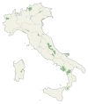
 Maddalena Location of Maddalena National Park | |
| Location | Sardegna |
| Coordinates | 41°14′45″N 9°24′43″E / 41.24583°N 9.41194°ECoordinates: 41°14′45″N 9°24′43″E / 41.24583°N 9.41194°E |
| Area | 201.46 km2 (77.78 sq mi) |
| Established | 1994 |
| Governing body | Ministero dell'Ambiente |
| http://www.parks.it/parco.nazionale.arcip.maddalena/Epar.php | |
Arcipelago di La Maddalena National Park is a geomarine national park on the coast of Sardinia.[1] The park was established on 1 April 1994, followed by the change of DPR on 17 May 1996. It covers an area on land and sea of over 12,000 hectares and 180 kilometers of coasts. This region includes all the islands and islets within the territory of the Municipality of La Maddalena, Italy. The territory of the National Park will also represent an important part of the Bocche di Bonifacio international marine park which will soon be established.[2]
Spargi isle in the La Maddalena National Park
See also
References
External links
This article is issued from Wikipedia - version of the 11/19/2016. The text is available under the Creative Commons Attribution/Share Alike but additional terms may apply for the media files.

