DeSoto County, Florida
| DeSoto County, Florida | ||
|---|---|---|
 DeSoto County Courthouse | ||
| ||
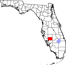 Location in the U.S. state of Florida | ||
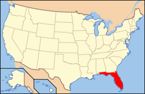 Florida's location in the U.S. | ||
| Founded | May 19, 1887 | |
| Named for | Hernando de Soto | |
| Seat | Arcadia | |
| Largest city | Arcadia | |
| Area | ||
| • Total | 639 sq mi (1,655 km2) | |
| • Land | 637 sq mi (1,650 km2) | |
| • Water | 2.4 sq mi (6 km2), 0.4% | |
| Population (est.) | ||
| • (2015) | 35,458 | |
| • Density | 55/sq mi (21/km²) | |
| Congressional district | 17th | |
| Time zone | Eastern: UTC-5/-4 | |
| Website |
www | |


DeSoto County is a county located in the U.S. state of Florida. As of the 2010 census, the population was 34,862.[1] Its county seat is Arcadia, Florida.[2]
DeSoto County comprises the Arcadia, FL Micropolitan Statistical Area, which is included in the North Port-Sarasota, FL Combined Statistical Area.
History
DeSoto County was created in 1887 from Manatee County. It was named for Spanish explorer Hernando de Soto, whose name was also honored in Hernando County.[3]
DeSoto County originally included several other present-day counties until 1921, when the Florida legislature created the following new counties: Charlotte, Glades, Hardee, and Highlands.
During World War II, DeSoto County operated the Carlstrom Field Air Base, which provided training for both American and British pilots. Twenty-three British pilots were killed while training at the base and are honored at DeSoto County's Oak Ridge Cemetery, which is located in the town of Arcadia. In 1945, the base turned out its last cadets and was decommissioned. The base was then sold to the State of Florida for one dollar and later converted into a mental health facility known as G. Pierce Wood Memorial Hospital. The hospital has since been converted into a facility for juvenile offenders. The facility was closed and is now up for sale.
On August 13, 2004, Hurricane Charley passed directly through DeSoto County. Hurricane-force winds persisted for an hour, damaging most of the structures in the county and causing some to be completely destroyed.
Geography
According to the U.S. Census Bureau, the county has a total area of 639 square miles (1,660 km2), of which 637 square miles (1,650 km2) is land and 2.4 square miles (6.2 km2) (0.4%) is water.[4]
Adjacent counties
- Hardee County, Florida - north
- Highlands County, Florida - east
- Glades County, Florida - southeast
- Charlotte County, Florida - south
- Sarasota County, Florida - west
- Manatee County, Florida - northwest
Demographics
| Historical population | |||
|---|---|---|---|
| Census | Pop. | %± | |
| 1890 | 4,944 | — | |
| 1900 | 8,047 | 62.8% | |
| 1910 | 14,200 | 76.5% | |
| 1920 | 25,434 | 79.1% | |
| 1930 | 7,745 | −69.5% | |
| 1940 | 7,792 | 0.6% | |
| 1950 | 9,242 | 18.6% | |
| 1960 | 11,683 | 26.4% | |
| 1970 | 13,060 | 11.8% | |
| 1980 | 19,039 | 45.8% | |
| 1990 | 23,865 | 25.3% | |
| 2000 | 32,209 | 35.0% | |
| 2010 | 34,862 | 8.2% | |
| Est. 2015 | 35,458 | [5] | 1.7% |
| U.S. Decennial Census[6] 1790-1960[7] 1900-1990[8] 1990-2000[9] 2010-2015[1] | |||
As of the census[10] of 2000, there were 32,209 people, 10,746 households, and 7,672 families residing in the county. The population density was 50 people per square mile (20/km²). There were 13,608 housing units at an average density of 21 per square mile (8/km²). The racial makeup of the county was 73.33% White, 12.72% Black or African American, 1.59% Native American, 0.41% Asian, 0.04% Pacific Islander, 10.49% from other races, and 1.43% from two or more races. 24.90% of the population were Hispanic or Latino of any race.
2005 estimates showed the population as being 56.3% non-Hispanic white, 31.4% Latino, 11.8% African-American and 2.9% Native American. (Source=http://quickfacts.census.gov/qfd/states/12/12027.html)
In 2000 there were 10,746 households out of which 26.50% had children under the age of 18 living with them, 55.50% were married couples living together, 10.30% had a female householder with no husband present, and 28.60% were non-families. 21.00% of all households were made up of individuals and 11.40% had someone living alone who was 65 years of age or older. The average household size was 2.70 and the average family size was 3.00.
In the county the population was spread out with 22.70% under the age of 18, 11.20% from 18 to 24, 26.70% from 25 to 44, 20.50% from 45 to 64, and 19.00% who were 65 years of age or older. The median age was 36 years. For every 100 females there were 128.30 males. For every 100 females age 18 and over, there were 134.70 males.
The median income for a household in the county was $30,714, and the median income for a family was $34,726. Males had a median income of $22,572 versus $20,004 for females. The per capita income for the county was $14,000. About 14.20% of families and 23.60% of the population were below the poverty line, including 31.50% of those under age 18 and 7.30% of those age 65 or over.
Politics
Voter Registration
According to the Secretary of State's office, Democrats are a plurality of registered voters in DeSoto County.
| DeSoto County Voter Registration & Party Enrollment as of September 30, 2015[11] | |||||
|---|---|---|---|---|---|
| Political Party | Total Voters | Percentage | |||
| Democratic | 7,198 | 48.41% | |||
| Republican | 4,449 | 29.92% | |||
| Independent | 2,973 | 19.99% | |||
| Third Parties | 250 | 1.68% | |||
| Total | 14,870 | 100% | |||
Statewide Elections
| Year | Republican | Democratic | Third Parties |
|---|---|---|---|
| 2012 | 56.51% 5,587 | 42.22% 4,174 | 1.28% 126 |
| 2008 | 55.41% 5,632 | 43.12% 4,383 | 1.47% 149 |
| 2004 | 58.09% 5,524 | 41.15% 3,913 | 0.76% 73 |
| 2000 | 54.48% 4,256 | 42.51% 3,321 | 3.01% 235 |
| 1996 | 43.71% 3,272 | 43.01% 3,219 | 13.28% 994 |
| 1992 | 41.32% 3,070 | 35.62% 2,646 | 23.06% 1,713 |
| Year | Republican | Democratic | Third Parties |
|---|---|---|---|
| 2014 | 49.00% 3,681 | 43.85% 3,294 | 7.15% 537 |
| 2010 | 53.10% 3,667 | 41.80% 2,887 | 5.10% 352 |
| 2006 | 57.41% 3,785 | 39.48% 2,603 | 3.11% 205 |
| 2002 | 54.47% 3,951 | 44.28% 3,212 | 1.25% 91 |
| 1998 | 61.67% 3,711 | 38.15% 2,296 | 0.18% 11 |
| 1994 | 54.40% 3,407 | 45.60% 2,856 | 0.00% 0 |
Library
DeSoto County is part of the Heartland Library Cooperative which has 7 branches that serve DeSoto County and some of the surrounding counties, including Glades, Highlands, Hardee, and Okeechobee.
- Avon Park
- DeSoto
- Glades
- Hardee
- Lake Placid
- Okeechobee
- Sebring
Local media
Newspaper
The Charlotte Sun produces a section dedicated to Desoto County called The Arcadian. Locally, the section is offered as a standalone for residential delivery.
Television
Desoto County is part of the Fort Myers/Naples DMA. Almost all stations from Fort Myers and Naples are receivable within the county, as well as some stations from the Tampa/St. Petersburg/Sarasota DMA. There was formerly a low-power television station, WALM-LD on channel 34. However, the station is currently silent, and is not receivable on television sets.
Radio
DeSoto County has three radio stations licensed to locations within the county:
WFLN (1480 AM NewsRadio - News/Talk) WZSP (105.3 FM La Zeta - Mexican)
Communities

City
Census-designated place
Unincorporated communities
- Brownville
- Fort Ogden
- Hull
- Lake Suzy
- Nocatee
- Hidden Acres
Ghost town
Transportation
Airports
Arcadia Municipal Airport is the only public-use airport in DeSoto County.
Major highways
I-75 runs only a short section in the very southwestern tip of the county and has no major junctions within the county.
See also
References
- 1 2 "State & County QuickFacts". United States Census Bureau. Retrieved February 12, 2014.
- ↑ "Find a County". National Association of Counties. Retrieved 2011-06-07.
- ↑ Publications of the Florida Historical Society. Florida Historical Society. 1908. p. 31.
- ↑ "US Gazetteer files: 2010, 2000, and 1990". United States Census Bureau. 2011-02-12. Retrieved 2011-04-23.
- ↑ "County Totals Dataset: Population, Population Change and Estimated Components of Population Change: April 1, 2010 to July 1, 2015". Retrieved July 2, 2016.
- ↑ "U.S. Decennial Census". United States Census Bureau. Retrieved June 13, 2014.
- ↑ "Historical Census Browser". University of Virginia Library. Retrieved June 13, 2014.
- ↑ "Population of Counties by Decennial Census: 1900 to 1990". United States Census Bureau. Retrieved June 13, 2014.
- ↑ "Census 2000 PHC-T-4. Ranking Tables for Counties: 1990 and 2000" (PDF). United States Census Bureau. Retrieved June 13, 2014.
- ↑ "American FactFinder". United States Census Bureau. Retrieved 2011-05-14.
- ↑ http://dos.myflorida.com/elections/data-statistics/voter-registration-statistics/voter-registration-monthly-reports/voter-registration-current-by-county/
External links
| Wikimedia Commons has media related to DeSoto County, Florida. |
Government links/Constitutional offices
- DeSoto County Board of County Commissioners official website
- DeSoto County Supervisor of Elections
- DeSoto County Property Appraiser
- DeSoto County Sheriff's Office
- DeSoto County Tax Collector
- DeSoto County Economic Development Office
Special districts
- DeSoto County Public Schools
- Southwest Florida Water Management District
- Heartland Library Cooperative
Judicial branch
- Office of the State Attorney, 12th Judicial Circuit of Florida serving DeSoto, Manatee, and Sarasota counties
- Circuit and County Court for the 12th Judicial Circuit of Florida
Tourism links
Computer Services
- Ducoda Technologies database design services, custom software solutions.
Medical Services
Media
- WFLM-AM (1480 WFLN Newsradio)
- WZZS-FM (106.9 The Bull)
- WZSP-FM (105.3 La Zeta)
- DeSoto County News and The Arcadian historical newspapers for DeSoto County are openly accessible in the Florida Digital Newspaper Library
 |
Manatee County | Hardee County | | |
| Sarasota County | |
Highlands County | ||
| ||||
| | ||||
| Charlotte County | Glades County |
Municipalities and communities of DeSoto County, Florida, United States | ||
|---|---|---|
| City | | |
| CDP | ||
| Unincorporated communities | ||
| Ghost town | ||
Coordinates: 27°11′N 81°49′W / 27.19°N 81.81°W