Ararat Township, Susquehanna County, Pennsylvania
| Ararat | |
|---|---|
| Township | |
 Location of Ararat Township in Susquehanna County | |
 Ararat Location of Ararat Township in Pennsylvania | |
| Coordinates: 41°48′27″N 75°30′56″W / 41.80750°N 75.51556°WCoordinates: 41°48′27″N 75°30′56″W / 41.80750°N 75.51556°W | |
| Country | United States |
| State | Pennsylvania |
| County | Susquehanna |
| Settled | 1810 |
| Incorporated | 1852 |
| Area | |
| • Total | 19.25 sq mi (49.9 km2) |
| • Land | 18.6 sq mi (48 km2) |
| • Water | 0.65 sq mi (1.7 km2) |
| Population (2010) | |
| • Total | 563 |
| • Density | 29/sq mi (11/km2) |
| Time zone | EST (UTC-5) |
| • Summer (DST) | EDT (UTC-4) |
| Zip Code | 18465 |
| Area code(s) | 570 |
Ararat Township is a township in Susquehanna County, Pennsylvania, United States. The population was 563 at the 2010 census.
History
Ararat Township was formed in 1852 from portions of Herrick, Thomson, and Gibson Twps.[1] The Ararat Summit Station was a stop on the Jefferson Branch of the Erie Railroad.[2]
Geography
According to the United States Census Bureau, the township has a total area of 19.25 square miles (49.9 km2), of which, 18.6 square miles (48 km2) of it is land and 0.65 square miles (1.7 km2) of it (3.38%) is water.
Communities
The following villages are located in Ararat Township:
Demographics
2000 census
As of the census[7] of 2000, there were 531 people, 218 households, and 151 families residing in the township. The population density was 28.0 people per square mile (10.8/km²). There were 452 housing units at an average density of 23.9/sq mi (9.2/km²). The racial makeup of the township was 98.49% White, 0.19% African American, 0.38% Asian, 0.19% from other races, and 0.75% from two or more races. Hispanic or Latino of any race were 0.38% of the population.
There were 218 households out of which 27.1% had children under the age of 18 living with them, 61.0% were married couples living together, 3.7% had a female householder with no husband present, and 30.7% were non-families. 25.2% of all households were made up of individuals and 11.9% had someone living alone who was 65 years of age or older. The average household size was 2.44 and the average family size was 2.91.
In the township the population was spread out with 22.4% under the age of 18, 6.8% from 18 to 24, 24.9% from 25 to 44, 29.0% from 45 to 64, and 16.9% who were 65 years of age or older. The median age was 43 years. For every 100 females there were 110.7 males. For every 100 females age 18 and over, there were 107.0 males.
The median income for a household in the township was $30,278, and the median income for a family was $34,063. Males had a median income of $36,429 versus $21,875 for females. The per capita income for the township was $14,793. About 18.6% of families and 22.5% of the population were below the poverty line, including 34.5% of those under age 18 and 13.3% of those age 65 or over.
2010 census
As of the census[8] of 2010, there were 563 people, 246 households, and 155 families residing in the township. The population density was 30.3 people per square mile (11.7/km²). There were 478 housing units at an average density of 25.7/sq mi (10/km²). The racial makeup of the township was 98.3% White, 0.4% African American, 0.4% American Indian, 0.2% Asian, 0.5% from other races, and 0.2% from two or more races. Hispanic or Latino of any race were 1.8% of the population.
There were 246 households out of which 25.2% had children under the age of 18 living with them, 54.1% were married couples living together, 5.7% had a female householder with no husband present, and 37% were non-families. 30.5% of all households were made up of individuals and 15% had someone living alone who was 65 years of age or older. The average household size was 2.29 and the average family size was 2.85.
In the township the population was spread out with 19.9% under the age of 18, 60.9% from 18 to 64, and 19.2% who were 65 years of age or older. The median age was 46 years.
The median income for a household in the township was $52,639, and the median income for a family was $57,857. Males had a median income of $32,500 versus $27,813 for females. The per capita income for the township was $21,389. About 7.8% of families and 15.1% of the population were below the poverty line, including 14.7% of those under age 18 and 12.5% of those age 65 or over.
References
- ↑ "Township Incorporations, 1790 to 1853". Susquehanna County Historical Society. Archived from the original on June 23, 2015. Retrieved 12 February 2016.
- ↑ "County Information". Susquehanna County Historical Society. Retrieved 12 February 2016.
- 1 2 3 "ARARAT: SECOND CLASS TOWNSHIP MAP" (PDF). Pennsylvania Department of Transportation. Commonwealth of Pennsylvania. 4 November 1999. Retrieved 20 November 2014.
- ↑ "Ararat". Geographic Names Information System. United States Geological Survey. 2 August 1979. Retrieved 20 November 2014.
- ↑ "Burnwood". Geographic Names Information System. United States Geological Survey. 2 August 1979. Retrieved 20 November 2014.
- ↑ "East Ararat". Geographic Names Information System. United States Geological Survey. 2 August 1979. Retrieved 20 November 2014.
- ↑ "American FactFinder". United States Census Bureau. Archived from the original on September 11, 2013. Retrieved 2008-01-31.
- ↑ "American FactFinder". United States Census Bureau. Archived from the original on September 11, 2013. Retrieved 2011-05-14.
Municipalities and communities of Susquehanna County, Pennsylvania, United States | ||
|---|---|---|
| Boroughs | 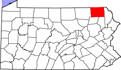 | |
| Townships | ||
| Unincorporated community | ||