Calhoun County, Alabama
| Calhoun County, Alabama | |
|---|---|
 Calhoun County courthouse in Anniston | |
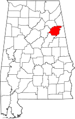 Location in the U.S. state of Alabama | |
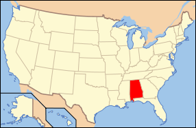 Alabama's location in the U.S. | |
| Founded |
December 18, 1832 as Benton County |
| Named for | John C. Calhoun |
| Seat | Anniston |
| Largest city | Anniston |
| Area | |
| • Total | 612 sq mi (1,585 km2) |
| • Land | 606 sq mi (1,570 km2) |
| • Water | 6.4 sq mi (17 km2), 1.0% |
| Population (est.) | |
| • (2015) | 115,620 |
| • Density | 191/sq mi (74/km²) |
| Congressional district | 3rd |
| Time zone | Central: UTC-6/-5 |
| Website |
www |
|
Footnotes:
| |
Calhoun County is a county in the U.S. state of Alabama. As of the 2010 census, the population was 118,572.[1] Its county seat is Anniston.[2] Its name is in honor of John C. Calhoun, famous member of the United States Senate from South Carolina.
Calhoun County is included in the Anniston-Oxford Metropolitan Statistical Area.
History
Benton County was established on December 18, 1832, named for Thomas Hart Benton, a member of the United States Senate from Missouri, with its county seat at Jacksonville. Benton, a slave owner, was a political ally of John C. Calhoun, another slaveholder and a U.S. senator from South Carolina. Through the 1820s-1840s, however, Benton's and Calhoun's political interests diverged, with Calhoun increasingly using secession as a weapon to maintain and expand slavery throughout the United States. Benton, on the other hand, was slowly coming to the conclusion that slavery was wrong and that preservation of the union was paramount. On January 29, 1858, Alabama supporters of slavery, objecting to Benton's change of heart, renamed Benton County as Calhoun County. The county seat was moved to Anniston after years of controversy and a State Supreme Court ruling in June 1900. An F4 tornado struck here on Palm Sunday March 27, 1994. It destroyed Piedmont's Goshen United Methodist Church twelve minutes after the National Weather Service of Birmingham issued a tornado warning for northern Calhoun, southeastern Etowah, and southern Cherokee.
Geography
According to the U.S. Census Bureau, the county has a total area of 612 square miles (1,590 km2), of which 606 square miles (1,570 km2) is land and 6.4 square miles (17 km2) (1.0%) is water.[3]
Adjacent counties
- Cherokee County - northeast
- Cleburne County - east
- Talladega County - south
- St. Clair County - west
- Etowah County - northwest
National protected areas
Transportation
Major highways
Rail
Demographics
| Historical population | |||
|---|---|---|---|
| Census | Pop. | %± | |
| 1840 | 14,260 | — | |
| 1850 | 17,163 | 20.4% | |
| 1860 | 21,539 | 25.5% | |
| 1870 | 13,980 | −35.1% | |
| 1880 | 19,591 | 40.1% | |
| 1890 | 33,835 | 72.7% | |
| 1900 | 34,874 | 3.1% | |
| 1910 | 39,115 | 12.2% | |
| 1920 | 47,822 | 22.3% | |
| 1930 | 55,611 | 16.3% | |
| 1940 | 63,319 | 13.9% | |
| 1950 | 79,539 | 25.6% | |
| 1960 | 95,878 | 20.5% | |
| 1970 | 103,092 | 7.5% | |
| 1980 | 119,761 | 16.2% | |
| 1990 | 116,034 | −3.1% | |
| 2000 | 112,249 | −3.3% | |
| 2010 | 118,572 | 5.6% | |
| Est. 2015 | 115,620 | [4] | −2.5% |
| U.S. Decennial Census[5] 1790–1960[6] 1900–1990[7] 1990–2000[8] 2010–2015[1] | |||
As of the census[9] of 2010, there were 118,572 people, 47,331 households, and 31,609 families residing in the county. The population density was 194 people per square mile (75/km2). There were 53,289 housing units at an average density of 87 per square mile (34/km2). The racial makeup of the county was 74.9% White, 20.6% Black or African American, 0.5% Native American, 0.7% Asian, 0.1% Pacific Islander, 1.6% from other races, and 1.7% from two or more races. 3.3% of the population were Hispanic or Latino of any race.
There were 47,331 households out of which 26.7% had children under the age of 18 living with them, 46.8% were married couples living together, 15.2% had a female householder with no husband present, and 33.2% were non-families. 27.7% of all households were made up of individuals and 10.2% had someone living alone who was 65 years of age or older. The average household size was 2.44 and the average family size was 2.97.
In the county the population was spread out with 22.9% under the age of 18, 10.9% from 18 to 24, 24.8% from 25 to 44, 27.1 % from 45 to 64, and 14.3% who were 65 years of age or older. The median age was 38.2 years. For every 100 females there were 93.1 males. For every 100 females age 18 and over, there were 94.8 males.
The median income for a household in the county was $38,407, and the median income for a family was $49,532. Males had a median income of $41,599 versus $29,756 for females. The per capita income for the county was $20,574. About 15.2% of families and 19.5% of the population were below the poverty line, including 26.8% of those under age 18 and 10.9% of those age 65 or over.
Politics
| Year | GOP | DEM | Others |
|---|---|---|---|
| 2016 | 68.6% 32,803 | 27.6% 13,197 | 3.8% 1,754 |
| 2012 | 65.5% 30,272 | 33.5% 15,500 | 1.0% 468 |
| 2008 | 65.7% 32,348 | 33.2% 16,334 | 1.1% 560 |
| 2004 | 65.9% 29,814 | 33.3% 15,083 | 0.8% 352 |
| 2000 | 57.3% 22,306 | 40.6% 15,781 | 2.1% 822 |
| 1996 | 49.0% 18,088 | 42.6% 15,725 | 8.4% 3,098 |
| 1992 | 48.2% 20,623 | 38.4% 16,453 | 13.4% 5,724 |
| 1988 | 58.3% 19,806 | 36.7% 12,451 | 5.0% 1,711 |
| 1984 | 61.2% 23,291 | 33.5% 12,752 | 5.4% 2,039 |
| 1980 | 49.2% 17,475 | 47.9% 17,017 | 2.9% 1,049 |
| 1976 | 36.0% 11,763 | 62.6% 20,466 | 1.4% 471 |
| 1972 | 76.9% 20,364 | 22.0% 5,832 | 1.0% 275 |
| 1968 | 11.4% 3,061 | 15.5% 4,146 | 73.0% 19,568 |
| 1964 | 63.1% 10,635 | 0.0% 0 | 36.9% 6,210 |
| 1960 | 33.0% 4,821 | 65.6% 9,590 | 1.5% 218 |
Calhoun is a staunchly Republican county in Presidential and Congressional elections. The last Democrat to win a majority in the county was Jimmy Carter in 1976. In 2008, Republican John McCain won 66% of the county's vote.
Calhoun is part of Alabama's 3rd congressional district, which is held by Republican Mike D. Rogers.
Communities
Cities
- Anniston (county seat)
- Glencoe (partly in Etowah County)
- Jacksonville
- Oxford (partly in Talladega County and in Cleburne County)
- Piedmont (partly in Cherokee County)
- Southside (partly in Etowah County)
- Weaver
Towns
Census-designated places
Unincorporated communities
Ghost towns
Places of interest
Calhoun County is home to Jacksonville State University, the Anniston Museum of Natural History, the Berman Museum of World History and the Coldwater Covered Bridge. It also contains a portion of the Talladega National Forest.
See also
- National Register of Historic Places listings in Calhoun County, Alabama
- Properties on the Alabama Register of Landmarks and Heritage in Calhoun County, Alabama
References
- 1 2 "State & County QuickFacts". United States Census Bureau. Retrieved May 15, 2014.
- ↑ "Find a County". National Association of Counties. Archived from the original on 2011-05-31. Retrieved 2011-06-07.
- ↑ "2010 Census Gazetteer Files". United States Census Bureau. August 22, 2012. Retrieved August 22, 2015.
- ↑ "County Totals Dataset: Population, Population Change and Estimated Components of Population Change: April 1, 2010 to July 1, 2015". Retrieved July 2, 2016.
- ↑ "U.S. Decennial Census". United States Census Bureau. Archived from the original on May 11, 2015. Retrieved August 22, 2015.
- ↑ "Historical Census Browser". University of Virginia Library. Retrieved August 22, 2015.
- ↑ Forstall, Richard L., ed. (March 24, 1995). "Population of Counties by Decennial Census: 1900 to 1990". United States Census Bureau. Retrieved August 22, 2015.
- ↑ "Census 2000 PHC-T-4. Ranking Tables for Counties: 1990 and 2000" (PDF). United States Census Bureau. April 2, 2001. Retrieved August 22, 2015.
- ↑ "American FactFinder". United States Census Bureau. Archived from the original on 2013-09-11. Retrieved 2015-07-09.
- ↑ "Dave Leip's Atlas of U.S. Presidential Elections". Retrieved November 15, 2016.
 |
Etowah County | Cherokee County | | |
| St. Clair County | |
Cleburne County | ||
| ||||
| | ||||
| Talladega County |
Municipalities and communities of Calhoun County, Alabama, United States | ||
|---|---|---|
| Cities | | |
| Towns | ||
| CDPs | ||
| Unincorporated communities | ||
| Ghost town | ||
| Footnotes | ‡This populated place also has portions in an adjacent county or counties | |
Coordinates: 33°46′10″N 85°49′15″W / 33.76944°N 85.82083°W