Annapolis, California
| Annapolis, California | |
|---|---|
| Unincorporated community | |
 Annapolis, California | |
| Coordinates: 38°43′19″N 123°22′11″W / 38.72194°N 123.36972°WCoordinates: 38°43′19″N 123°22′11″W / 38.72194°N 123.36972°W | |
| Country | United States |
| State | California |
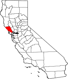
| County | Sonoma |
| Elevation | 771 ft (235 m) |
| Population (2010) | |
| • Total | 401 |
| Time zone | Pacific (PST) (UTC-8) |
| • Summer (DST) | PDT (UTC-7) |
| ZIP code | 95412 |
| Area code(s) | 707 |
| GNIS feature ID | 1657935[1] |
Annapolis is an unincorporated community in Sonoma County, California, United States. Annapolis is situated near the coastline of northern Sonoma County, and is 5 miles (8.0 km) north-northeast of the nearest community, Stewarts Point. Annapolis has ZIP code 95412.[2] The community is named after Annapolis Orchards, which was founded in the area in the 1880s.[3] As of 2010, Annapolis has about 401 residents.
Features
Annapolis has one winery, Annapolis Winery. Annapolis is home to the Starcross Monastic Community. Kayaking, fishing, and boating are popular activities in Annapolis and the surrounding area.
Education
The community has one school, Horicon School, a K-8 public school. Students who attend Horicon School are transitioned to the Point Arena Joint Union High District, and attend Point Arena High School in Point Arena, Mendocino County.
Climate
This region experiences warm (but not hot) and dry summers, with no average monthly temperatures above 71.6 °F. According to the Köppen Climate Classification system, Annapolis has a warm-summer Mediterranean climate, abbreviated "Csb" on climate maps.[4]
References
- ↑ U.S. Geological Survey Geographic Names Information System: Annapolis, California
- ↑ ZIP Code Lookup Archived June 14, 2011, at the Wayback Machine.
- ↑ Durham, David L. (1998). California's Geographic Names: A Gazetteer of Historic and Modern Names of the State. Quill Driver Books. p. 594. ISBN 1-884995-14-4.
- ↑ Climate Summary for Annapolis, California