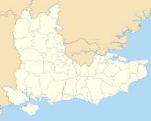
Isle of Wight
| Isle of Wight | |||
|---|---|---|---|
| County | |||
|
| |||
| |||
| Motto: "All this beauty is of God" | |||
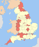
 Isle of Wight in England | |||
| Coordinates: 50°40′N 1°16′W / 50.667°N 1.267°WCoordinates: 50°40′N 1°16′W / 50.667°N 1.267°W | |||
| Sovereign state | United Kingdom | ||
| Country | England | ||
| Region | South East | ||
| Established | 1890 | ||
| Preceded by | Hampshire | ||
| Ceremonial county | |||
| Lord Lieutenant | Martin White | ||
| High Sheriff | Robin Courage MBE | ||
| Area | 384 km2 (148 sq mi) | ||
| • Ranked | 46th of 48 | ||
| Population (mid-2014 est.) | 138,400 | ||
| • Ranked | 46th of 48 | ||
| Density | 364/km2 (940/sq mi) | ||
| Ethnicity | 97.3% White, 1.1% Asian, 0.2% Black, 0.1% Other, 1.2% Mixed[2] | ||
| Unitary authority | |||
| Council | Isle of Wight Council | ||
| Executive | Island Independents | ||
| Admin HQ | Newport | ||
| Area | 380.2 km2 (146.8 sq mi) | ||
| • Ranked | 106th of 326 | ||
| Population | 139,105 | ||
| • Ranked | 148th of 326 | ||
| Density | 366/km2 (950/sq mi) | ||
| ISO 3166-2 | GB-IOW | ||
| ONS code | 00MW | ||
| GSS code | E06000046 | ||
| NUTS | UKJ34 | ||
| Website |
www | ||
| Member of Parliament | Andrew Turner | ||
| Police | Hampshire Constabulary | ||
| Time zone | GMT (UTC) | ||
| • Summer (DST) | BST (UTC+1) | ||

The Isle of Wight /ˈaɪl əv ˈwaɪt/ is a county and the largest and second-most populous island in England. It is located in the English Channel, about 4 miles (6 km) off the coast of Hampshire, separated by the Solent. The island has resorts that have been holiday destinations since Victorian times, and is known for its mild climate, coastal scenery, and verdant landscape of fields, downland and chines.
The island has been home to the poets Swinburne and Tennyson and to Queen Victoria, who built her much-loved summer residence and final home Osborne House at East Cowes. It has a maritime and industrial tradition including boat building, sail making, the manufacture of flying boats, the world's first hovercraft, and development of Britain's space rockets. The island hosts annual music festivals including Bestival and the Isle of Wight Festival, which, in 1970, was the largest rock music event ever held.[3] It has well-conserved wildlife and some of the richest cliffs and quarries for dinosaur fossils in Europe.
The Isle was owned by a Norman family until 1293[4] and was earlier a kingdom in its own right. The island has played an important part in the defence of the ports of Southampton and Portsmouth, and been near the front-line of conflicts through the ages that include the Spanish Armada and the Battle of Britain. It was part of Hampshire until 1890 when it became an independent administrative county, but continued to share the Lord Lieutenant until 1974, when the island became a non-metropolitan ceremonial county. Apart from a shared police force, there is now no administrative link with Hampshire. Until 1995 the island had a governor.[n 1]
The quickest public transport link to the mainland is the hovercraft from Ryde to Southsea, while three ferry and two catamaran services cross the Solent to Southampton, Lymington and Portsmouth.
History
Neolithic
There are theories that, during the Neolithic era, Bouldnor was a seaport that traded with the Middle East, or that nomadic gatherers roamed over wider areas than previously thought, because wheat was present there 8,000 years ago, hundreds if not thousands of years before it is known to have been grown in northern Europe.[5][6][7]
Bronze and Iron Ages
Bronze Age Britain had large reserves of tin in Cornwall and Devon, and tin is necessary to smelt bronze. At that time the sea level was much lower, and so tin for export could be brought across the Solent at low tide on carts,[8][9] or possibly on boats such as those found at Ferriby. A shortage of tin during the Bronze Age collapse and trade disruptions in the Mediterranean around 1300 BCE may have forced metalworkers to seek an alternative to bronze.[10][11]
During the pre-Roman eras, Southeastern Britain experienced significant immigration from the continent, which is reflected in the genetic makeup of the current residents.[12] Finds of late Late Iron Age coins, such as the South Wight[13] and Shalfleet Hoards, suggest trading links both with nearby tribes and further afield. The coins and ingots from these hoards has been defaced before burial, for reasons that are unknown; this feature has only found been in coin finds from Hampshire and Wight.[14] The variety of origin of the coins found locally is more marked than elsewhere in Britain and suggests that the island may have had a degree of political separation.[15][16]
Roman period
Caesar reported that the Belgae took the Isle of Wight in about 85 BC and gave its name as Vectis.[17] The Roman historian Suetonius mentions that the entire island was captured by the commander Vespasian, who later became emperor.
The Romans built no towns or roads on the island, but the remains of at least seven Roman villas have been found, including one that is now submerged near Gurnard.[18]
Jutish and Saxon era
In 685 the island was invaded by Cædwalla of Wessex. Bede reports that Caedwalla "endeavoured to destroy all the inhabitants", who were pagan, and replace them with his own followers. Resistance was led by the local King Arwald; after he was defeated and slain in 686, the island became the last part of the English lands to be converted to Christianity.[19][20][21]
After Alfred the Great (reigned 871–899) made the West Saxon kings the rulers of all England, the island became part of England, being of the shire of Hampshire and divided into hundreds as was the norm. From this time it suffered especially from Viking raids. Alfred the Great's navy defeated the Danes in 871, after they had "ravaged Devon and the Isle of Wight".[22]

Later middle ages
The Norman conquest of England created the position of Lord of the Isle of Wight, the island being given by William the Conqueror to his kinsman William FitzOsbern. Carisbrooke Priory and the fort of Carisbrooke Castle were founded. Thereafter allegiance on the island was sworn to FitzOsbern as 'Lord' rather than the king, a role subsequently granted to the de Redvers family by Henry I after his succession in 1100.
For nearly 200 years the island was a semi-independent feudal fiefdom, with the de Redvers family ruling from Carisbrooke Castle. The final private owner was the Countess Isabella de Fortibus, who inherited it aged 25 after her brother died suddenly. She ruled for thirty years, during which time all of her children died. On her deathbed in 1293 she was persuaded to sell the island to Edward I, and so it came under control of the English crown.[23]
On 20 April 1313 the ship St. Marie was wrecked in Chale Bay, its cargo of wine plundered by local landowners. This led to the construction of St. Catherine's Oratory as penance for the crime.
In 1374, the fleet of the Crown of Castile, led by Fernando Sánchez de Tovar, sacked and burned the island.[24]
In 1377 French raiders attacked and burned several towns, including Newtown, and laid siege to Carisbrooke Castle. Peter de Heynoe, Lord of Stenbury, killed the French commander with a crossbow shot aimed through an arrow slit still visible in the castle's west wall.
The Lordship was now a royal appointment. It is sometimes said there was a brief interruption in 1444 when Henry Beauchamp was crowned King of the Isle of Wight,[25] with King Henry VI placing the crown on his head; the regal title supposedly expired when he died heirless in 1446. But there little evidence to support this story.[26][27]
The French invasion of the Isle of Wight of 21 July 1545 was rapidly repulsed by local militia. English ships were engaged in battle with the French navy, two days after the Mary Rose had been sunk.[28]
Early modern period
Under Henry VIII, who developed the Royal Navy and its Portsmouth base, the island was fortified at Yarmouth, Cowes, East Cowes, and Sandown.
During the English Civil War, King Charles fled to the Isle of Wight, believing he would receive sympathy from the governor Robert Hammond. But Hammond imprisoned the king in Carisbrooke Castle.[29]


During the Seven Years' War, the island was used as a staging post for British troops departing on expeditions against the French coast, such as the Raid on Rochefort. During 1759, with a planned French invasion imminent, a large force of soldiers was stationed there. The French called off their invasion following the Battle of Quiberon Bay.[30]
Modern history
In the 1860s, what remains in real terms the most expensive ever government spending project saw fortifications built on the island and in the Solent, as well as elsewhere along the south coast, including the Palmerston Forts, The Needles Battery and Fort Victoria, because of fears about the strength of the French and their possible invasion.
Queen Victoria spent childhood holidays on the island and became fond of it. When Queen she made Osborne House her winter home, and so the island became a fashionable holiday resort for many Victorians, including Alfred, Lord Tennyson, Julia Margaret Cameron, and Charles Dickens (who wrote much of David Copperfield there), as well as the French painter Berthe Morisot and members of European royalty.[31] Until then, the island had been rural, with most people employed in farming, fishing or boat-building. The boom in tourism, spurred by growing wealth and leisure time, and by Victoria's example, led to significant urban development of the island's coastal resorts.
Queen Victoria died at Osborne House on 22 January 1901, aged 81.
During her reign, the world's first radio station was set up by Marconi in 1897 at the Needles Battery, at the western tip of the island.[32][33] In 1898 the first paid telegram (called a 'Marconigram at the time) was sent from this station, and the island is now the home of the National Wireless Museum, near Ryde.[34]
During the Second World War the island was frequently bombed. With its proximity to German-occupied France, the island had a number of observation stations and transmitters, as well as the RAF radar station at Ventnor. It was the starting-point for one of the earlier Operation Pluto pipelines to feed fuel to Europe after the Normandy landings.[35]
The Needles Battery was used to develop and test the Black Arrow and Black Knight space rockets, which were subsequently launched from Woomera, Australia.[36]

The Isle of Wight Festival was a very large rock festival that took place near Afton Down, West Wight in 1970, following two smaller concerts in 1968 and 1969. The 1970 show was notable both as one of the last public performances by Jimi Hendrix and for the number of attendees, reaching by some estimates 600,000.[37] The festival was revived in 2002 in a different format, and is now an annual event.[38]
Physical geography and wildlife

The Isle of Wight is situated between the Solent and the English Channel, is roughly rhomboid in shape, and covers an area of 150 sq mi (380 km2). Slightly more than half, mainly in the west, is designated as the Isle of Wight Area of Outstanding Natural Beauty. The island has 100 sq mi (258 km2) of farmland, 20 sq mi (52 km2) of developed areas, and 57 miles (92 km) of coastline. Its landscapes are diverse, leading to its oft-quoted description as "England in miniature".
West Wight is predominantly rural, with dramatic coastlines dominated by the chalk downland ridge, running across the whole island and ending in the Needles stacks. The southwestern quarter is commonly referred to as the Back of the Wight, and has a unique character. The highest point on the island is St Boniface Down in the south east, which at 791 feet (241 m) is a marilyn.[39] The most notable habitats on the rest of the island are probably the soft cliffs and sea ledges, which are scenic features, important for wildlife, and internationally protected.

The Island has three principal rivers. The River Medina flows north into the Solent, the Eastern Yar flows roughly northeast to Bembridge Harbour, and the Western Yar flows the short distance from Freshwater Bay to a relatively large estuary at Yarmouth. Without human intervention the sea might well have split the island into three: at the west end where a bank of pebbles separates Freshwater Bay from the marshy backwaters of the Western Yar east of Freshwater, and at the east end where a thin strip of land separates Sandown Bay from the marshy Eastern Yar basin.
The Isle of Wight is one of the few places in England where the red squirrel is still flourishing; no grey squirrels are to be found.[40] There are occasional sightings of wild deer, and there is a colony of wild goats on Ventnor's downs.[41][42][43][44] Protected species such as the dormouse and rare bats can be found. The Glanville fritillary butterfly's distribution in the United Kingdom is largely restricted to the edges of the island's crumbling cliffs.[45]
A competition in 2002 named the pyramidal orchid as the Isle of Wight's county flower.[46]
The island is one of the most important areas in Europe for dinosaur fossils. The eroding cliffs often reveal previously hidden remains, particularly along the Back of the Wight.[47]
The Undercliff between St Catherine's Point and Bonchurch is the largest area of landslip morphology in western Europe.
The north coast is unusual in having four high tides each day, with a double high tide every twelve and a half hours. This arises because the western Solent is narrower than the eastern; the initial tide of water flowing from the west starts to ebb before the stronger flow around the south of the island returns through the eastern Solent to create a second high water.[48]
Climate
Like the rest of the UK, the island has an oceanic climate, but is somewhat milder and sunnier, which makes it a holiday destination. It also has a longer growing season. Lower Ventnor and the neighbouring UnderCliff have a particular microclimate, because of their sheltered position south of the downs. The island enjoys 1,800–2,100 hours of sunshine a year.[49] Some years have almost no snow in winter, and only a few days of hard frost.[50]
| Climate data for Shanklin | |||||||||||||
|---|---|---|---|---|---|---|---|---|---|---|---|---|---|
| Month | Jan | Feb | Mar | Apr | May | Jun | Jul | Aug | Sep | Oct | Nov | Dec | Year |
| Average high °C (°F) | 8.1 (46.6) |
7.9 (46.2) |
10.0 (50) |
12.3 (54.1) |
15.6 (60.1) |
18.2 (64.8) |
20.4 (68.7) |
20.5 (68.9) |
18.3 (64.9) |
15.0 (59) |
11.3 (52.3) |
8.8 (47.8) |
13.87 (56.95) |
| Average low °C (°F) | 3.5 (38.3) |
2.9 (37.2) |
4.3 (39.7) |
5.4 (41.7) |
8.4 (47.1) |
11.1 (52) |
13.4 (56.1) |
13.5 (56.3) |
11.8 (53.2) |
9.5 (49.1) |
6.2 (43.2) |
4.0 (39.2) |
7.83 (46.09) |
| Average precipitation mm (inches) | 90.8 (3.575) |
65.5 (2.579) |
66.0 (2.598) |
53.4 (2.102) |
52.1 (2.051) |
46.3 (1.823) |
47.1 (1.854) |
54.6 (2.15) |
70.5 (2.776) |
115.0 (4.528) |
108.6 (4.276) |
101.0 (3.976) |
870.9 (34.288) |
| Mean monthly sunshine hours | 68.2 | 89.8 | 132.9 | 201.4 | 241.1 | 247.7 | 262.3 | 240.9 | 173.1 | 122.3 | 82.6 | 60.7 | 1,923 |
| Source: Met Office Climate Averages, Shanklin, 1981-2010 | |||||||||||||
Geology


The Isle of Wight is made up of a variety of rock types dating from early Cretaceous (around 127 million years ago) to the middle of the Palaeogene (around 30 million years ago). The geological structure is dominated by a large monocline which causes a marked change in age of strata from the northern younger Tertiary beds to the older Cretaceous beds of the south. This gives rise to a dip of almost 90 degrees in the chalk beds, seen best at the Needles.
The northern half of the island is mainly composed of clays, with the southern half formed of the chalk of the central east–west downs, as well as Upper and Lower Greensands and Wealden strata.[51] These strata continue west from the island across the Solent into Dorset, forming the basin of Poole Harbour (Tertiary) and the Isle of Purbeck (Cretaceous) respectively. The chalky ridges of Wight and Purbeck were a single formation before they were breached by waters from the River Frome during the last ice age, forming the Solent and turning Wight into an island. The Needles, along with Old Harry Rocks on Purbeck, represent the edges of this breach.
All the rocks found on the island are sedimentary, such as limestones, mudstones and sandstones. They are rich in fossils; many can be seen exposed on beaches as the cliffs erode. Lignitic coal is present in small quantities within seams, and can be seen on the cliffs and shore at Whitecliff Bay. Fossilised molluscs have been found there, and also on the northern coast along with fossilised crocodiles, turtles and mammal bones; the youngest date back to around 30 million years ago.
Dinosaur bones and fossilised footprints can be seen in and on the rocks exposed around the island's beaches, especially at Yaverland and Compton Bay. As a result, the island has been nicknamed "Dinosaur Island".
The area was affected by sea level changes during the repeated Quaternary glaciations. The island probably became separated from the mainland about 125,000 years ago, during the Ipswichian interglacial.[52]
Politics

The island has a single Member of Parliament and 138,300 permanent residents in 2011, being one of the most populated constituencies in the United Kingdom (more than 50% above the English average).[53] However, in 2011 the Parliamentary Voting System and Constituencies Act was to have changed this, as part of the Sixth Periodic Review of Westminster constituencies,[54] but this was deferred to no earlier than October 2018 by the Electoral Registration and Administration Act 2013. Thus the single constituency remained for the 2015 general election. However, two separate East and West constituencies are proposed for the island under the 2018 review now underway.
The Isle of Wight is a ceremonial and non-metropolitan county. Since the abolition of its two borough councils and restructuring of the county council as Isle of Wight Council in 1995, it has been a unitary authority.
Elections in the constituency have traditionally been a battle between the Conservatives and the Liberal Democrats. The Member of Parliament since 2001, Andrew Turner, is a Conservative, and while predecessor Dr Peter Brand was a Liberal Democrat. In recent years Turner has been embroiled in controversy over his expenses, health, and relationships with colleagues, with local Conservatives having tried but failed to remove him in the runup to the 2015 election.[55]
The Isle of Wight Council election of 2013 saw the Conservatives lose the majority which they had held since 2005 to the Island Independents. Island Independent councillors currently hold 16 of the 40 seats, with a further five sitting as independents outside the group.[56]
There have been small regionalist movements: the Vectis National Party and the Isle of Wight Party; but they have attracted little support in elections.[57]
Main towns

- Newport is the centrally located county town, with a population of about 25,000[58] and the island's main shopping area. Located next to the River Medina, Newport Quay was a busy port until the mid-19th century.
- Ryde, the largest town with a population of about 30,000, is in the northeast. It is Victorian with the oldest seaside pier in England and miles of sandy and pebble beaches.
- Cowes hosts the annual Cowes Week and is an international sailing centre.
- East Cowes is famous for Osborne House, Norris Castle and as the home from 1929 to 1964 of Saunders-Roe, the historic aircraft, flying boat, rocket and hovercraft company.
- Sandown is a popular seaside resort. It is home to the Isle of Wight Zoo, the Dinosaur Isle geological museum and one of the island's two 18-hole golf courses.
- Shanklin, just south of Sandown, attracts tourists with its high summer sunshine levels, sandy beaches, Shanklin Chine and the old village.
- Ventnor, built on the steep slopes of St Boniface Down on the south coast of the island, leads down to a picturesque bay that attracts many tourists. Ventnor Haven is a small harbour.

Culture
Language and dialect
The local accent is similar to the traditional dialect of Hampshire, featuring the dropping of some consonants and an emphasis on longer vowels. It is similar to the West Country dialects heard in South West England, but less pronounced.[59][60]
The island has its own local and regional words. Some, such as nipper/nips (a young male person), are still commonly used and are shared with neighbouring areas of the mainland. A few are unique to the island, for example overner and caulkhead (see below). Others are more obscure and now used mainly for comic emphasis, such as mallishag (meaning "caterpillar"), gurt meaning "large", nammit (a mid-morning snack) and gallybagger ("scarecrow", and now the name of a local cheese).[61]
Identity
There remains occasional confusion between the Isle of Wight as a county and its former position within Hampshire.[62] The island was regarded and administered as a part of Hampshire until 1890, when its distinct identity was recognised with the formation of Isle of Wight County Council (see also Politics of the Isle of Wight). However, it remained a part of Hampshire until the local government reforms of 1974 when it became a full ceremonial county with its own Lord Lieutenant.[63]
In January 2009, the first general flag for the county was accepted by the Flag Institute.[64]
Island residents are sometimes referred to as 'Vectensians', 'Vectians' or, if born on the island, "caulkheads".[65] One theory is that this last comes from the once prevalent local industry of caulking or sealing wooden boats; the term became attached to islanders either because they were so employed, or as a derisory term for perceived unintelligent labourers from elsewhere. The term 'overner' is used for island residents originating from the mainland (an abbreviated form of 'overlander', which is an archaic term for 'outsider' still found in parts of Australia).[66]
Residents refer to the island as "The Island", as did Jane Austen in Mansfield Park, and sometimes to the UK mainland as "North Island".[67]
To promote the island's identity and culture, the High Sheriff Robin Courage founded an Isle of Wight Day; the first was held on Saturday 24 September 2016.
'Hauntings'
The island is said to be the most haunted in the world, sometimes referred to as 'Ghost Island'. Notable claimed hauntings include God's Providence House in Newport (now a tea room), Appuldurcombe House, and the remains of Knighton Gorges.[68]
Sport
Cycling
The island is well known for its cycling, and it was included within Lonely Planet's Best in Travel Guide (2010) top ten cycling locations. The island also hosts events such as the Isle of Wight Randonnée and the Isle of Wight Cycling Festival each year.
Rowing
There are rowing clubs at Newport, Ryde and Shanklin.
In May 1999 a group of local women made history by becoming the first ladies crew to row around the island, in ten hours and twenty minutes. Rowers from Ryde Rowing Club have rowed around the island several times since 1880. The fours record was set 16 August 1995 at 7 hours 54 minutes.[69]
Two rowers from Southampton ARC set the two-man record in July 2003 at 8 hours 34 minutes, and in 2005 Gus McKechnie of Coalporters Rowing Club completed a clockwise row.[70]
The route around the island is about 60 miles (97 km) and usually rowed anticlockwise. Even in good conditions, it includes a number of significant obstacles such as the Needles and the overfalls at St Catherine's Point. The traditional start and finish were at Ryde Rowing Club; however other starts have been chosen in recent years to give a tidal advantage.
Sailing

Cowes is a centre for sailing, hosting several racing regattas. Cowes Week is the longest-running regular regatta in the world, with over 1,000 yachts and 8,500 competitors taking part in over 50 classes of racing.[71] In 1851 the first America's Cup race was around the island. Other major sailing events hosted in Cowes include the Fastnet race, the Round the Island Race,[72] the Admiral's Cup, and the Commodore's Cup.[73]
Trampolining
There are two main trampoline clubs on the island, in Freshwater and Newport, competing at regional, national and international grades.[74][75]
Marathon
The Isle of Wight Marathon is the United Kingdom's oldest continuously held marathon, having been run every year since 1957.[76] Since 2013 the course has started and finished in Cowes, heading out to the west of the island and passing through Gurnard, Rew Street, Porchfield, Shalfleet, Yarmouth, Afton, Willmingham, Thorley, Wellow, Shalfleet, Porchfield, and Northwood. It is an undulating course with a total climb of 1,043 feet (318 m).
Speedway
The island is home to the Wightlink Warriors speedway team, who compete in the sport's third division, the National League.
Hockey
Following an amalgamation of local hockey clubs in 2011, the Isle of Wight Hockey Club now runs two men's senior and two ladies' senior teams. These compete at a range of levels in the Hampshire open leagues.[77]
Football
The now-disbanded Ryde Sports F.C., founded in 1888, was one of the eight founder members of the Hampshire League in 1896. There are several non-league clubs such as Newport (IW) F.C. There is an Isle of Wight Saturday Football League with three divisions, and a rugby union club.[78][79]
Cricket

The Isle of Wight is the 39th official county in English cricket, and the Isle of Wight Cricket Board organises a league of local clubs. Ventnor Cricket Club competes in the Southern Premier League, and has won the Second Division several times. Newclose County Cricket Ground near Newport[80][81][82] opened officially in 2009 but with its first match held on 6 September 2008.[83] The island has produced some notable cricketers, such as Danny Briggs, who plays county cricket for Hampshire.
Island Games
The Isle of Wight competes in the biennial Island Games, which it hosted in 1993 and again in 2011.
Motor scooter

The annual Isle of Wight International Scooter Rally has since 1980 met on the August Bank Holiday. This is now one of the biggest scooter rallies in the world, attracting between four and seven thousand participants.[84]
Music

The island is home to the Isle of Wight Festival and Bestival. In 1970, the festival headlined by Jimi Hendrix attracted an audience of 700,000, seven times the local population at the time.[85] It is the home of the band The Bees, which performs at smaller local concerts. Trixie's Big Red Motorbike[86] as well as three of the founding members of Level 42 (Mark King, Boon Gould and Phil Gould) came from the island. It has also hosted a one-day festival called 'Summer Madness', which started in 2009 headlined by Madness; in 2010 Paul Weller headlined. In January 2011 it was reported that the promoter of Summer Madness was insolvent.
Economy
Socio-economic data
The table below shows the regional gross value (in millions of pounds) added by the Isle of Wight economy, at current prices, compiled by the Office for National Statistics:[87][88]
| Year | Regional gross value added[89] | Agriculture[90] | Industry[91] | Services[92] |
|---|---|---|---|---|
| 1995 | 831 | 28 | 218 | 585 |
| 2000 | 1,369 | 27 | 375 | 800 |
| 2003 | 1,521 | 42 | 288 | 1,161 |
| 2008 | 2,023 | |||
| 2012 | 2,175 |
According to the 2011 census,[93] the island's population of 138,625 lives in 61,085 households, giving an average household size of 2.27 people.
41% of households own their home outright and a further 29% own with a mortgage, so in total 70% of households are owned (compared to 68% for South East England).
Compared to South East England, the island has fewer children (19% aged 0–17 against 22% for the South East) and more elderly (24% aged 65+ against 16%), giving an average age of 44 years for an island resident compared to 40 in South East England.
Industry and agriculture
The largest industry is tourism, but the island also has a strong agricultural heritage, including sheep and dairy farming and arable crops. Traditional agricultural commodities are more difficult to market off the island because of transport costs, but local farmers have managed successfully to exploit some specialist markets, with the higher price of such products being able to absorb the transport costs. One of the most successful agricultural sectors is now the growing of crops under cover, particularly salad crops including tomatoes and cucumbers. The island has a warmer climate and longer growing season than much of the United Kingdom. Garlic has been successfully grown in Newchurch for many years, and is even exported to France. This has led to the establishment of an annual Garlic Festival at Newchurch, which is one of the largest events of the local calendar. A favourable climate supports two vineyards, including one of the oldest in the British Isles at Adgestone.[94] Lavender is grown for its oil.[95] The largest agricultural sector has been dairying, but due to low milk prices and strict legislation for UK milk producers, the dairy industry has been in decline: there were nearly 150 producers in the mid-1980s, but now just 24.
Maritime industries, especially the making of sailcloth and boat building, has long been associated with the island, although this has diminished somewhat in recent years. GKN operates what began as the British Hovercraft Corporation, a subsidiary of (and known latterly as) Westland Aircraft, although they have reduced the extent of plant and workforce and sold the main site. Previously it had been the independent company Saunders-Roe, one of the island's most notable historic firms that produced many flying boats and the world's first hovercraft.[96]
Another manufacturing activity is in composite materials, used by boat-builders and the wind turbine manufacturer Vestas, which has a wind turbine blade factory and testing facilities in West Medina Mills and East Cowes.[97]
Bembridge Airfield is the home of Britten-Norman, manufacturers of the Islander and Trislander aircraft. This is shortly to become the site of the European assembly line for Cirrus light aircraft. The Norman Aeroplane Company is a smaller aircraft manufacturing company operating in Sandown. There have been three other firms that built planes on the island.[98]
In 2005, Northern Petroleum began exploratory drilling for oil at its Sandhills-2 borehole at Porchfield, but ceased operations in October that year after failing to find significant reserves.[99]
Breweries
There are three breweries on the island. Goddards Brewery in Ryde opened in 1993.[100] David Yates, who was head brewer of the Island Brewery, started brewing as Yates Brewery at the Inn at St Lawrence in 2000.[101]
Ventnor Brewery, which closed in 2009, was the last incarnation of Burt's Brewery, brewing since the 1840s in Ventnor.[102] Until the 1960s most pubs were owned by Mews Brewery, situated in Newport near the old railway station, but it closed and the pubs were taken over by Strong's, and then by Whitbread. By some accounts Mews beer was apt to be rather cloudy and dark. In the 19th Century they pioneered the use of screw top cans for export to British India.[103]
Services
Tourism and heritage
Its heritage is a major asset that has for many years supported the island's tourist economy. Holidays focused on natural heritage, including wildlife and geology, are becoming an alternative to the traditional British seaside holiday, which went into decline in the second half of the 20th century due to the increased affordability of foreign holidays.[104] The island is still an important destination for coach tours from other parts of the United Kingdom.

Tourism is still the largest industry, and most island towns and villages offer hotels, hostels and camping sites. In 1999, it hosted 2.7 million visitors, with 1.5 million staying overnight, and 1.2 million visits day visits; only 150,000 of these were from abroad. Between 1993 and 2000, visits increased at an average rate of 3% per year.[105]
At the turn of the 19th century the island had ten pleasure piers including two at Ryde and a "chain pier" at Seaview. The Victoria Pier in Cowes succeeded the earlier Royal Pier but was itself removed in 1960. The piers at Ryde, Seaview, Sandown, Shanklin and Ventnor originally served a coastal steamer service that operated from Southsea on the mainland. The piers at Seaview, Shanklin, Ventnor and Alum Bay were all destroyed by various storms during the 20th century; only the railway pier at Ryde and the piers at Sandown, Totland Bay (currently closed to the public) and Yarmouth survive.
Blackgang Chine is the oldest theme park in Britain, opened in 1843.[106] The skeleton of a dead whale that its founder Alexander Dabell found in 1844 is still on display.[107]
As well as its more traditional attractions, the island is often host to walking[108] or cycling holidays through the attractive scenery. An annual walking festival[109] has attracted considerable interest. The 70 miles (113 km) Isle of Wight Coastal Path follows the coastline as far as possible, deviating onto roads where the route along the coast is impassable.[110]
A major contributor to the local economy is sailing and marine-related tourism.[111]
Summer Camp at Camp Beaumont is an attraction at the old Bembridge School site.[112]
Transport

The Isle of Wight has 489 miles (787 km) of roadway. It does not have a motorway, although there is a short stretch of dual carriageway towards the north of Newport near the hospital and prison.
A comprehensive bus network operated by Southern Vectis links most settlements, with Newport as its central hub.[113]
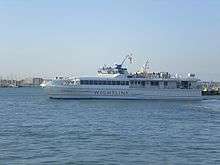
Journeys away from the island involve a ferry journey. Car ferry and passenger catamaran services are run by Wightlink and Red Funnel, and a hovercraft passenger service (the only such remaining in the world) by Hovertravel.
The Island formerly had its own railway network of over 55 miles (89 km), but only one line remains in regular use. The Island Line is part of the United Kingdom's National Rail network, running a little under 9 miles (14 km) from Shanklin to Ryde Pier Head, where there is a connecting ferry service to Portsmouth Harbour station on the mainland network. The line was opened by the Isle of Wight Railway in 1864, and from 1996 to 2007 was run by the smallest train operating company on the network, Island Line Trains. It is notable for utilising old ex-London Underground rolling stock, due to the small size of its tunnels and unmodernised signalling. Branching off the Island Line at Smallbrook Junction is the heritage Isle of Wight Steam Railway, which runs for 5 1⁄2 miles (8.9 km) to the outskirts of Wootton on the former line to Newport.[114]
There are two airfields for general aviation, Isle of Wight Airport at Sandown and Bembridge Airport.
The island has over 200 miles (322 km) of cycleways, many of which can be enjoyed off-road. Major Trails are:[115]
- The Sunshine Trail, which is a circular route linking Sandown, Shanklin, Godshill, and Wroxall of 12 miles (19 km);
- The Troll Trail between Cowes and Sandown of 13 miles (21 km), 90% off-road;
- The Round the Island Cycle Route of 62 miles (100 km).
Media
The main local newspaper is the Isle of Wight County Press, published most Fridays.
The island has one local commercial radio station: Isle of Wight Radio has broadcast in the medium-wave band since 1990 and on 107.0 MHz (with three smaller transmitters on 102.0 MHz) FM since 1998, as well as streaming on the Internet.[116] The island is also covered by a number of local stations on the mainland, including the BBC station BBC Radio Solent broadcast from Southampton.
The island's not-for-profit community radio station Angel Radio opened in 2007. Angel Radio began broadcasting on 91.5 MHz from studios in Cowes and a transmitter near Newport.[117][118]
Local online radio station Vectis Radio has broadcast since 2010, broadcasting from the Riverside Centre in Newport.[119]
Online news sources for the Isle of Wight include On the Wight[120] and The Isle of Wight Chronicle.[121] The Chronicle was originally an island local paper during the later 19th and early 20th Century.
The island has an online 24/7 breaking news source Island Echo,[122] which was founded in May 2012.
The island has had community television stations in the past, first TV12 and then Solent TV from 2002 until its closure on 24 May 2007. iWight.tv is a local internet video news channel.
The Isle of Wight is part of the BBC South region and the ITV Meridian region.
Important broadcasting infrastructure includes Chillerton Down transmitting station with a mast that is the tallest structure on the island, and Rowridge transmitting station, which broadcasts the main television signal both locally and for most of Hampshire and parts of Dorset and West Sussex.[123]
Prisons
Its separation from the mainland yet being near the densely populated south of England led to it hosting three prisons: Albany, Camp Hill and Parkhurst, all located outside Newport near the main road to Cowes. Albany and Parkhurst were among the few Category A prisons in the UK until they were downgraded in the 1990s.[124] The downgrading of Parkhurst was precipitated by a major escape: three prisoners (two murderers and a blackmailer) escaped from the prison on 3 January 1995 for four days, before being recaptured.[125] Parkhurst enjoyed notoriety as one of the toughest jails in the United Kingdom, and housed many notable inmates including the Yorkshire Ripper Peter Sutcliffe, New Zealand drug lord Terry Clark and the Kray twins.
Camp Hill is located adjacent but to the west of Albany and Parkhurst, on the very edge of Parkhurst Forest, having been converted first to a borstal and later to a Category C prison. It was built on the site of an army camp (both Albany and Parkhurst were barracks); there is a small estate of tree-lined roads with the former officers' quarters (now privately owned) to the south and east. Camp Hill closed as a prison in March 2013.
The management of all three prisons was merged into a single administration, under HMP Isle of Wight in April 2009.
Education
There are sixty-nine Local Education Authority-maintained schools on the Isle of Wight, and two independent schools.[126] As a rural community, many of these are small and with fewer pupils than in urban areas. The Isle of Wight College is located on the outskirts of Newport.
From September 2010, there was a transition period from the three-tier system of primary, middle and high schools to the two-tier system that is usual in England.[127] Some schools have now closed, such as Chale C.E. Primary. Others have become "federated", such as Brading C.E. Primary and St Helen's Primary. Christ the King College started as a "middle school" but has now been converted into a secondary school and sixth form.
As of September 2011, there are five new secondary schools, with an age range of 11 to 18 years, which have replaced the island's high schools (as a part of the previous three-tier system).
Notable residents
Notable residents have included:
17th Century and earlier
- King Arwald, last pagan king in England
- King Charles I of England, who was imprisoned at Carisbrooke Castle
- actor, highwayman and conspirator Cardell 'Scum' Goodman
- soldier and regicide of Charles I Thomas Harrison, imprisoned at Carisbrooke with John Rogers & Christopher Feake
- soldier Peter de Heyno
- philosopher and polymath Robert Hooke
- murderer Michal Morey
18th Century
- explorer Anthony Henday
- radical journalist John Wilkes
19th Century
- Queen Victoria and Prince Albert (monarch and consort), who built and lived at Osborne House
- photographer Julia Margaret Cameron, who lived at Dimbola Lodge
- Irish Republican Thomas Clarke
- naval captain Jeremiah Coghlan CBG, who retired to Ryde
- writer Charles Dickens
- poet John Keats
- inventor and radio pioneer Guglielmo Marconi
- geologist and engineer John Milne
- regency architect John Nash
- novelist Miss Harriet Parr
- New Zealand PM Henry Sewell
- poet Algernon Charles Swinburne
- poet Alfred Tennyson
20th Century onwards
- scriptwriter Raymond Allen
- Indie rock group The Bees
- concert organist E. Power Biggs
- darts player Keegan Brown
- inventor of the hovercraft Sir Christopher Cockerell
- presenter and actor Ray Cokes
- actor Marius Goring
- survival expert and Chief Scout Bear Grylls
- actress Sheila Hancock
- folk-rock musician Robyn Hitchcock
- actor Geoffrey Hughes
- author and conspiracy theorist David Icke
- actor Jeremy Irons
- comedian Phill Jupitus
- actor Laura Michelle Kelly
- Iranian poet Mimi Khalvati
- musician Mark King
- radio presenter Allan Lake
- yachtswoman Ellen MacArthur
- film director Anthony Minghella
- actor David Niven
- cyclist Kieran Page
- TV personality Anneka Rice
- heptathlete Kelly Sotherton
- gardener and presenter Alan Titchmarsh
Places of interest
| Key | |
| | Abbey/Priory/Cathedral |
| | Accessible open space |
| | Amusement/Theme Park |
| | Castle |
| | Country Park |
| | English Heritage |
| | Forestry Commission |
| | Heritage railway |
| | Historic House |
| | Museum (free/not free) |
| | National Trust |
| | Theatre |
| | Zoo |
- Alum Bay
- Appuldurcombe House

- Amazon World Zoo
- Bembridge Lifeboat Station
- Blackgang Chine

- Brading Roman Villa
.png)
- Carisbrooke Castle

- Classic Boat Museum, East Cowes
- Dimbola Lodge
- Dinosaur Isle
- Fort Victoria

- Godshill village and model village
- Isle of Wight Bus & Coach Museum
- Isle of Wight Steam Railway

- Isle of Wight Zoo, Yaverland

- Medina Theatre
- The Needles

- Osborne House
- Quarr Abbey

- Robin Hill
- Botanic Gardens, Ventnor
- Yarmouth Castle
Overseas names
The Isle of Wight has given names to many parts of former colonies, most notably Isle of Wight County in Virginia founded by settlers from the island in the 17th century. Its county seat is a town named Isle of Wight.
Other notable examples include:
- Isle of Wight - an island off Maryland, USA
- Dunnose Head, West Falkland
- Ventnor, Cowes on Philip Island, Victoria, Australia
- Carisbrook, Victoria, Australia
- Carisbrook, a former stadium in Dunedin, New Zealand
- Ryde, New South Wales, Australia
- Shanklin, Sandown, New Hampshire, USA
- Ventnor City, New Jersey, USA
- Gardiners Island, New York, USA shown as "Isle of Wight" on some of the older maps.[128]
Media references
Film
- The film Something to Hide (1972; US title Shattered), starring Peter Finch, was filmed near Cowes, including a scene on the Red Funnel ferry;
- The British film That'll Be the Day (1973), starring David Essex and Ringo Starr, included scenes shot in Ryde (notably Cross Street), Sandown (school), Shanklin (beach) and Wootton Bridge (fairground);
- Mrs. Brown (1997), with Dame Judi Dench and Billy Connolly, was filmed at Osborne and Chale;
- The film Fragile (2005), starring Calista Flockhart, is based on the Isle of Wight.
Games
- John Worsley's Commodore 64 game Spirit of the Stones is set on the Isle of Wight.[130]
Literature
The Isle of Wight was:[131]
- the setting of Julian Barnes's novel England, England;
- where Northumbrian scholar Bede recorded the arrival of Christianity in 686, when the population was supposedly massacred and replaced by Christians;[132]
- called The Island in some editions of Thomas Hardy's novels in his fictional Wessex;
- selected for the development of a new base by the supercomputer 'Colossus', in D. F. Jones' novel Colossus (1966);
- the setting for D.H. Lawrence's book The Trespasser, filmed for TV on location in 1981;
- visited by Karl Marx, who stayed in Ventnor while writing the Communist Manifesto;
- the setting of Graham Masterton's book Prey;
- mentioned in J.K. Rowling's first Harry Potter book, which refers to Uncle Vernon's sister Marge on holiday on the island, who got sick after eating a whelk;
- a major element in Daniel O'Malley's series The Rook (2012) & its sequel Stiletto (2016). The antagonists try to invade in the 1600s, the effects of which continue to colour perceptions of the Crown's secret supernatural agency, the 'Checquy Group';
- the refuge of the British monarchy & government in S.M. Stirling's alternative history novel The Protector's War (2005), in which high energy technology ceased to function. After an ensuing holocaust, the island was the base for re-population of Europe, whose populations had mostly perished;
- one of the destinations to which the British government evacuates in Frank Tayell's post-apocalyptic novel Surviving the Evacuation Book One: London (2013), guided by the mistaken impression that it would be defensible against the zombie hordes;[133]
- featured in John Wyndham's novel The Day of the Triffids and Simon Clark's sequel The Night of the Triffids.
Music
- The Beatles' song "When I'm Sixty-Four" (1967), credited to Lennon-McCartney and sung by Paul McCartney, refers to renting a cottage on the island;[134]
- Bob Dylan recorded "Like a Rolling Stone" (1965), "Minstrel Boy", "Quinn the Eskimo (The Mighty Quinn)" (1967), and "She Belongs to Me" (1965) for the album Self Portrait (1970) live on the island;
- "Wight Is Wight" (1969), a song by French artist Michel Delpech, also spawned an Italian cover by Dik Dik, titled "L'isola di Wight"(IT) (1970).
Radio
- There was a running joke in radio sitcom The Navy Lark involving Sub-Lieutenant Phillips's inability to navigate and subsequently tail the Isle of Wight ferry.[135]
Television
- ITV's dramatisation of Dennis Potter's work Blade on the Feather (19 October 1980) was filmed on the island;[136]
- A 2002 Top Gear feature showed an Aston Martin being driven around Cowes, East Cowes, and along the Military Road and seawall at Freshwater Bay.[137]
See also
- List of civil parishes on the Isle of Wight
- List of places on the Isle of Wight
- List of High Sheriffs of the Isle of Wight
- List of Lord Lieutenants of the Isle of Wight
- List of Governors of the Isle of Wight
- Isle of Wight gasification facility
- Isle of Wight NHS Trust
- Isle of Wight Rifles
- Yaverland Battery
Notes
- ↑ As well as the former Princess Beatrice during World War II, most otherwise notable was Lord Mountbatten in 1969–1974, after which he became Lord Lieutenant until his assassination in 1979.
References
- ↑ "Chris Hadfield on Twitter".
- ↑ "2011 Census, Key Statistics for Local Authorities in England and Wales". Office for National Statistics. 2011. Retrieved 29 November 2016.
- ↑ "Isle of Wight Festival history". Redfunnel.co.uk. Retrieved 25 September 2010.
- ↑ "Isabella de Fortibus, 'Queen of the Wight' - English Heritage".
- ↑ Smith, Oliver; et al. (27 February 2015). "Sedimentary DNA from a submerged site reveals wheat in the British Isles 8000 years ago". Science. 347 (6225): 998–1001. doi:10.1126/science.1261278. PMID 25722413. Retrieved 17 March 2015.
- ↑ Cunliffe, Barry (2008). "A Companion to Roman Britain: Britain and the continent: networks of interaction". John Wiley & Sons: 1–11.
- ↑ Balter, Michael. "DNA recovered from underwater British site may rewrite history of farming in Europe". Science. Retrieved 17 March 2015.
- ↑ Adams, William Henry Davenport (1877). Nelsons' hand-book to the Isle of Wight. Oxford University. Retrieved 16 March 2015.
- ↑ Hawkes, C. F. C. (July 1984). "Ictis disentangled, and the British tin trade". Oxford Journal of Archaeology. 3 (2): 211–233. doi:10.1111/j.1468-0092.1984.tb00327.x. Retrieved 16 March 2015.
- ↑ Snodgrass, A. M. (1966). Arms and Armour of the Greeks. London: Thames & Hudson.
- ↑ Snodgrass, A. M. (1971). The Dark Age of Greece. Edinburgh University Press, Edinburgh.
- ↑ Leslie, Stephen; et al. (Mar 2015). "The fine-scale genetic structure of the British population". Nature. 519 (March 2015): 309–314. doi:10.1038/nature14230. PMID 25788095. Retrieved 29 March 2015.
- ↑ "The Isle of Wight Ingot Hoard". The Art Fund.
- ↑ Leins, Ian; Joy, Jody; Basford, Frank. "Record ID: IOW-EAAFE2". Portable Antiquities Scheme.
- ↑ Wellington, Imogen (February 2001). "Iron Age Coinage on the Isle of Wight". Oxford Journal of Archaeology. 20 (1): 39–57. doi:10.1111/1468-0092.00122. Retrieved 16 March 2015.
- ↑ Crawford, Osbert Guy Stanhope (1912). "The distribution of early bronze age settlements in Britain". Geographical Journal. 1912: 184–197. doi:10.2307/1778466.
- ↑ Adams, William Henry Davenport (1877). Nelson's Hand-book to the Isle of Wight. Oxford.
- ↑ The Journal of the British Archaeological Association (PDF). December 1866.
- ↑ "Saxon Graves at Shalfleet". Isle of Wight History Centre. August 2005. Archived from the original on 1 November 2006.
- ↑ Williams, Peter N. "England, A Narrative History". Britannia.com. Retrieved 25 September 2010.
- ↑ Harding, Samuel B. "The English Accept Christianity". The Story of England.
- ↑ The Anglo Saxon Chronicle. 1116.
- ↑ English Heritage. "Isabella de Fortibus, 'Queen of the Wight'". English Heritage Story of England. Retrieved 28 November 2016.
- ↑ Fernández Duro, Cesáreo (1995). La Marina de Castilla. Madrid. ISBN 978-84-86228-04-0.
- ↑ Camden, William (1610). Britain, or, a Chorographicall Description of the most flourishing Kingdomes, England, Scotland and Ireland. London.
- ↑ "Earls of Warwick". Encyclopedia Britannica 1911. 2011. Retrieved 15 November 2015.
- ↑ 'Dictionary of National Biography. 4. New York: Macmillan. 1985. p. 28.
- ↑ Chisholm, Hugh (1911). The Encyclopædia Britannica: A Dictionary of Arts, Sciences, Literature and General Information. Encyclopædia Britannica. p. 627.
- ↑ English Heritage. "English Heritage Story of England". Retrieved 28 November 2016.
- ↑ Longmate, Norman (2001). Island Fortress: The Defence of Great Britain, 1603–1945. London. pp. 186–188.
- ↑ visitisleofwight.co.uk: The Island's Official Tourism website. "Isle of Wight history and heritage". Retrieved 28 November 2016.
- ↑ Lee, Eric (2005). How internet radio can change the world: an activist's handbook. New York: iUniversr, Inc. ISBN 9780595349654. Retrieved 22 March 2015.
- ↑ "Connected Earth". Retrieved 22 March 2015.
- ↑ Julia Skinner (2012). Isle of Wight: A Miscellany. www.francisfrith.com. ISBN 978-1-84589-683-6.
- ↑ "PLUTO pumping station, Sandown, Isle of Wight". D-Day Museum and Overlord Embroidery. Retrieved 16 February 2015.
- ↑ "Welcome to Britain's secret Cape Canaveral (... on the Isle of Wight)". London Evening Standard. 31 March 2007. Retrieved 16 February 2015.
- ↑ "Movies". Movies.msn.com. Retrieved 25 September 2010.
- ↑ "Isle of Wight Festival History 1968 to Today". isleofwightguru.com. Retrieved 28 November 2016.
- ↑ Staff writer(s); no by-line (1987–2012). "St Boniface Down, England". Peakbagger.com. Retrieved 11 December 2012.
- ↑ "Operation Squirrel". Iwight.com. Archived from the original on 28 June 2009. Retrieved 25 September 2010.
- ↑ "Deer could damage Island warning". Iwcp.co.uk. 17 August 2010. Retrieved 26 March 2013.
- ↑ "Natural History of Red Deer". Wildlife Online. 27 April 2010. Retrieved 12 September 2013.
- ↑ http://www.bds.org.uk/index.php/documents/deer-species/12-muntjac-deer-poster/file
- ↑ http://www.fingerprintdigitalmedia.com/mammal-society/wp-content/uploads/2016/06/SE-Mammal-Atlas-8-Hoofed-mammals.pdf
- ↑ "Glanville Fritillary". UK Butterflies. Retrieved 28 November 2016.
- ↑ "Pyramidal orchid". Plantlife. Retrieved 10 March 2016.
- ↑ "Fossil and Dinosaur Hunting". redfunnel.co.uk. Retrieved 28 November 2016.
- ↑ Julia Skinner (2012). Isle of Wight: A Miscellany. www.francisfrith.com. ISBN 978-1-84589-683-6.
- ↑ "Isle of Wight Climate Statistics". Archived from the original on 21 April 2008.
- ↑ weatheronline.co.uk. "Frost Days data 2000-2008 St Catherine's Point". Retrieved 28 November 2016.
- ↑ Hopson P. (2011). "The geological history of the Isle of Wight: an overview of the 'diamond in Britain's geological crown'" (PDF). Proceedings of the Geologists' Association. 122 (5): 745–763. doi:10.1016/j.pgeola.2011.09.007.
- ↑ Booth K.A. & Brayson J. (2011). "Geology, landscape and human interactions : examples from the Isle of Wight" (PDF). Proceedings of the Geologists' Association. 122 (5): 938–948. doi:10.1016/j.pgeola.2011.01.004.
- ↑ "Turner Will Fight On For 'Unique' Island Status". Isle of Wight Chronicle. 6 July 2010.
- ↑ "Isle of Wight Set To Have Two MPs in 2015". Isle of Wight Chronicle. 15 February 2011b.
- ↑ "Isle Of Wight MP Andrew Turner survives no confidence vote". BBC. 24 January 2015.
- ↑ "Isle of Wight council results". BBC News. 29 April 2013.
- ↑ Adam Grydehøj and Philip Hayward (2011). Autonomy Initiatives and Quintessential Englishness on the Isle of Wight (PDF). Island Studies Journal. p. 185.
- ↑ "Newport Parish Council, Isle of Wight, Official Website". Newport Parish Council - Isle of Wight. Retrieved 2016-03-07.
- ↑ University of Leeds (1959). "Survey of English Dialects: Whitwell, Isle of Wight". British Library. Retrieved 28 November 2016.
- ↑ W Long (1886). A dictionary of the Isle of Wight dialect (PDF). Reeves & Turner, London.
- ↑ Lavers, Jack (1988). The Dictionary of the Isle of Wight Dialect. Dovecote Press. ISBN 0-946159-63-7.
- ↑ "Oiled birds may be linked to Ice Prince sinking". The Daily Telegraph. UK. 16 January 2008. Retrieved 25 September 2010.
- ↑ UK Government (1972). "Local Government Act 1972". Retrieved 28 November 2016.
- ↑ "Flag institute". Flag institute. 6 July 2010. Retrieved 25 September 2010.
- ↑ "Why are natives of the Isle of Wight known as caulkheads? - Notes and Queries". www.theguardian.com. Retrieved 2016-09-23.
- ↑ overlander
- ↑ "Celebrate all things Island on Isle of Wight Day". www.redfunnel.co.uk. Retrieved 2016-11-27.
- ↑ Julia Skinner (2012). Isle of Wight: A Miscellany. www.francisfrith.com. ISBN 978-1-84589-683-6.
- ↑ Ryde Rowing Club (1999). "Record round the Isle of Wight row". University of Oxford. Retrieved 28 November 2016.
- ↑ redfunnel.co.uk. "About Gus McKechnie - Fundraising Legend!". Retrieved 28 November 2016.
- ↑ "Skandia Cowes Week 2008 – Welcome". Skandiacowesweek.co.uk. Retrieved 25 September 2010.
- ↑ "JPMorgan Asset Management Round the Island Race". Roundtheisland.org.uk. Retrieved 25 September 2010.
- ↑ "Rolex Commodores' Cup – Home". Rorc.org. Retrieved 25 September 2010.
- ↑ "Club directory". Isle of Wight Council. Retrieved 28 November 2016.
- ↑ "Wight Flyers Trampoline & Gymnastics Club". Wight Flyers. Retrieved 28 November 2016.
- ↑ "Isle Of Wight Marathon Race". Rydeharriers.co.uk. Retrieved 25 September 2010.
- ↑ "Isle of Wight Hockey Club". Isle of Wight Hockey Club. Retrieved 28 November 2016.
- ↑ "The Isle has produced several high profile players including Kevin "The Hitman" Broderick, now playing for a local Sunday side. Isle Of Wight Rugby Football Club". Iwrfc.co.uk. Retrieved 25 September 2010.
- ↑ "Isle of Wight Sport". Archived from the original on 13 May 2007. Retrieved 15 May 2007.
- ↑ "Isle of Wight County Cricket Ground". Isle of Wight Cricket Board. Retrieved 25 September 2010.
- ↑ Southern Premier Cricket League – Construction work underway on new island county ground
- ↑ "Newclose: Cricket Scoreboard Arrives | Isle of Wight News". Ventnor Blog. 10 July 2008. Retrieved 25 September 2010.
- ↑ "Newclose County Cricket Ground Open Days". Isle of Wight Cricket Board. Retrieved 21 November 2008.
- ↑ "Scooter rally takes place on Isle of Wight". bbc.co.uk. 27 August 2013. Retrieved 29 August 2013.
- ↑ "Concerts with Record Attendance". Noiseaddicts.com. Retrieved 12 September 2013.
- ↑ "Trixie's Big Red Motorbike – Discover music, concerts, stats, & pictures at". Last.fm. 11 February 2009. Retrieved 15 March 2012.
- ↑ published (pp.240–253) Archived 28 July 2011 at the Wayback Machine.
- ↑ "Annual estimates of NUTS3 regional Gross Value Added (GVA)". Office for National Statistics. 2014. Retrieved 29 November 2016.
- ↑ Components may not sum to totals due to rounding
- ↑ includes hunting and forestry
- ↑ includes energy and construction
- ↑ includes financial intermediation services indirectly measured
- ↑ "Key census statistics, Isle of Wight Authority area". 2011.
- ↑ "Wine for Sale – Vineyard Tours, Isle of Wight". English Wine. Retrieved 25 September 2010.
- ↑ "Isle of Wight lavender farm, lavender products, lavender plants, teas". Lavender.co.uk. Retrieved 25 September 2010.
- ↑ Antony Barton. "Saunders-Roe/Westland Aircraft/British Hovercraft Corporation". Retrieved 28 November 2016.
- ↑ "Isle of Wight wind turbine firm Vestas creates 200 jobs". BBC News. 2015-02-05. Retrieved 2016-09-18.
- ↑ "A list of aircraft and airplane manufacturers as well as airfields on the Isle of Wight". Daveg4otu.tripod.com. Retrieved 25 September 2010.
- ↑ Ian West (2016). "Petroleum Geology - South of England: The Portland - Isle of Wight Offshore Basin". Southampton University. Retrieved 28 November 2016.
- ↑ "about us". Goddards-brewery.co.uk. Retrieved 25 September 2010.
- ↑ "Yates' Brewery". Yates-brewery.co.uk. Retrieved 25 September 2010.
- ↑ Ventnor Brewery:: Since 1840 Archived 5 October 2008 at the Wayback Machine.
- ↑ "Isle of Wight Nostalgia". Retrieved 17 May 2016.
- ↑ "A POTTED HISTORY OF ISLE OF WIGHT HOLIDAYS". redfunnel.co.uk. 2014. Retrieved 29 November 2016.
- ↑ "A website with Isle of Wight statistics for investors". Investwight.com. Archived from the original on 27 March 2009. Retrieved 25 September 2010.
- ↑ "The World's Oldest Amusement Parks". Huffington Post. Retrieved 28 November 2016.
- ↑ Julia Skinner (2012). Isle of Wight: A Miscellany. www.francisfrith.com. ISBN 978-1-84589-683-6.
- ↑ "Isle of Wight walking holidays". Wight Walks. Retrieved 25 September 2010.
- ↑ "Welcome to the official website of the Isle of Wight Walking Festival 2013". Isleofwightwalkingfestival.co.uk. Retrieved 26 March 2013.
- ↑ "Isle of Wight Coastal Path". Long Distance Walkers Association. Retrieved 29 November 2016.
- ↑ "Draft Tourism Development Plan" (PDF). Isle of Wight Council. 2005. Retrieved 28 November 2016.
- ↑ "Coastal Adventure: Isle of Wight". Kingswood Camps. Retrieved 28 November 2016.
- ↑ "Southern Vectis bus route map". Southern Vectis. Retrieved 28 November 2016.
- ↑ "Isle of Wight Steam Railway". Isle of Wight Steam Railway. Retrieved 29 November 2016.
- ↑ "Isle of Wight Cycle Hire & Cycling Guide - Isle Cycle - Cowes & Sandown".
- ↑ "Isle of White Radio 107.0 Newport". internetradiouk.com. Retrieved 28 November 2016.
- ↑ ""History of Our Station" and "Gallery"". Angel Radio Isle of Wight Website. Retrieved 28 October 2007.
- ↑ "The Record Library". Angel Radio Isle of Wight Website. Retrieved 20 August 2016.
- ↑ Vectis radio
- ↑ "On The Wight". On The Wight. Retrieved 7 October 2012.
- ↑ "The Isle of Wight Chronicle". Iwchronicle.co.uk. 5 December 2011. Retrieved 15 March 2012.
- ↑ "Island Echo". island Echo. Retrieved 22 July 2015.
- ↑ "The Big Tower: Chillerton Down". thebigtower.com. Retrieved 28 November 2016.
- ↑ "Isle of Wight Prison information". UK Justice Department. Retrieved 29 November 2016.
- ↑ James Cusick (10 January 1995). "The Parkhirst (sic) Breakout: Fugitives were trapped by the sea". The Independent Newspaper. Retrieved 29 November 2016.
- ↑ "Schools and Learning". Isle of Wight Council. Retrieved 29 November 2016.
- ↑ David Newbie (25 September 2009). "It's all change in schools' shake up". Isle of Wight County Press. Retrieved 29 November 2016.
- ↑ "Palaces for the People - Panoramic Views".
- ↑ "filming locations including 'wight'". Internet Movie Database. Retrieved 29 November 2016.
- ↑ "The Lost Talismans of Spirit of the Stones".
- ↑ "The Isle of Wight's Literary Connections". h2g2.com. 2013. Retrieved 29 November 2016.
- ↑ "arrival of Christianity". Mytimemachine.co.uk. Retrieved 25 September 2010.
- ↑ Tayell, Frank (2013). Surviving the Evacuation Book One London.
- ↑ "Sgt. Pepper's Lonely Hearts Club band". Lib.ru. 16 May 1996. Retrieved 25 September 2010.
- ↑ "The Navy Lark Volume 24: You're A Rotten!". amazon.co.uk. Retrieved 29 November 2016.
- ↑ "Blade on the Feather (1980)". Internet Movie Database. Retrieved 29 November 2016.
- ↑ "Top Gear on the Isle of Wight, starring Red Funnel and the Military Road". Isle of Wight Guru. Retrieved 2016-03-17.
- Hansard, Wednesday 14 November 2001 column 850
External links
| Wikimedia Commons has media related to Isle of Wight. |
| Look up Isle of Wight in Wiktionary, the free dictionary. |
| Wikivoyage has a travel guide for Isle of Wight. |
|
|
Photos
 |
Dorset | Hampshire Solent |
West Sussex | |
| English Channel | |
English Channel | ||
| ||||
| | ||||
| English Channel | English Channel | English Channel |