Amadok Point

Location of Livingston Island in the South Shetland Islands.
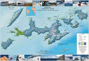
Topographic map of Livingston Island, Greenwich, Robert, Snow and Smith Islands.
Amadok Point (Nos Amadok \'nos a-ma-'dok\) is a point on the south coast of Livingston Island, Antarctica which projects 400 m into the Bransfield Strait. The point was named after the Thracian King Amadokos, 415-384 BC. It is snow-free in the summer.
Location
Amadok Point is located at 62°40′45″S 60°53′22″W / 62.67917°S 60.88944°WCoordinates: 62°40′45″S 60°53′22″W / 62.67917°S 60.88944°W, which is 2 km northwest of Elephant Point and 1.8 km southeast of Clark Nunatak.
See also
Maps
- Península Byers, Isla Livingston. Mapa topográfico a escala 1:25000. Madrid: Servicio Geográfico del Ejército, 1992.
- L.L. Ivanov et al. Antarctica: Livingston Island and Greenwich Island, South Shetland Islands. Scale 1:100000 topographic map. Sofia: Antarctic Place-names Commission of Bulgaria, 2005.
- L.L. Ivanov. Antarctica: Livingston Island and Greenwich, Robert, Snow and Smith Islands. Scale 1:120000 topographic map. Troyan: Manfred Wörner Foundation, 2009. ISBN 978-954-92032-6-4 (Second edition 2010, ISBN 978-954-92032-9-5)
External links
This article includes information from the Antarctic Place-names Commission of Bulgaria which is used with permission.
This article is issued from Wikipedia - version of the 11/21/2015. The text is available under the Creative Commons Attribution/Share Alike but additional terms may apply for the media files.