Alta Vista, Ottawa
| Alta Vista | |
|---|---|
| Neighbourhood | |
 Alta Vista Location within Ottawa | |
| Coordinates: 45°23′20″N 75°39′00″W / 45.38889°N 75.65000°WCoordinates: 45°23′20″N 75°39′00″W / 45.38889°N 75.65000°W | |
| Country | Canada |
| Province | Ontario |
| City | Ottawa |
| Government | |
| • MPs | David McGuinty |
| • MPPs | John Fraser |
| • Councillors | Jean Cloutier |
| • Governing body | Alta Vista Community Association |
| • Chair | Tony Bernard |
| Elevation | 90 m (300 ft) |
| Population (2011) | |
| • Total | 24,047 |
| Canada 2011 Census | |
| Time zone | Eastern (EST) (UTC-5) |
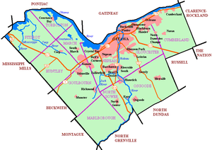
Alta Vista is a neighbourhood in Ottawa, Ontario, Canada. Its boundaries can be broadly described as: Smyth Road in the north, St. Laurent Boulevard in the east, Walkley Road and Heron Road in the south, and Bank Street and Riverside Drive in the west. However, the name is ambiguous, as there are several sub-neighbourhoods in this area, (see list below), as well as a core Alta Vista area, (which could be defined as south of Pleasant Park Road, north of Heron Road, and west of the eastern greenspace corridor), centered on Alta Vista Drive.
Alta Vista Drive is a major street running through the neighbourhood, and shares its name. Both are named for their relative height, as the neighbourhood is generally higher than most of the city. Alta Vista is a highly residential neighbourhood with a strong community, several schools, churches, and community centres. It also has a vast amount of greenspace and parks, much of which is part of the Alta Vista Transportation Corridor Environmental Assessment .
The OC Transpo Transitway also runs through Alta Vista, with two stations in the neighbourhood itself (Pleasant Park and Riverside) as well as two just outside (Billings Bridge and Smyth), serving as a vital transit link to the rest of the city.
The General Campus of the Ottawa Hospital, and The Children's Hospital of Eastern Ontario are located just on the north side of Smyth Road, in Riverview, while the Riverside Campus of the Ottawa Hospital is located at Smyth and Riverside Drive. There are two shopping malls in and around Alta Vista: the Billings Bridge Plaza Shopping Centre at Bank Street and Riverside and the Elmvale Shopping Centre at St. Laurent and Smyth.
Alta Vista had a population of about 24,047 as of the Canada 2011 Census.
Sub neighbourhoods
The Alta Vista area encompasses many smaller neighbourhoods:
- Applewood Acres
- Billings
- Canterbury
- Elmvale Acres
- Faircrest
- Guildwood Estates
- Playfair Park
- Rideau Park
- Ridgemont
- Urbandale
- Urbandale Acres
Schools
There are several schools in the area, including:
Public elementary schools
- Alta Vista Public School
- Arch Street Public School
- Featherston Drive Public School
- Hawthorne Public School
- Pleasant Park Public School
- Vincent Massey Public School (on the north side of Smyth, technically in Riverview)
Public secondary schools
Catholic schools
- McMaster Catholic
- Ste-Geneviève Catholic School
- St. Patrick's Intermediate
- St. Patrick's High School
Demographics
If Alta Vista is defined as Smyth on the north, St. Laurent on the east, Bank St. on the west, and Walkley on the south (excluding Heron Gate), then Alta Vista corresponds to Census Tracts 5050005.00, 5050006.00, 5050007.03, 5050007.01, 5050008.00, and 5050009.00 which have has a combined population of 24,047 (2011 census). Census Tract 5050009.00 corresponds to Elmvale Acres which had a population of 3280[1] Census Tract 5050008.00 corresponds to Urbandale (Canterbury) which had a population of 4,597[2] Census Tract 5050007.01 corresponds to Playfair Park which had a population of 2,254 [3] Census Tract 5050007.03 corresponds to the Featherston Drive area (Guildwood Estates and Urbandale Acres) and had a population of 3,719[4] Census Tracts 5050006.00 and 5050005.00 make up the remaining core of Alta Vista, west of the greenspace running from Smyth Road to Walkley Road. These two census tracts had a combined population of 10197.[5][6] Of those 10197, 2185 live in Ridgemont, which is south of Heron Road and west of Heron Gate. This corresponds to Dissemination areas 35061702, 35061701 and 35061700.[7][8][9]
See also
References
- ↑ http://www12.statcan.gc.ca/census-recensement/2011/dp-pd/prof/details/page.cfm?Lang=E&Geo1=CT&Code1=0844&Geo2=CMA&Code2=505&Data=Count&SearchText=&SearchType=Begins&SearchPR=01&B1=All&Custom=
- ↑ http://www12.statcan.gc.ca/census-recensement/2011/dp-pd/prof/details/page.cfm?Lang=E&Geo1=CT&Code1=0843&Geo2=CMA&Code2=505&Data=Count&SearchText=&SearchType=Begins&SearchPR=01&B1=All&Custom=
- ↑ http://www12.statcan.gc.ca/census-recensement/2011/dp-pd/prof/details/page.cfm?Lang=E&Geo1=CT&Code1=2524&Geo2=CMA&Code2=505&Data=Count&SearchText=&SearchType=Begins&SearchPR=01&B1=All&Custom=
- ↑ http://www12.statcan.gc.ca/census-recensement/2011/dp-pd/prof/details/page.cfm?Lang=E&Geo1=CT&Code1=3204&Geo2=CMA&Code2=505&Data=Count&SearchText=&SearchType=Begins&SearchPR=01&B1=All&Custom=
- ↑ http://www12.statcan.gc.ca/census-recensement/2011/dp-pd/prof/details/page.cfm?Lang=E&Geo1=CT&Code1=0841&Geo2=CMA&Code2=505&Data=Count&SearchText=&SearchType=Begins&SearchPR=01&B1=All&Custom=
- ↑ http://www12.statcan.gc.ca/census-recensement/2011/dp-pd/prof/details/page.cfm?Lang=E&Geo1=CT&Code1=0840&Geo2=CMA&Code2=505&Data=Count&SearchText=&SearchType=Begins&SearchPR=01&B1=All&Custom=
- ↑ http://www12.statcan.gc.ca/census-recensement/2011/dp-pd/prof/details/page.cfm?Lang=E&TABID=3&Geo1=DA&Code1=35061700&Geo2=CSD&Code2=3506008&Data=Count&SearchText=35061700&SearchType=Begins&SearchPR=01&B1=All&Custom=
- ↑ http://www12.statcan.gc.ca/census-recensement/2011/dp-pd/prof/details/page.cfm?Lang=E&TABID=3&Geo1=DA&Code1=35061701&Geo2=CSD&Code2=3506008&Data=Count&SearchText=35061701&SearchType=Begins&SearchPR=01&B1=All&Custom=
- ↑ http://www12.statcan.gc.ca/census-recensement/2011/dp-pd/prof/details/page.cfm?Lang=E&TABID=3&Geo1=DA&Code1=35061702&Geo2=CSD&Code2=3506008&Data=Count&SearchText=35061702&SearchType=Begins&SearchPR=01&B1=All&Custom=
External links
| Infrastructure | |
|---|---|
| Sport in Ottawa | |
| Entertainment and festivals | |
| Museums |
|
| Parks, squares, and natural landmarks | |
| Historical | |
| Demolished structures | |
| Shopping | |
| Neighbourhoods | |
| |
| History | |
|---|---|
| Geography | |
| Culture | |
| Public services | |
| Education | |
| Government | |
| Transportation | |
| Features | |
| |