Alta Township, Harvey County, Kansas
| Alta Township | |
|---|---|
| Township | |
 Location in Harvey County | |
| Coordinates: 38°08′00″N 097°38′31″W / 38.13333°N 97.64194°WCoordinates: 38°08′00″N 097°38′31″W / 38.13333°N 97.64194°W | |
| Country | United States |
| State | Kansas |
| County | Harvey |
| Area | |
| • Total | 36.03 sq mi (93.31 km2) |
| • Land | 35.85 sq mi (92.86 km2) |
| • Water | 0.17 sq mi (0.45 km2) 0.48% |
| Elevation | 1,437 ft (438 m) |
| Population (2000) | |
| • Total | 221 |
| • Density | 6.2/sq mi (2.4/km2) |
| GNIS feature ID | 0477740 |
| Website | County Website |
Alta Township is a township in Harvey County, Kansas, USA. As of the 2000 census, its population was 221.
Geography
Alta Township covers an area of 36.03 square miles (93.3 km2) and contains no incorporated settlements. According to the USGS, it contains one cemetery, Hebron. The streams of Big Slough, Blaze Fork, Sand Creek and Turkey Creek run through this township.
Further reading
References
External links
- Harvey County Website
- City-Data.com
- Harvey County Maps: Current, 1941
Municipalities and communities of Harvey County, Kansas, United States | ||
|---|---|---|
| Cities | 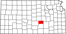 | |
| Unincorporated communities | ||
| Ghost town |
| |
| Townships | ||
| Footnotes | ‡This populated place also has portions in an adjacent county or counties | |
This article is issued from Wikipedia - version of the 6/5/2014. The text is available under the Creative Commons Attribution/Share Alike but additional terms may apply for the media files.