Allegany County, New York
| Allegany County, New York | |
|---|---|
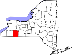 Location in the U.S. state of New York | |
 New York's location in the U.S. | |
| Founded | 1806 |
| Seat | Belmont |
| Largest town | Wellsville |
| Area | |
| • Total | 1,034 sq mi (2,678 km2) |
| • Land | 1,029 sq mi (2,665 km2) |
| • Water | 5.1 sq mi (13 km2), 0.5% |
| Population | |
| • (2010) | 48,946 |
| • Density | 48/sq mi (19/km²) |
| Congressional district | 23rd |
| Time zone | Eastern: UTC-5/-4 |
| Website |
www |
Allegany County is a county in the southern tier of the U.S. state of New York. As of the 2010 census, the population was 48,946.[1] Its county seat is Belmont.[2] Its name derives from a Delaware Indian (Lenape) word, applied by European-American settlers of Western New York State, to a trail that followed the Allegheny River and then used for the county.
The county is bisected by the Genesee River, flowing north to its mouth on Lake Ontario. During the mid-nineteenth century, the Genesee Valley Canal was built to link southern markets to the Great Lakes and Mohawk River. The county was also served by railroads, which soon superseded the canals in their capacity for carrying freight. Part of the Oil Springs Reservation, controlled by the Seneca Nation, is located in the county.
History
This was for centuries the territory of the Seneca people, the westernmost nation of the Five Nations of the Haudenosaunee, a confederacy of Iroquoian languages-speaking peoples. European-American permanent settlement did not take place until after the American Revolutionary War and the forced cession by the Seneca of most of their lands in western New York. New York State sold off the lands cheaply to attract new European-American settlers and agricultural development. Allegany County was created by the state legislature on April 7, 1806 when Genesee County, New York was partitioned to set aside some 1,570 square miles (4,000 km2) to the new county. The first County Seat was established at Angelica, New York where it remained for half a century. It was later moved to Belmont, a village located along the Genesee River.[3] On March 11, 1808, the borders were adjusted so that 230 square miles (600 km2) of Steuben County passed to Allegany County,[4] and 600 miles (1,000 km) of Allegany County passed to Genesee County.[5] This established the current border between Genesee and Steuben counties, and reduced the size of Allegany County to 1,200 square miles (3,100 km2). On June 12, 1812, the legislature authorized the attachment of Cattaraugus County, New York to Allegany County for administration reasons, but for practical reasons this action did not take place at that time.[6] However, on April 13, 1814, the eastern half of Cattaraugus County was so attached and administered from Belmont.[7] This attachment was ended on March 28, 1817.[8] With continued settlement through the mid-nineteenth century, the legislature periodically adjusted county borders as new counties were organized in western New York. On April 1, 1846, Allegany County lost 120 square miles (310 km2) to Wyoming County, reducing the size of Allegany County to 1,140 square miles (3,000 km2), and establishing the current border between Allegany and Wyoming counties.[9] On May 11, 1846, Allegany County lost 50 square miles (100 km2) to Livingston County, reducing the total to 1,090 square miles (2,800 km2), and establishing the western portion of the current border with Livingston County.[10] On March 23, 1857, Allegany County lost another 40 square miles (100 km2) to Livingston County, passing the Ossian, New York area to Livingston County, and establishing the current border between them.[11]
Geography
According to the U.S. Census Bureau, the county has a total area of 1,034 square miles (2,680 km2), of which 1,029 square miles (2,670 km2) is land and 5.1 square miles (13 km2) (0.5%) is water.[12]
Allegany County is in the southwestern part of New York State, along the Pennsylvania border. Allegany County does not lie along the Allegheny River, as its name would suggest. The highest point in the county is Alma Hill, with an elevation of 2,548 feet above sea level. This is the highest point in the state west of the Catskill Mountains. The highest point of Interstate 86 is located in the Town of West Almond with an elevation of 2,110 feet. This is also believed to be the highest point of any interstate in the New York.
The County is unique from a watershed perspective as it is providing water to three major watersheds of North America: The eastern part near Alfred has Canacadea Creek that goes into the Canisteo River, Susquehanna River and eventually to Chesapeake Bay.
The Genesee River bisects the county from south to north, flowing north out of the County through Letchworth State Park with its three waterfalls on to Rochester over three more waterfalls to its mouth on Lake Ontario and then on to the St. Lawrence River and Atlantic Ocean.
The southwestern part of the County flows into the Allegheny River that flows into the Ohio and then to the Mississippi River basin to the Gulf of Mexico.
In June 1972 the remnants of Hurricane Agnes stalled over the area, dropping more than 20 inches (510 mm) of rain. Flooding took place in the valley communities of Wellsville, Belmont, Belfast and others in the county.
Long a necessary transportation waterway for the Seneca and other Native Americans, and successive European-American settlers, since the late 20th century, the Genesee River has been extremely popular with canoeists. The river is also favored by fishermen as it abounds in smallmouth bass, trout and panfish.
Adjacent counties
- Livingston County - northeast
- Steuben County - east
- Potter County, Pennsylvania - southeast
- McKean County, Pennsylvania - southwest
- Cattaraugus County - west
- Wyoming County - northwest
Major highways
-
 Interstate 86
 -
 New York State Route 17 (Southern Tier Expressway)
 -
 New York State Route 19
 -
 New York State Route 21
 -
 New York State Route 305
 -
 New York State Route 417
Demographics
| Historical population | |||
|---|---|---|---|
| Census | Pop. | %± | |
| 1810 | 1,942 | — | |
| 1820 | 9,330 | 380.4% | |
| 1830 | 26,276 | 181.6% | |
| 1840 | 40,975 | 55.9% | |
| 1850 | 37,808 | −7.7% | |
| 1860 | 41,881 | 10.8% | |
| 1870 | 40,814 | −2.5% | |
| 1880 | 41,810 | 2.4% | |
| 1890 | 43,240 | 3.4% | |
| 1900 | 41,501 | −4.0% | |
| 1910 | 41,412 | −0.2% | |
| 1920 | 36,842 | −11.0% | |
| 1930 | 38,025 | 3.2% | |
| 1940 | 39,681 | 4.4% | |
| 1950 | 43,784 | 10.3% | |
| 1960 | 43,978 | 0.4% | |
| 1970 | 46,458 | 5.6% | |
| 1980 | 51,742 | 11.4% | |
| 1990 | 50,470 | −2.5% | |
| 2000 | 49,927 | −1.1% | |
| 2010 | 48,946 | −2.0% | |
| Est. 2015 | 47,462 | [13] | −3.0% |
| U.S. Decennial Census[14] 1790-1960[15] 1900-1990[16] 1990-2000[17] 2010-2013[1] | |||
As of the census[18] of 2000, there were 49,927 people, 18,009 households, and 12,192 families residing in the county. The population density was 48 people per square mile (19/km²). There were 24,505 housing units at an average density of 24 per square mile (9/km²). The racial makeup of the county was 97.03% White, 0.72% Black or African American, 0.28% Native American, 0.72% Asian, 0.37% from other races, and 0.88% from two or more races. 0.91% of the population were Hispanic or Latino of any race. 22.3% identified as being of German, 16.6% English, 13.8% Irish, 11.9% American and 7.0% Italian ancestry according to Census 2000. 96.5% spoke English and 1.3% Spanish as their first language.
There were 18,009 households out of which 31.50% had children under the age of 18 living with them, 54.20% were married couples living together, 9.00% had a female householder with no husband present, and 32.30% were non-families. 26.00% of all households were made up of individuals and 11.30% had someone living alone who was 65 years of age or older. The average household size was 2.53 and the average family size was 3.04.
In the county the population was spread out with 24.40% under the age of 18, 15.50% from 18 to 24, 23.90% from 25 to 44, 22.20% from 45 to 64, and 14.00% who were 65 years of age or older. The median age was 35 years. For every 100 females there were 99.80 males. For every 100 females age 18 and over, there were 98.10 males.
The median income for a household in the county was $32,106, and the median income for a family was $38,580. Males had a median income of $30,401 versus $21,466 for females. The per capita income for the county was $14,975. About 10.50% of families and 15.50% of the population were below the poverty line, including 19.20% of those under age 18 and 7.50% of those age 65 or over.
Government and politics
Allegany County is considered a conservative county, supporting Republican national and state candidates. In 2004, it voted for George W. Bush over John Kerry 63% to 34%, and in 2008 it voted for John McCain over Barack Obama 59% to 39%.[19] It has been reported that in the last 170 years, the only Democratic candidates to win were Franklin Pierce in 1852[20] and Lyndon B. Johnson in 1964.[21] In 2006, neither Democrat Eliot Spitzer or Hillary Clinton carried it in their otherwise landslide elections for governor and US senator, respectively. Eliot Spitzer lost 48.98% to John Faso's 49.03%. Hillary Clinton lost the county by 3 points. In 2010, Andrew Cuomo lost by a wide margin while Senator Chuck Schumer carried it by a narrow margin of 49.46% to Jay Townsend's 48.86% a margin of 78 votes. It was one of only two counties that Senator Kirsten Gillibrand lost to Wendy Long in 2012.
| Voter registration as of April 1, 2016[22] | |||||
|---|---|---|---|---|---|
| Party | Active voters | Inactive voters | Total voters | Percentage | |
| Democratic | 5,869 | 401 | 6,270 | 24.14% | |
| Republican | 12,217 | 537 | 12,754 | 49.10% | |
| Unaffiliated | 4,509 | 386 | 4,895 | 18.85% | |
| Other[nb 1] | 1,908 | 148 | 2,056 | 7.92% | |
| Total | 24,503 | 1,472 | 25,975 | 100% | |
Allegany is part of New York's 29th congressional district, which has a Cook Partisan Voting Index of R+5. In the New York State Senate, it is part of the 57th district and is represented by Republican Catharine Young. In the New York State Assembly, the County is in the 148th Assembly District represented by Republican Joseph Giglio.
The Allegany Board of Legislators consists of 15 members from five three-member districts. As of 2010, the Board consists of 14 Republicans and one Independent. The current chairman is Curtis W. Crandall. The County Administrator is Mitchell M. Alger.
Allegany County is divided into 29 towns and 10 villages. There are no cities as designated by New York State Law. The border between Allegany and Steuben County runs through the Village of Almond. The towns and villages by County Legislative District are as follows:
District I: Angelica, Belfast, Caneadea, Centerville, Granger, Hume, Rushford and the Village of Angelica.
District II: Amity, Clarksville, Cuba, Friendship, New Hudson, Ward and the Villages of Belmont & Cuba.
District III: Alma, Bolivar, Genesee, Independence, Scio, Willing, Wirt and the Villages of Bolivar & Richburg.
District IV: Andover, Wellsville and the Villages of Andover and Wellsville.
District V: Alfred, Allen, Almond, Birdsall, Burns, Grove, West Almond and the Villages of Alfred, Almond & Canaseraga.
The Oil Springs Reservation is an Indian Reservation of the Seneca Nation shared with Cattaraugus County having a total area of only 1-square-mile (2.6 km2). This is the site of the famed spring described by the Franciscan Missionary Joseph DeLa Roch D'Allion in 1627, the first recorded mention of oil on the North American Continent. In 1927, the New York State Oil Producers Association sponsored the dedication of a monument at the site describing the history of the oil industry in North America. There is a small park with parking and a foot bridge to the monument. The remainder of the reservation is mostly utilized for cottages on Cuba Lake, Seneca run gas stations and woodlands.
Education
Higher education facilities include Alfred University, the New York State College of Ceramics (a member of SUNY), Alfred State College, and Houghton College. The County has twelve school districts with their buildings in the County and parts of an additional six districts. Districts include: Alfred-Almond Central, Canaseraga Central that are part of the Greater Southern Tier BOCES with a facility in Hornell. Districts in associated with the Cattaraugus-Allegany BOCES include: Andover Central, Whitesville Central, Wellsville Central, Bolivar-Richburg Central, Scio Central, Genesee Valley Central, Belfast Central, Fillmore Central, Friendship Central, Cuba-Rushford Central. Districts with their buildings outside the County include Canisteo-Greenwood, Portville, Pioneer, Letchworth, Keshequa and Arkport. There are two private schools: Immaculate Conception in Wellsville and Houghton Academy in Houghton. There are also two Montessori Schools in Wellsville and Alfred.[23]
Communities
Allegany County comprises 29 Towns and 10 Villages.
Towns
Villages
Census-designated places
Hamlets
Indian reservations
- Oil Springs Reservation (part)
See also
- List of counties in New York
- National Register of Historic Places listings in Allegany County, New York
Notes
- ↑ Included are voters affiliated with the Conservative Party, Green Party, Working Families Party, Independence Party, Women's Equality Party, Reform Party, and other small parties.
References
- 1 2 "State & County QuickFacts". United States Census Bureau. Retrieved October 11, 2013.
- ↑ "Find a County". National Association of Counties. Archived from the original on May 31, 2011. Retrieved 2011-06-07.
- ↑ New York. Laws of New York; 1806; 29th Session; Chapter 162; Section 1; Page 605.
- ↑ New York. Laws of New York; 1808; 31st Session, Chapter 38; Page 263.
- ↑ New York. Laws of New York; 1808; 31st Session; Chapter 40; Sections 1—2; Page266.
- ↑ New York. Laws of New York; 1812; 35th Session; Chapter 38; Page 263 .
- ↑ New York. Laws of New York; 1814; 37th Session; Chapter 123; Page 146.
- ↑ New York. Laws of New York; 1816; 40th Session; Chapter 115; Section 1; Page 107.
- ↑ New York. Laws of New York; 1846; 69th Session; Chapter 51; Page 53.
- ↑ New York. Laws of New York; 1846; 69th Session; Chapter 197; Section 1; Page 235.
- ↑ New York. Laws of New York; 1857; 80th Session; Chapter 166; Page 366.
- ↑ "2010 Census Gazetteer Files". United States Census Bureau. August 22, 2012. Retrieved January 3, 2015.
- ↑ "County Totals Dataset: Population, Population Change and Estimated Components of Population Change: April 1, 2010 to July 1, 2015". Retrieved July 2, 2016.
- ↑ "U.S. Decennial Census". United States Census Bureau. Archived from the original on May 11, 2015. Retrieved January 3, 2015.
- ↑ "Historical Census Browser". University of Virginia Library. Retrieved January 3, 2015.
- ↑ "Population of Counties by Decennial Census: 1900 to 1990". United States Census Bureau. Retrieved January 3, 2015.
- ↑ "Census 2000 PHC-T-4. Ranking Tables for Counties: 1990 and 2000" (PDF). United States Census Bureau. Retrieved January 3, 2015.
- ↑ "American FactFinder". United States Census Bureau. Archived from the original on September 11, 2013. Retrieved 2011-05-14.
- ↑ CNN: New York results by county
- ↑ Geographie Electorale for 1852
- ↑ Geographie Electorale for 1964
- ↑ "NYSVoter Enrollment by County, Party Affiliation and Status" (PDF). New York State Board of Elections. April 2016. Retrieved July 30, 2016.
- ↑ http://www.alleganyplanning.com/pdfs/25_Schools.pdf
External links
| Wikivoyage has a travel guide for Allegany County (New York). |
- Allegany County at DMOZ
- Alfred University
- Houghton College
- Allegany County Data and Information Resource
- Links to historical information about Allegany County
- Historical summary of Allegany County and its subdivisions
 |
Wyoming County | Livingston County | | |
| Cattaraugus County | |
Steuben County | ||
| ||||
| | ||||
| McKean County, Pennsylvania | Potter County, Pennsylvania |
Municipalities and communities of Allegany County, New York, United States | ||
|---|---|---|
| Towns | | |
| Villages | ||
| CDPs | ||
| Hamlets | ||
| Indian reservation | ||
| Footnotes | ‡This populated place also has portions in an adjacent county or counties | |
Coordinates: 42°15′N 78°01′W / 42.25°N 78.02°W