Jinsafut
| Jinsafut | |
|---|---|
| Other transcription(s) | |
| • Arabic | جينصافوط |
| • Also spelled | Jensafut (official) |
|
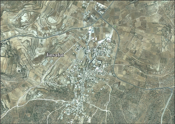
Jinsafut, 2015 | |
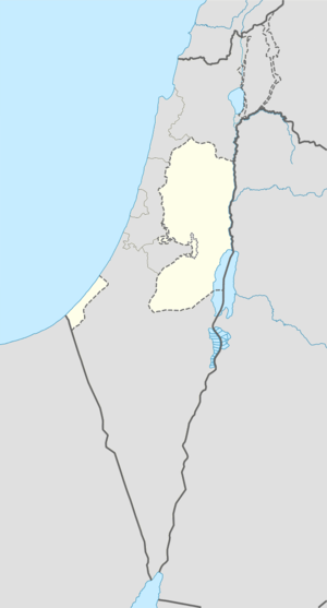 Jinsafut Location of Jinsafut within the Palestinian territories | |
| Coordinates: 32°10′43″N 35°07′46″E / 32.17861°N 35.12944°ECoordinates: 32°10′43″N 35°07′46″E / 32.17861°N 35.12944°E | |
| Palestine grid | 162/176 |
| Governorate | Qalqilya |
| Government | |
| • Type | Village council |
| Area | |
| • Jurisdiction | 9,335 dunams (9.3 km2 or 3.6 sq mi) |
| Population (2007) | |
| • Jurisdiction | 2,357 |
| Name meaning | Jinsafut[1] |

Jinsafut (Arabic: جينصافوط) is a Palestinian village in the Qalqilya Governorate in the northeastern West Bank, located fifteen kilometers east of Qalqilya,[2] and sixteen kilometers west of Nablus. It lies at an elevation of around 430 meters above sea level.[3] According to the Palestinian Central Bureau of Statistics, the village had a population of approximately 2,300 inhabitants in mid-year 2006.[4]
Fatah's Secretary-General Farouk Kaddoumi was born in Jinsafut.[5]
History
Ottoman era
The place appeared in 1596 Ottoman tax registers as "Jim Safut", being in the Nahiya of Bani Sa'b of the Liwa of Nablus. It had a population of 26 households, all Muslim. The villagers paid taxes on wheat, barley, summercrops, olives, and goats or beehives, and a press for olives or grapes.[6]
In 1882, the Palestine Exploration Fund's Survey of Western Palestine described the village as "a small village on high ground, with wells to the north, and a few olives."[7]
Modern era
In the 1922 census of Palestine conducted by the British Mandate authorities, Jensafut had a population of 267 inhabitants, all Muslims,[8] while in the 1931 census, Jinsafut had 76 occupied houses and a population of 315, again all Muslim.[9]
In 1945 the population was 450, all Muslims,[10] with 9,356 dunams of land, according to an official land and population survey.[11] Of this, 1,410 dunams were for plantations or irrigated land, 2,208 for cereals,[12] while 14 dunams were built-up land.[13]
In the wake of the 1948 Arab–Israeli War, and after the 1949 Armistice Agreements, Jinsafut came under Jordanian rule. After the Six-Day War in 1967, Jinsafut has been under Israeli occupation.
Demographics
Some families of Jinsafut include al-Ayoub, al-Sukar, al-Saber, al-Allan, al-Nassar, al-Bashir and Eid.[14] Prior to 1967, Jinsafut had a population of 700, which decreased to 550 after the 1967 Six-Day War; The drop was caused by residents fleeing the village to Jordan. According to a PCBS estimate, the village had grown to 2,122 inhabitants in 2003, then rose to 2,280 in 2006.[2]
Economy
Before 1967, 99.5% of Jinsafut's labor force depended agriculture, particularly on peach and grape crops, as well as raising livestock. The remainder worked in civil jobs. From 1967 to 2002, 91% of the village residents depended on agriculture or working in Israel, 6% were employed in the Palestinian National Authority government and 3% worked in commerce. Since the beginning of the Second Intifada, vehicle movement in Jinsafut has been constricted by Israel, contributing to 93% of the working population being unemployed.[2]
According to the Applied Research Institute - Jerusalem, Jinsafut has a land area of 9,335 dunams; 31.8% is used for growing crops, 4.3% are for heterogeneous agricultural areas, 1.9% for herbaceous vegetation associations, 5.2% is designated as arable land, 3% is built-up area, 8% is used for land for Israeli settlements and the remainder is forest area.[2]
References
- ↑ Palmer, 1881, p. 183
- 1 2 3 4 The Segregation Wall hits more Palestinian lands in Qalqilyia district Land Research Center (LRC) & The Applied Research Institute-Jerusalem (ARIJ). 2004-06-15.
- ↑ Welcome To Jinsafut PalestineRemembered.
- ↑ Projected Mid -Year Population for Qalqiliya Governorate by Locality 2004- 2006 Palestinian Central Bureau of Statistics (PCBS)
- ↑ Biographies of Palestinian political leaders Middle East Reference.
- ↑ Hütteroth and Abdulfattah, 1977, p. 139
- ↑ Conder and Kitchener, 1882, SWP II, p. 164
- ↑ Barron, 1923, Table IX, Sub-district of Nablus, p. 25
- ↑ Mills, 1932, p. 62
- ↑ Department of Statistics, 1945, p. 18
- ↑ Government of Palestine, Department of Statistics. Village Statistics, April, 1945. Quoted in Hadawi, 1970, p. 60
- ↑ Government of Palestine, Department of Statistics. Village Statistics, April, 1945. Quoted in Hadawi, 1970, p. 106
- ↑ Government of Palestine, Department of Statistics. Village Statistics, April, 1945. Quoted in Hadawi, 1970, p. 156
- ↑ Hundreds of olive trees burned by Israeli settlers in Jinsafut Village Land Research Center. 2007-10-01.
Bibliography
| Wikimedia Commons has media related to Jinsafut. |
| Wikimedia Commons has media related to Al-Funduq. |
- Barron, J. B., ed. (1923). Palestine: Report and General Abstracts of the Census of 1922. Government of Palestine.
- Conder, Claude Reignier; Kitchener, H. H. (1882). The Survey of Western Palestine: Memoirs of the Topography, Orography, Hydrography, and Archaeology. 2. London: Committee of the Palestine Exploration Fund.
- Department of Statistics (1945). Village Statistics, April, 1945. Government of Palestine.
- Hadawi, Sami (1970). Village Statistics of 1945: A Classification of Land and Area ownership in Palestine. Palestine Liberation Organization Research Center.
- Hütteroth, Wolf-Dieter; Abdulfattah, Kamal (1977). Historical Geography of Palestine, Transjordan and Southern Syria in the Late 16th Century. Erlanger Geographische Arbeiten, Sonderband 5. Erlangen, Germany: Vorstand der Fränkischen Geographischen Gesellschaft. ISBN 3-920405-41-2.
- Mills, E., ed. (1932). Census of Palestine 1931. Population of Villages, Towns and Administrative Areas (PDF). Jerusalem: Government of Palestine.
- Palmer, E. H. (1881). The Survey of Western Palestine: Arabic and English Name Lists Collected During the Survey by Lieutenants Conder and Kitchener, R. E. Transliterated and Explained by E.H. Palmer. Committee of the Palestine Exploration Fund.
External links
- Welcome To Jinsafut
- Welcome To al-Funduq
- Survey of Western Palestine, Map 11: IAA, Wikimedia commons
- Jinsafut Village (including Al Funduq Locality) (Fact Sheet), ARIJ
- Jinsafut Village Profile (including Al Funduq Locality), ARIJ
- Jinsafut, aerial photo, ARIJ
- The Segregation Wall hits more Palestinian lands in Qalqilyia district, 15, June, 2004, ARIJ
- Tree uprooting and colonial expansion in Jinsafut village, 04, June, 2005, ARIJ
- Talk of Churchills and Chamberlains, By Akiva Eldar, Haaretz, May.16, 2006
- Jinsafut village's land devastated for Wall construction, 15, January, 2007, ARIJ
- Demolition Warnings in Jinsafut Village - Qalqlyiah Governorate, 24, February, 2007, ARIJ
- House demolition and warning campaign continued in Qalqiliay governorate, 11, September, 2007, ARIJ
- Hundreds of olive trees burned by Israeli settlers in Jinsafut Village, 01, October, 2007, ARIJ
- Halt Construction Orders against a number of structures in Hajja and Jinsafut villages, 20, February, 2010, ARIJ
- Ravaging 60 trees in Jinsafut village in Qalqiliya 15, January, 2012, ARIJ
| Cities |  | |
|---|---|---|
| Municipalities |
| |
| Villages |
| |