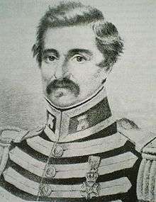
Agostino Codazzi
| Agostino Codazzi | |
|---|---|
 | |
| Born |
Giovanni Battista Agostino Codazzi Bartolotti July 12, 1793 Lugo, Italy |
| Died |
February 7, 1859 (aged 65) Codazzi, Granadine Confederation |
| Nationality | Italian, Venezuelan |
| Occupation | Explorer, engineer, geographer, cartographer, ethnographer, naturalist, governor, military |
| Notable work | Atlas Físico y Político de la República de Venezuela (1840) |
| Signature | |
 | |

Giovanni Battista Agostino Codazzi (alternatively known in Latin America as Agustín Codazzi; 12 July 1793 - 7 February 1859) was an Italian military, scientist, geographer, cartographer, and governor of Barinas (1846-1847). He made his main investigations and cartographic work in Venezuela and Colombia, thereby creating for both countries a complete set of maps and statistics after the tumultuous post-independence years from the Spanish Empire.
Biography
Famous geographer and cartographer born in Lugo, Ravenna(Italy), arrived in South America in the 1810s and fought under the corsair Aury, claiming the independence of Florida. Attracted to the ideals of southamerican freedom, after obtaining the friendship of Bolivar and other generals, enrolled in the "Libertador" Army, where -thanks to his military expertice obtained in Italian academies- behaved as excellent artillery official (colonel). After the independence wars, he left the military service and dedicated to what he liked most, the geographical & cartographical investigation, doing his most renowned masterpiece: "The Geography and Atlas of the Venezuelan Provinces" (Célebre geógrafo y cartógrafo nacido en Lugo, Ferrara, llegó a Sudamérica avanzado ya el siglo XIX y combatió a las órdenes del célebre corsario Aury, reclamando con éste la Independencia de La Florida. Cautivado por los ideales de la emancipación sudamericana, al ganarse la amistad y consideración de Simón Bolívar y otros generales patriotas se incorporó al ejército del Libertador, en cuyas filas, gracias a la preparación militar adquirida en academias italianas, tuvo destacada actuación como hábil artillero, y detentó el grado de coronel. Finalizada la lucha por la Independencia, dejaría de lado su actividad bélica para dedicarse a lo que realmente le apasionaba, la investigación geográfica y cartográfica, y llevaría a cabo su singular obra: la geografía y el atlas de las provincias venezolanas).[1]
Codazzi was born in the Italian city of Lugo. Since young he appreciated the ideals of the French Revolution and, after his studies at the military academy "Scuola di Artiglieria" of Pavia, actively served in the Napoleon Army.
With the defeat of Napoleon in 1815 Codazzi moved away from Italy and after some travels went to Venezuela, where he offered his military knowledge to Simon Bolivar.[2]
Successively he received the task of mapping the area of the Maracaibo Lake and the borders between Venezuela, Colombia and Ecuador. The Venezuelan government named him Colonel and ordered the creation of an Atlas of Venezuela, a task that gave him international fame (in Paris Codazzi was awarded in 1842 the Legion of Honor by the King of France, on behalf of the French Academy of Science).
Agustin Codazzi meanwhile took the Venezuelan citizenship from president José Antonio Páez and become Governor of Barinas, a region of southwestern Venezuela. In those years his academic activity of geographer was continuously interrupted by his duties of military commander, suffocating many revolts.
Codazzi even promoted the creation in the 1840s of the Colonia Tovar, a small German settlement in the Venezuelan central mountains that still exist today and has become one of the main tourist attractions near Maracay.
With the fall of Páez after a military insurrection, Codazzi was forced to escape to Cúcuta (Colombia), where he continued his geographic and mapping activity with military duties for the Colombian government.
In 1852 Codazzi did a scientific and cartographic inspection of Panama for the British government: in 1854 - even if with no official mention of Codazzi's work — the Panama Canal project was done following exactly his indications and route.
Codazzi died of malaria in February 1859 at the small town of Espíritu Santo in the Colombian mountains, in the arms of his friend Manuel María Paz, while he was mapping the area for the Comisión Corográfica.[3] The town where he died has been renamed "Aldea Codazzi", and now is a city with a population of nearly 70,000 inhabitants.
Venezuela honored the memory of Agustin Codazzi placing his remains inside the Panteón Nacional of Caracas in 1942, where he is considered one the Heroes of Venezuela.
Colombia's national geographical society, a government agency, is named after Agustin Codazzi (Instituto Geográfico Agustin Codazzi).
Works
This is a list of main works of Agostino Codazzi:
See also
Notes
- ↑ Vannini, Marisa. "Afectos Científicos Italianos" p.536
- ↑ Biography (in Italian)
- ↑ Tobar Gómez, Oscar. "La obra pictórica de Manuel María Paz y la Comisión Corográfica" (in Spanish). Retrieved 3 Sep 2011.
External links
| Wikisource has the text of a 1905 New International Encyclopedia article about Agostino Codazzi. |
- Biography of Codazzi: Agustin Codazzi, Vida y Empresas, by Giorgio Antei (in Italian & Spanish)
- Photo of Agostino Codazzi