Abbey Line
| Abbey Line | |
|---|---|
|
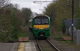
A London Midland Abbey Line service departs St Albans Abbey for Watford Junction | |
| Overview | |
| Type | Heavy rail |
| System | National Rail |
| Status | Operational |
| Locale | Hertfordshire |
| Termini |
Watford Junction St Albans Abbey |
| Stations | 7 |
| Operation | |
| Opened | 5 May 1858 |
| Owner | Network Rail |
| Operator(s) | London Midland |
| Rolling stock | Class 319 |
| Technical | |
| Line length | 6.5 mi (10.5 km) |
| Track gauge | 1,435 mm (4 ft 8 1⁄2 in) standard gauge |
| Electrification | 25 kV AC OHLE |
| Operating speed | 40–75 mph (64–121 km/h) |
| Abbey Line | |||||||||||||||||||||||||||||||||||||||||||||||||||||||||||||||||||||||||||||||||||||||||||||||||||||||||||||||||
|---|---|---|---|---|---|---|---|---|---|---|---|---|---|---|---|---|---|---|---|---|---|---|---|---|---|---|---|---|---|---|---|---|---|---|---|---|---|---|---|---|---|---|---|---|---|---|---|---|---|---|---|---|---|---|---|---|---|---|---|---|---|---|---|---|---|---|---|---|---|---|---|---|---|---|---|---|---|---|---|---|---|---|---|---|---|---|---|---|---|---|---|---|---|---|---|---|---|---|---|---|---|---|---|---|---|---|---|---|---|---|---|---|---|
Legend | |||||||||||||||||||||||||||||||||||||||||||||||||||||||||||||||||||||||||||||||||||||||||||||||||||||||||||||||||
| |||||||||||||||||||||||||||||||||||||||||||||||||||||||||||||||||||||||||||||||||||||||||||||||||||||||||||||||||
The Abbey Line, also called the St Albans Abbey Branch Line, is a railway line from Watford Junction to St Albans Abbey. The 6.5-mile (10.5 km) route passes through town and countryside in the county of Hertfordshire, just outside the boundaries of the Oyster Card and London fare zones.[1] Its northern terminus in St Albans Abbey is located in the south of the city, around 1.2 kilometres (0.75 mi) away from the larger St Albans City railway station on the Thameslink line.
The Abbey Line is a semi-rural line and, due to its single-track operation, service frequencies are limited. The service is sometimes referred to locally as the Abbey Flyer.[2]
History
The line was opened by the London and North Western Railway (LNWR) on 5 May 1858 and was the first railway to reach St Albans.[3]
Originally there were two intermediate stations:
In 1910 a station at Callowland opened, now Watford North.
In 1924 the terminus at St Albans became St Albans Abbey to distinguish it from the Midland Railway main line station at St Albans City, which opened in 1868. The LNWR station was also served by a branch of the Great Northern Railway from Hatfield.
A sixth station was added at Garston in 1966 and a seventh at How Wood in 1988, to coincide with the electrification of the route at 25 kV AC overhead.
Past connections
The line was built in its current form: a branch from Watford to St. Albans. However, the line was at times connected to two other lines. One, the Hatfield and St Albans Railway, opened in 1865 from St. Albans Abbey station to the East Coast main line at Hatfield. Mostly a local route, the construction of the Midland main line ensured that it never became popular with the critical market of passengers to London. It closed to passengers in 1951, part of a cutback of minor routes after the war. The whole route closed to goods in 1964, though a short stub at the Hatfield end lasted until 1968.
During construction of the Midland main line in the 1860s, a branch was laid from near How Wood to the Midland route to carry building materials. Never used by passenger services, Ordnance Survey maps indicate it closed between 1883 and 1898 although the embankment and some bridge abutments remain very visible.[4][5][6][7] As part of a cost-cutting plan in the 1980s, British Rail examined reopening this, with the aim of diverting the branch to the City station and selling off the valuable Abbey station site.
The line today
Operations
Passenger services are operated by London Midland.
Stations on the branch are unstaffed and tickets must be bought on the train, except at St Albans Abbey and Watford North which have a ticket machine, and Watford Junction which is staffed. If starting your journey at Watford Junction, in compliance with National Rail conditions of carriage, you must have a valid ticket prior to boarding the train.
The Abbey Line is part of the Network Rail Strategic Route 18, SRS 18.10 and is classified as a Rural line.[8]
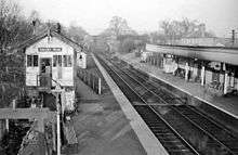
Infrastructure
The line is single track and is electrified at 25 kV AC using overhead line equipment. It has a loading gauge of W6 and a line speed of between 40 and 75 mph (64 and 121 km/h).[8]
Rolling stock
The service is operated using EMUs. A Class 319 EMU is in regular use, with services formerly operated by Class 321 and Class 313 units before that. Rarely (more commonly in the past) a Class 150 DMU has been substituted. London Midland recently acquired the Class 319 trains to replace the Class 321 units acquired by Abellio ScotRail to operate on Glasgow's suburban rail network.
| Class | Image | Type | Top speed | Number | Cars per set | Seat layout | Built | |
|---|---|---|---|---|---|---|---|---|
| mph | km/h | |||||||
| Class 319 | .jpg) |
EMU | 100 | 161 | 4 | 4 | 2+3 | 1987-88 |
Signalling
Signalling is under "One Train Working" (without Train Staff) rules, where only one train is allowed on the line at a time. Trains can be moved into Watford Junction yard by a manual ground frame there. On 28 October 2005 its incorrect operation caused an incident with a train not in passenger service.[9]
There is an automatic level crossing outside Watford North. This is operated by a manual plunger for trains heading towards St Albans, and by a treadle towards Watford Junction.
The future
Since 1995 the Abbey Flyer Users Group (ABFLY)[10] has been campaigning to secure the future of the line and encourage its growth. The Abbey Line was designated by the Strategic Rail Authority as a community rail line in July 2005, one of seven pilots under the Community Rail Development Strategy.[11]
In 2004 a proposal was made by Transport for London for a London Regional Rail Authority to take control over some rail services that extended out of Greater London, including the branch line.[12]
On 30 October 2009 Secretary of State for Transport Lord Adonis announced a plan to increase frequency on the line by allowing Hertfordshire County Council to lease the line from Network Rail and converting it to light rail from 2011. It was hoped that this would be possible for the same amount of subsidy the line received, as the new infrastructure required, such as a passing loop would be cheaper for light rail than heavy rail.[2][13] Longer-term proposals envisaged extensions into Watford town centre via Clarendon Road and High Street, and St Albans city centre,[14] possibly as far as St Albans City railway station, and possible re-instatement of the line to Hatfield.[15]
The light rail plan was cancelled in May 2013, as it was found to be impossible to deliver the scheme within the existing heavy rail subsidy as planned and more complicated than had been expected with disputes over apportionment of ticket revenue and who was responsible for the cost of maintaining structures.[16] Hertfordshire County Council pledged to prepare a more ambitious bid to the DfT for funding for full segregation from the national rail network and extensions on either end rather than to lease the line from Network Rail.

In a Draft Rail Strategy consultation published in June 2015,[18] Hertfordshire County Council highlighted the difficulties presented by single-track operation on the Abbey Line, in particular the fact that the maximum service frequency that can be operated is one train per 45 minutes. The report notes that the service pattern makes it difficult to enable interchange connections with other rail services and to offer a "clockface" timetable that is memorable to passengers. Among the solutions evaluated by Hertfordshire are: a proposal to reopen the passing loop at Bricket Wood; running trains which skip certain stations; closing some stations; conversion of the line to light rail operation; and conversion of the line to a guided busway. The passing loop solution would enable a 30-minute service, but the report notes that there would be an additional cost of running the line with two train sets (rather than a single train, as at present), and that it would be "difficult to achieve a favourable business case". The report states that a light rail or busway solution would be quicker to implement and offer higher service frequencies, although the capacity of such vehicles would fall from 60,000 passengers per hour to 2000, and concludes that these alternative modes would offer a stronger "business case" than heavy rail. The ABFLY campaign group has criticised the busway proposal, citing environmental concerns about replacing an electric train service with a diesel bus service and rejecting plans to replace the tracks with a concrete busway.[17]
Other proposals considered included adding the Abbey Line as a branch of the proposed extension of Crossrail to Milton Keynes Central; this proposal was rejected due to the technical challenges associated with upgrading the Abbey Line to accommodate Crossrail trains.[19]
See also
- Hatfield and St Albans Railway (closed)
- Nickey Line (closed)
References
- ↑ "Abbey Line - Community Rail Partnership - Route Guide". Community Rail Partnership. Retrieved 9 May 2009.
- 1 2 Lewis, Alex (30 October 2009). "Tram service promised for St Albans to Watford Abbey Flyer rail link". Watford Observer. Watford: Newsquest. Retrieved 6 March 2010.
Provided the project gets through a 12-week consultation, ownership of the line will transfer from Network Rail to Hertfordshire County Council, which will tender for a contractor to run the service. Watford MP Claire Ward said...'The Abbey Flyer is going to be put on a firmer footing, and there will be better services'.
- ↑ Route History, Community Rail Partnership, retrieved 9 May 2009
- ↑ "Ordnance Survey maps, various dates". oldmaps.co.uk. Retrieved 15 November 2014.
- ↑ "St Albans London Road". Disused Stations. Retrieved 14 November 2014.
- ↑ "Conservation Area Statement" (PDF). Hertfordshire County Council. Archived from the original (PDF) on 29 November 2014. Retrieved 14 November 2014.
- ↑ "Streetview pictures & aerial footage". Google Earth. Google. Retrieved 15 November 2014.
- 1 2 "Route 18 - West Coast Main Line" (PDF). Network Rail. 2009. Retrieved 1 June 2009.
- ↑ Report released on the derailment at Watford Junction Yard, Rail Accident Investigation Branch (published 28 March 2006), 28 October 2005, archived from the original on 20 July 2011, retrieved 9 May 2009
- ↑ Abbey Flyer Users Group, 13 November 2007, archived from the original on 15 May 2009, retrieved 9 May 2009
- ↑ Community Rail, Network Rail, archived from the original on 3 May 2009, retrieved 9 May 2009
- ↑ "London Rail Authority". alwaystouchout.com. 7 September 2006. Archived from the original on 26 September 2007. Retrieved 6 March 2010.
Because the London commuter rail network does not stop at the GLA boundary, we will look at whether it is feasible to give Transport for London the right to specify and pay for services in an area slightly bigger than Greater London that makes more sense in rail transport terms.
- ↑ "Watford and St Albans passengers on track for new tram service" (Press release). Department for Transport. 30 October 2009.
- ↑ "Rail Strategy" (PDF). Herts County Council. 2011. Retrieved 15 September 2011.
- ↑ "St Albans Abbey tram-train announced". Railway Gazette International. 30 October 2009. Archived from the original on 4 January 2010. Retrieved 24 December 2009.
- ↑ "St Albans light rail conversion plan dropped". Railway Gazette International. 29 May 2013.
- 1 2 Ikonen, Charlotte. "Direct rail link between Watford and St Albans could be ripped up and converted into busway". Watford Observer. Archived from the original on 13 July 2015. Retrieved 12 July 2015.
- ↑ "Hertfordshire Rail Strategy Draft Rail Strategy consultation". Hertfordshire County Council/Arup. 10 June 2015. pp. 65–67. Retrieved 12 July 2015.
- ↑ Hertfordshire Rail Strategy Draft Rail Strategy consultation, p.30
External links
| Wikimedia Commons has media related to Abbey Line. |

Coordinates: 51°42′14″N 0°21′40″W / 51.704°N 0.361°W