Abalá Municipality
| Abalá | |
|---|---|
| Municipality | |
|
Church of Abalá, Yucatán | |
 Region 2 Noroeste #001 | |
|
Abalá Location of the Municipality in Mexico | |
| Coordinates: 20°38′48″N 89°40′47″W / 20.64667°N 89.67972°WCoordinates: 20°38′48″N 89°40′47″W / 20.64667°N 89.67972°W | |
| Country |
|
| State |
|
| Government | |
| • Type |
|
| • Municipal President | Jose Candelario Ac Canche[2] |
| Area | |
| • Total | 301.45 km2 (116.39 sq mi) |
| [1] | |
| Elevation[1] | 6 m (20 ft) |
| Population (2005 [3][4]) | |
| • Total | 5,976 |
| Time zone | Central Standard Time (UTC-6) |
| • Summer (DST) | Central Daylight Time (UTC-5) |
| INEGI Code | 001 |
| Major Airport | Merida (Manuel Crescencio Rejón) International Airport |
| IATA Code | MID |
| ICAO Code | MMMD |
| Website | Official Website |
.JPG)
Abalá Municipality (In the Yucatec Maya Language: “Place of the plum juice”) is one of the 106 municipalities in the Mexican state of Yucatán containing (301.45 km2) of land and located roughly 50 km south of the city of Mérida.
History
After the conquest, during the colonial period, the Municipality of Abalá was founded as an encomienda first for Francisco de Montejo the Younger in 1549 and then in 1607 for Juan de Montejo Maldonado. The right to press the natives into labor then passed in 1632 to Conde-Duque of San Lucas, in 1633 to the Countess of Olivares, in 1699 to Mariana de Guzmán Duchess of Medina Cidoña, and in 1727 to Doña Josefa Díaz Bolio who had control of 211 Indians.[1]
In the modern era, the haciendas Maxal y Kambriche became part of the Muna Municipality on 18 April 1902.
On 20 January 1926, the cocoa farm and ranch Yaxcopoil are incorporated into the town of Umán but a decade later on 17 January 1936, the cocoa farm was restored to Abalá municipality.[1]
Governance
The municipal president is elected for a three-year term. Four aldermen—Secretary, public works, nomenclature, and ecology—also serve on the town council.[5]
Communities
The municipality is made up of 7 communities:
| Community | Population |
|---|---|
| Entire Municipality (2010) | 6,356[6] |
| Abalá | 1797 in 2005[7] |
| Cacao | 261 in 2005[8] |
| Mucuyché | 454 in 2005[9] |
| Peba | 275 in 2005[10] |
| Sihunchén | 336 in 2005[11] |
| Temozón | 716 in 2005[12] |
| Uayalceh | 2122 in 2005[13] |
Local festivals
Every year from 10 to 17 May, Abalá holds a fiesta celebrating the Virgin Mary.[1]
Tourist attractions
- Cave/Cenote Kankirixché
- Hacienda Nuestra Señora de la Soledad Pebá
- Hacienda San Pedro Ochil
- Hacienda Temozón Sur
- Hacienda Uayalceh
- Hacienda Cacao
Notables
External links
References
- 1 2 3 4 5 6 "Municipios de Yucatán » Abalá". Archived from the original on March 23, 2015. Retrieved 6 May 2015.
- ↑ "Priistas agradecidos" (in Spanish). Mérida, Mexico: Diario de Yucatán. 12 July 2012. Retrieved 6 May 2015.
- ↑ "Encyclopedia of the Municipalities of Mexico: Yucatan". Retrieved 1 November 2009.
- ↑ Census Results by Locality, 2005 INEGI.
- ↑ "Abalá". inafed (in Spanish). Mérida, Mexico: Enciclopedia de Los Municipios y Delegaciones de México. Retrieved 4 June 2015.
- ↑ "Mexico In Figures: Abalá, Yucatán". INEGI (in Spanish and English). Aguascalientes, México: Instituto Nacional de Estadística y Geografía (INEGI). Retrieved 6 May 2015.
- ↑ "Abalá". PueblosAmerica (in Spanish). PueblosAmerica. 2005. Retrieved 6 May 2015.
- ↑ "Cacao". PueblosAmerica (in Spanish). PueblosAmerica. 2005. Retrieved 6 May 2015.
- ↑ "Mucuyché". PueblosAmerica (in Spanish). PueblosAmerica. 2005. Retrieved 6 May 2015.
- ↑ "Peba". PueblosAmerica (in Spanish). PueblosAmerica. 2005. Retrieved 6 May 2015.
- ↑ "Sihunchén". PueblosAmerica (in Spanish). PueblosAmerica. 2005. Retrieved 6 May 2015.
- ↑ "Temozón". PueblosAmerica (in Spanish). PueblosAmerica. 2005. Retrieved 6 May 2015.
- ↑ "Uayalceh". PueblosAmerica (in Spanish). PueblosAmerica. 2005. Retrieved 6 May 2015.
Mérida (capital) | |||||||||||||||||||||||||||
| Topics | 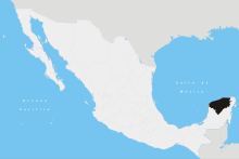 | ||||||||||||||||||||||||||
| Metros | |||||||||||||||||||||||||||
| Larger cities | |||||||||||||||||||||||||||
| Smaller cities |
| ||||||||||||||||||||||||||
| Municipalities |
| ||||||||||||||||||||||||||