2013 Bushehr earthquake
 | |
| Date | April 9, 2013 |
|---|---|
| Origin time | 16:22 IRDT (UTC+04:30) |
| Magnitude | 6.3 Mw[1] |
| Depth | 10.0 km (6.2 mi) |
| Epicenter | 28°29′N 51°35′E / 28.48°N 51.58°ECoordinates: 28°29′N 51°35′E / 28.48°N 51.58°E |
| Areas affected | Iran |
| Aftershocks | 32 |
| Casualties | 37 dead, 850 injured |


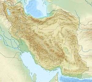
The 2013 Bushehr earthquake occurred with a moment magnitude of 6.3 on April 9 in Iran. The shock's epicenter was in the province of Bushehr, near the city of Khvormuj and the towns of Kaki and Shonbeh. At least 37 people were killed, mostly from the town of Shonbeh and villages of Shonbeh-Tasuj district, and an estimated 850 people were injured.
Tectonic setting
Iran lies within the complex zone of collision between the Arabian Plate and the Eurasian Plate. The rate of convergence between the plates near the epicentre is about 30 millimetres (1 in) per year, of which only part is taken up by within the Zagros fold and thrust belt. The earthquake was the result of thrust faulting on a NW-SE trending fault plane, consistent with continuing shortening of the Arabian Plate.[1]
Earthquake
At 16:22 IRDT (11:52 UTC) on April 9, 2013, an earthquake with a magnitude of 6.3 struck the southwestern coast of Iran, in Bushehr Province.[2][3] It struck at a depth of 10 kilometres (6.2 mi), near the towns of Khvormuj and Kaki.[2] "Dozens" of aftershocks followed, most within the first hour of the main quake.[3][4] The strongest aftershock had a magnitude of 5.6.[5]
The area is home to ten thousand people and fifty villages.[3] The United States Geological Survey (USGS) estimated that 80,000 people experienced strong tremors while several million felt light shaking.[3] The earthquake was felt in many countries around the Persian Gulf, including Qatar, Bahrain, Saudi Arabia, and the United Arab Emirates.[2][3][6]
Damage
At least 37 people were killed and an estimated 850 were injured by the earthquake.[2] Most of those killed were in the town of Shonbeh and villages of Shonbeh-Tasuj District.[2] Of the injured, 100 required hospitalization.[2]
Two villages in the Khvormuj district were "levelled".[3] Landslides caused by the earthquake were reported in Kaki City.[7] According to provincial governor Fereydun Hasanvand, 700 homes were damaged, affecting 200 families.[3] Many residents in the Shonbeh District lost power and water services.[4] Residents took to the streets in search of safety as aftershock after aftershock hit.[3]
According to Hasanvand, the Bushehr Nuclear Power Plant was not damaged.[2] A company official remarked "The earthquake in no way affected the normal situation at the reactor, personnel continue to work in the normal regime and radiation levels are fully within the norm."[2] It was built to withstand a magnitude 8 earthquake, according to an official.[4] The earthquake happened to occur on the National Nuclear Technology Day of Iran.[8]
Several high-rise buildings were evacuated in Manama, Bahrain.[9] In Dubai, the United Arab Emirates, buildings were also evacuated, including those in TECOM (Dubai Technology, Electronic Commerce and Media Free Zone Authority).[10] The earthquake was felt in Abu Dhabi, UAE, prompting residents to leave their buildings.[7] Having perceived the shaking, people crowded outside of their buildings in Dammam, Saudi Arabia.[6]
Aftermath
Iran's Red Crescent Society sent five teams to Bushehr Province to coordinate rescue efforts.[2] Several helicopters from nearby provinces helped airlift in emergency supplies.[2] Rescue efforts were hampered by darkness, but generators were sent to allow the effort to continue into the night, with hopes of completing it by daybreak.[3]
Three days of national mourning were announced on April 9.[4]
See also
References
- 1 2 "M6.3 – 89km SE of Bandar Bushehr, Iran". USGS. Retrieved April 9, 2013.
- 1 2 3 4 5 6 7 8 9 10 Alastair Jamieson; John Newland (April 9, 2013). "'Devastating' quake strikes near Iran's Bushehr nuclear plant, kills dozens". NBC News. Retrieved April 9, 2013.
- 1 2 3 4 5 6 7 8 9 "Earthquake near Iran's Bushehr nuclear power station". BBC News. April 9, 2013. Retrieved April 9, 2013.
- 1 2 3 4 "Iran says at least 37 killed in earthquake in south, nuclear plant undamaged". Washington Post. Associated Press. April 9, 2013. Retrieved April 9, 2013.
- ↑ http://earthquake.usgs.gov/earthquakes/recenteqsww/Quakes/usb000g3p7.php
- 1 2 Al-Asmari, Saeed (10 April 2013). "Quake tremors jolt Dammam, Alkhobar". ArabNews.
- 1 2 "Earthquake: 37 dead and 850 injured in Iran by tremor that rocked UAE". thenational.ae.
- ↑ "Quake hits near Iran's nuclear city Bushehr, 37 dead". Reuters.
- ↑ "Bahrain evacuates high-rise buildings after tremors in Manama". Xinhua. 2013-04-09. Retrieved 2013-04-16.
- ↑ Afshan Ahmed. "37 dead and 850 injured in Iran earthquake that rocked UAE". thenational.ae.
External links
| Wikimedia Commons has media related to 2013 Bushehr earthquake. |