142nd meridian east

142°
142nd meridian east

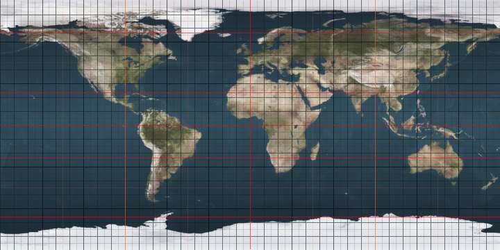
The 142nd meridian east of Greenwich is a line of longitude that extends from the North Pole across the Arctic Ocean, Asia, the Pacific Ocean, Australasia, the Indian Ocean, the Southern Ocean, and Antarctica to the South Pole.

The 142nd meridian east is the estimated location of the boundary between Spain and Portugal (as per the Treaty of Zaragoza) signed on 22 April 1529.[1] Consequently, at Possession Island 142°24'E, just before sunset on Wednesday 22 August 1770, Captain Cook declared the coast to be British territory in the name of King George III. The Coast to the west was already Dutch territory.

The 142nd meridian east forms a great circle with the 38th meridian west.

From Pole to Pole

Starting at the North Pole and heading south to the South Pole, the 142nd meridian east passes through:

Co-ordinates Country, territory or sea Notes
90°0′N 142°0′E / 90.000°N 142.000°E / 90.000; 142.000 (Arctic Ocean) Arctic Ocean
76°3′N 142°0′E / 76.050°N 142.000°E / 76.050; 142.000 (Russia)  Russia Sakha RepublicKotelny Island, New Siberian Islands
74°55′N 142°0′E / 74.917°N 142.000°E / 74.917; 142.000 (East Siberian Sea) East Siberian Sea Sannikov Strait
73°55′N 142°0′E / 73.917°N 142.000°E / 73.917; 142.000 (Russia)  Russia Sakha RepublicGreat Lyakhovsky Island, New Siberian Islands
73°16′N 142°0′E / 73.267°N 142.000°E / 73.267; 142.000 (East Siberian Sea) East Siberian Sea Laptev Strait
72°43′N 142°0′E / 72.717°N 142.000°E / 72.717; 142.000 (Russia)  Russia Sakha Republic
Khabarovsk Krai — from 62°1′N 142°0′E / 62.017°N 142.000°E / 62.017; 142.000 (Khabarovsk Krai)
58°59′N 142°0′E / 58.983°N 142.000°E / 58.983; 142.000 (Sea of Okhotsk) Sea of Okhotsk
53°28′N 142°0′E / 53.467°N 142.000°E / 53.467; 142.000 (Russia)  Russia Sakhalin Oblast — island of Sakhalin
51°31′N 142°0′E / 51.517°N 142.000°E / 51.517; 142.000 (Strait of Tartary) Strait of Tartary
48°56′N 142°0′E / 48.933°N 142.000°E / 48.933; 142.000 (Russia)  Russia Sakhalin Oblast — island of Sakhalin
48°30′N 142°0′E / 48.500°N 142.000°E / 48.500; 142.000 (Strait of Tartary) Strait of Tartary
47°39′N 142°0′E / 47.650°N 142.000°E / 47.650; 142.000 (Russia)  Russia Sakhalin Oblast — island of Sakhalin
47°16′N 142°0′E / 47.267°N 142.000°E / 47.267; 142.000 (Strait of Tartary) Strait of Tartary
46°56′N 142°0′E / 46.933°N 142.000°E / 46.933; 142.000 (Russia)  Russia Sakhalin Oblast — island of Sakhalin
45°58′N 142°0′E / 45.967°N 142.000°E / 45.967; 142.000 (La Pérouse Strait) La Pérouse Strait
45°28′N 142°0′E / 45.467°N 142.000°E / 45.467; 142.000 (Russia)  Japan Hokkaidō Prefecture — island of Hokkaidō
42°30′N 142°0′E / 42.500°N 142.000°E / 42.500; 142.000 (Pacific Ocean) Pacific Ocean
39°38′N 142°0′E / 39.633°N 142.000°E / 39.633; 142.000 (Russia)  Japan Iwate Prefecture — island of Honshū
39°24′N 142°0′E / 39.400°N 142.000°E / 39.400; 142.000 (Pacific Ocean) Pacific Ocean Passing just west of the island of Chichi-jima, Tokyo Prefecture,  Japan (at 27°5′N 142°10′E / 27.083°N 142.167°E / 27.083; 142.167 (Chichi-jima))
Passing just west of the island of Haha-jima, Tokyo Prefecture,  Japan (at 26°42′N 142°7′E / 26.700°N 142.117°E / 26.700; 142.117 (Haha-jima))
2°58′S 142°0′E / 2.967°S 142.000°E / -2.967; 142.000 (Papua New Guinea)  Papua New Guinea
9°12′S 142°0′E / 9.200°S 142.000°E / -9.200; 142.000 (Arafura Sea) Arafura Sea Passing just west of the Torres Strait Islands,  Australia (at 10°7′S 142°5′E / 10.117°S 142.083°E / -10.117; 142.083 (Torres Strait Islands))
10°42′S 142°0′E / 10.700°S 142.000°E / -10.700; 142.000 (Gulf of Carpentaria) Gulf of Carpentaria
11°46′S 142°0′E / 11.767°S 142.000°E / -11.767; 142.000 (Australia)  Australia Queensland
New South Wales — from 29°0′S 142°0′E / 29.000°S 142.000°E / -29.000; 142.000 (New South Wales)
Victoria — from 34°7′S 142°0′E / 34.117°S 142.000°E / -34.117; 142.000 (Victoria)
38°18′S 142°0′E / 38.300°S 142.000°E / -38.300; 142.000 (Indian Ocean) Indian Ocean Australian authorities consider this to be part of the Southern Ocean[2][3]
38°24′S 142°0′E / 38.400°S 142.000°E / -38.400; 142.000 (Australia)  Australia VictoriaLady Julia Percy Island
38°25′S 142°0′E / 38.417°S 142.000°E / -38.417; 142.000 (Indian Ocean) Indian Ocean Australian authorities consider this to be part of the Southern Ocean
60°0′S 142°0′E / 60.000°S 142.000°E / -60.000; 142.000 (Southern Ocean) Southern Ocean
66°49′S 142°0′E / 66.817°S 142.000°E / -66.817; 142.000 (Antarctica) Antarctica Adélie Land, claimed by  France

See also

References

  1. "Who Did Discover Australia?: The Portuguese and Spanish". Australia on CD. Archived from the original on 24 February 2011. Retrieved 25 January 2013.
  2. Darby, Andrew (22 December 2003). "Canberra all at sea over position of Southern Ocean". The Age. Retrieved 13 January 2013.
  3. "Indian Ocean". Encyclopaedia Britannica. Retrieved 13 January 2013.
This article is issued from Wikipedia - version of the 9/11/2016. The text is available under the Creative Commons Attribution/Share Alike but additional terms may apply for the media files.