Šamorín
| Šamorín (Somorja) | |
| Town | |
 A church in Šamorín | |
| Nickname: Somi | |
| Country | Slovakia |
|---|---|
| Region | Trnava |
| District | Dunajská Streda |
| Tourism region | Podunajsko |
| River | Danube |
| Elevation | 130 m (427 ft) |
| Coordinates | SK 48°01′36″N 17°18′42″E / 48.02667°N 17.31167°ECoordinates: SK 48°01′36″N 17°18′42″E / 48.02667°N 17.31167°E |
| Area | 44.348 km2 (17 sq mi) |
| Population | 13,028 (2014) |
| Density | 294/km2 (761/sq mi) |
| First mentioned | 1238 |
| Mayor | Gabriel Bárdos |
| Timezone | CET (UTC+1) |
| - summer (DST) | CEST (UTC+2) |
| Postal code | 931 01 |
| Phone prefix | 421-31 |
| Car plate | DS |
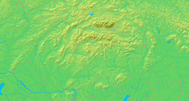  Location of Šamorín in Slovakia | |
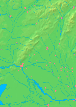  Location of Šamorín in the Trnava Region | |
| Wikimedia Commons: Šamorín | |
| Statistics: MOŠ/MIS | |
| Website: http://www.samorin.sk | |
Šamorín (Slovak pronunciation: [ˈʃ̺ɐ̞mɔ̝ri̞ːn̺]; Hungarian: Somorja, German: Sommerein) is a small Slovak town in western Slovakia, southeast of Bratislava.
Etymology
The name is derived from a Parton saint of a local church Sancta Maria, mentioned for the first time as villa Sancti Marie (1285).[1] Today's name is an adaptation of the original name: Zent Maria - Samaria - Somoria - Šamorín.
Geography
The town is located on the Danubian Flat on the Rye island, near the Gabčíkovo dam on the Danube. It is located around 17 kilometres (11 miles) southeast of Bratislava and 25 kilometres (16 miles) west of Dunajská Streda. Administratively the town belongs to the Trnava Region, Dunajská Streda District.
History
The oldest artifacts indicating the settlement of the area are dated to the Neolithic and Eneolithic Period.[2] The settlement of the location is documented also for the Bronze Age and the Iron Age. Later archaeologic research (2008) uncovered artifacts from the Early and High Middle Ages (remnants of settlements, dwellings, farm buildings).[2]
After the Mongol invasion, the village was settled by German "guests" who had the leading role in the town administration.[3] The German minority was given a royal privilege to apply Pressburg Law (now Bratislava) and lived in the town until the end of the Middle Ages. The presence of other ethnic groups like Pechenegs and Székelys is also documented.[4]
The settlement was a prominent port on the Danube during the Middle Ages and the market center of Rye Island. Agriculture also played a major role in the town's development. As a result of this prosperity, its citizens enjoyed a brisk trade in the new technologies and many shipyards on the Danube. However, with rise of Bratislava, the importance of the town began declining. Šamorín eventually lost its right to the status of royal free city granted in 1405 during the reign of Hungarian King Sigismund. In the sixteenth century, the city became notable again because of the witch trials held there. After the Austro-Hungarian army disintegrated in November 1918, Czechoslovak troops unlawfully occupied the area, later acknowledged internationally (contested by Hungary) by the Treaty of Trianon. Between 1938 and 1945 Šamorín became a part of Miklós Horthy's Hungary through the First Vienna Award. From 1945 until the Velvet Divorce, it was part of Czechoslovakia. Since then it has been part of Slovakia.
Demography
According to the 2014 census, the municipality had 13,028 inhabitants. In 2011 7,309 of the inhabitants were Hungarians, 4,365 Slovaks, 63 Czechs and 989 others and unspecified.[5]
In 1910, the town has a total population of 2,930, which included 2,699 Hungarians, 112 Germans and 114 Slovaks.[6]
According to the 1991 census, ethnic groups included 71% Hungarians and 27.4% Slovaks.
According to the 2001 census, ethnic groups included 66.63% Hungarians and 30.96% Slovaks.
The religious make-up was 75.27% Roman Catholics, 4.42% Protestant, 11.75% without denomination and others.[7]
Landmarks
- The Reformed Church, originally Catholic and built in the 13th century in the late Romanesque style.
- The Catholic Church and its former cloister from the 18th century in the Baroque style.
- The Protestant Church of 1784
- The Synagogue, built in 1912 in a Romanesque Revival style
- The Renaissance-style city hall
Municipal division
Šamorín has five districts: Šamorín (hu: Somorja) proper and the villages of Bučuháza (hu: Bucsuháza), Čilistov (hu: Csölösztő), Kráľovianky (hu: Királyfia) and Mliečno (hu: Tejfalu).
Historically incorporated villages
- 1808: Gančháza
- 1960: Čilistov
- 1976: Mliečno
International relations
Twin towns - Sister cities
Šamorín is twinned with:
References
- The information in this article is based on that in its German equivalent.
- Notes
- ↑ Štefánik, Martin; Lukačka, Ján, eds. (2010). Lexikón stredovekých miest na Slovensku [Lexicon of Medieval Towns in Slovakia] (PDF) (in Slovak). Bratislava: Historický ústav SAV. p. 495. ISBN 978-80-89396-11-5.
- 1 2 Štefánik & Lukačka 2010, p. 496.
- ↑ Štefánik & Lukačka 2010, p. 497.
- ↑ Štefánik & Lukačka 2010, p. 498.
- ↑ http://portal.statistics.sk/files/obce-narodnost.pdf
- ↑ http://www.omm1910.hu/hu/adatbank/adatok/duna_bal_partja_1910.xls
- ↑ "Mestská a obecná štatistika SR". Statistics.sk. Archived from the original on February 8, 2008. Retrieved 2009-05-06.
External links
- Official website (Slovak) (Hungarian)