Čaklov
| Čaklov | |
| Village | |
 | |
| Country | Slovakia |
|---|---|
| Region | Prešov |
| District | Vranov nad Topľou |
| Elevation | 135 m (443 ft) |
| Coordinates | 48°54′N 21°38′E / 48.900°N 21.633°ECoordinates: 48°54′N 21°38′E / 48.900°N 21.633°E |
| Area | 12.76 km2 (4.93 sq mi) |
| Population | 2,442 (2011) |
| Density | 191/km2 (495/sq mi) |
| First mentioned | 1282 |
| Postal code | 094 35 |
| Area code | +421-57 |
| Car plate | VT |
  Location of Čaklov in Slovakia | |
  Location of Čaklov in the Prešov Region | |
| Statistics: MOŠ/MIS | |
| Website: www.caklov.ocu.sk | |
Čaklov is a village and municipality in Vranov nad Topľou District in the Prešov Region of eastern Slovakia.
History
In historical records the village was first mentioned in 1282.
Geography
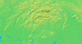
The municipality lies at an altitude of 135 metres and covers an area of 12.759 km².
Population
According to the 2011 census, the municipality had 2,442 inhabitants. 1,795 of inhabitants were Slovaks, 429 Roma and 218 others and unspecified.[1]
See also
References
Genealogical resources
The records for genealogical research are available at the state archive "Statny Archiv in Presov, Slovakia"
- Roman Catholic church records (births/marriages/deaths): 1769-1910 (parish B)
- Greek Catholic church records (births/marriages/deaths): 1796-1951 (parish B)
External links
This article is issued from Wikipedia - version of the 3/23/2016. The text is available under the Creative Commons Attribution/Share Alike but additional terms may apply for the media files.