Sterling Micropolitan Statistical Area
Map of the Sterling Micropolitan Statistical Area
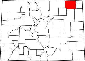
The Sterling Micropolitan Statistical Area is a United States Census Bureau defined Micropolitan Statistical Area located in the Sterling area of the State of Colorado. The Sterling Micropolitan Statistical Area is defined as Logan County, Colorado. The Micropolitan Statistical Area had a population of 20,504 at the 2000 Census. A July 1, 2009 U.S. Census Bureau estimate placed the population at 20,772.[1]
The Sterling Micropolitan Statistical Area includes the City of Sterling, the Town of Crook, the Town of Fleming, the Town of Iliff, the Town of Merino, the Town of Peetz, and the unincorporated areas of Logan County.
See also
- Summit County, Colorado
- Colorado census statistical areas
- Colorado metropolitan areas
- Combined Statistical Area
- Core Based Statistical Area
- Metropolitan Statistical Area
- Micropolitan Statistical Area
- Table of United States Combined Statistical Areas
- Table of United States Metropolitan Statistical Areas
- Table of United States Micropolitan Statistical Areas
- Table of United States primary census statistical areas
- Census statistical areas adjacent to the Sterling Micropolitan Statistical Area:
References
- ↑ "Table 1. Annual Estimates of the Population of Metropolitan and Micropolitan Statistical Areas: April 1, 2000 to July 1, 2009 (CBSA-EST2009-01)" (CSV). 2009 Population Estimates. United States Census Bureau, Population Division. 2010-03-23. Retrieved 2010-03-28.

Coordinates: 40°44′N 103°07′W / 40.73°N 103.11°W
This article is issued from Wikipedia - version of the 12/27/2013. The text is available under the Creative Commons Attribution/Share Alike but additional terms may apply for the media files.