Colorado State Highway 151
| ||||
|---|---|---|---|---|
|
Map of southwestern Colorado with SH 151 highlighted in red | ||||
| Route information | ||||
| Maintained by CDOT | ||||
| Length: | 33.9 mi[1] (54.6 km) | |||
| Major junctions | ||||
| West end: |
| |||
| East end: |
| |||
| Location | ||||
| Counties: | Archuleta, La Plata | |||
| Highway system | ||||
|
Colorado State Highways
| ||||

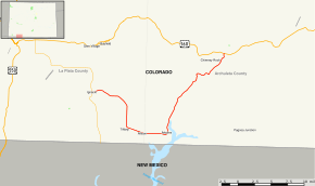
State Highway 151 (SH 151) is a 33.9 miles (54.6 km) state highway in far southern Colorado.
Route description
SH 151 begins in the west at its junction with State Highway 172 in Ignacio on the Southern Ute Indian Reservation. From there, the road proceeds generally eastward with a southern arc past Allison and through Arboles. The route then turns to the northeast passing near Navajo State Park and across the Piedra River. 25.7 mi (41.4 km) from its western end at Ignacio, SH 151 enters San Juan National Forest through which it continues to its eastern endpoint at U.S. Highway 160 roughly six miles east of Chimney Rock.
Major intersections
| County | Location | mi | km | Destinations | Notes |
|---|---|---|---|---|---|
| La Plata | Ignacio | 0.000 | 0.000 | West end of route | |
| Archuleta | | 33.960 | 54.653 | East end of route | |
| 1.000 mi = 1.609 km; 1.000 km = 0.621 mi | |||||
References
- ↑ "Segment Descriptions for Highway 151". Colorado Department of Transportation. Retrieved 2008-03-27.
External links
This article is issued from Wikipedia - version of the 7/10/2016. The text is available under the Creative Commons Attribution/Share Alike but additional terms may apply for the media files.