Whyalla - Cowleds Landing Aquatic Reserve
| Whyalla-Cowleds Landing Aquatic Reserve South Australia | |
|---|---|
|
IUCN category II (national park) | |
 Whyalla-Cowleds Landing Aquatic Reserve | |
| Nearest town or city | Whyalla |
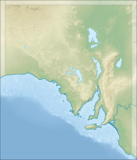
| Coordinates | 33°07′37″S 137°30′21″E / 33.1269°S 137.5059°ECoordinates: 33°07′37″S 137°30′21″E / 33.1269°S 137.5059°E |
| Established | 28 June 1984[1] |
| Area | 36.48 km2 (14.1 sq mi)[2] |
| Managing authorities | Primary Industries and Resources South Australia (PIRSA) |
| Footnotes |
Coordinates[2] Nearest town[1] |
| See also | Protected areas of South Australia |
Whyalla-Cowleds Landing Aquatic Reserve is a marine protected area in the Australian state of South Australia located in the waters of Spencer Gulf adjoining the east coast of Eyre Peninsula including land in the suburbs of Cowleds Landing and Middleback Range which is subject to tidal inundation.[3][4] It was declared in 1984 to protect “the mangrove-seagrass communities and associated fish nursery areas.”[3]
Since 2012, it has been located within the boundaries of a ‘sanctuary zone’ in the Upper Spencer Gulf Marine Park.[5]
The aquatic reserve is classified as an IUCN Category II protected area.[2]
See also
References
- 1 2 "Search result for " Whyalla - Cowleds Landing Aquatic Reserve '" (Record no. SA0037679) with the following layers selected - "Suburbs and Localities" and " Place names (gazetteer)"". Property Location Browser. Government of South Australia. Retrieved 9 October 2016.
- 1 2 3 "Collaborative Australian Protected Area Database (CAPAD) - Marine Protected Areas in coastal waters of South Australia (refer "DETAIL' tab)". Australian Government, Department of the Environment (DoE). Retrieved 11 April 2016.
- 1 2 Primary Industries and Regions South Australia (PIRSA) (2007), Aquatic Reserve: Whyalla – Cowleds Landing (PDF), Primary Industries and Regions South Australia, archived from the original (PDF) on 6 October 2014
- ↑ "Search result for " Whyalla - Cowleds Landing Aquatic Reserve '" with the following databases selected - "Suburbs and Localities" and "Aquatic Reserves"". Location SA Viewer. Government of South Australia. Retrieved 9 October 2016.
- ↑ "Upper Spencer Gulf Marine Park Management Plan 2012" (PDF). Department of Environment, Water and Natural Resources (DEWNR). pp. 3, 11, 29, 31, 32 and 33. Retrieved 9 October 2016.
External links
This article is issued from Wikipedia - version of the 10/9/2016. The text is available under the Creative Commons Attribution/Share Alike but additional terms may apply for the media files.