Voll, Møre og Romsdal
| Voll herad | |
|---|---|
| Former Municipality | |
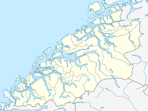 Voll herad Location in Møre og Romsdal | |
| Coordinates: 62°32′05″N 07°26′33″E / 62.53472°N 7.44250°ECoordinates: 62°32′05″N 07°26′33″E / 62.53472°N 7.44250°E | |
| Country | Norway |
| Region | Western Norway |
| County | Møre og Romsdal |
| District | Romsdal |
| Municipality ID | NO-1523 |
| Adm. Center | Voll |
| Area[1] | |
| • Total | 260 km2 (100 sq mi) |
| Time zone | CET (UTC+01:00) |
| • Summer (DST) | CEST (UTC+02:00) |
| Created from | Eid og Voll in 1874 |
| Merged into | Rauma in 1964 |
Voll is a former municipality in Møre og Romsdal county, Norway. The municipality existed from 1874 until 1964. The 260-square-kilometre (100 sq mi) municipality encompassed the Måndalen and Innfjorden valleys west of the Romsdalsfjorden in the west-central part of the present-day Rauma Municipality. The administrative centre of the village was the village of Voll which is also where the main Voll Church is located.
History
The municipality of Voll was established on 1 January 1874 when the old municipality of Eid og Voll was divided into the municipalities of Eid and Voll. Voll had an initial population of 695. On 1 January 1965, Voll was merged with the neighboring municipalities of Eid, Grytten, Hen, and part of Veøy to form the new Rauma Municipality. Before the merger, Voll had a population of 1,163.[1][2]
References
- 1 2 "Administrasjonshistorisk Oversyn for Rauma Kommune" (in Norwegian). Retrieved 2010-10-28.
- ↑ Jukvam, Dag (1999). "Historisk oversikt over endringer i kommune- og fylkesinndelingen" (PDF) (in Norwegian). Statistisk sentralbyrå.