Rahugh (civil parish)
| Rahugh Ráth Aodha | |
|---|---|
| Civil parish | |
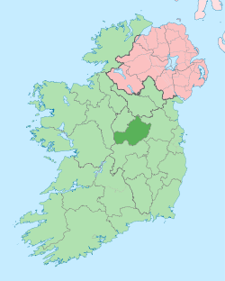
 Rahugh Location of Rahugh within County Westmeath in the Republic of Ireland | |
| Coordinates: 53°20′55″N 7°24′14″W / 53.34861°N 7.40389°WCoordinates: 53°20′55″N 7°24′14″W / 53.34861°N 7.40389°W | |
| Country |
|
| Province | Leinster |
| County | County Westmeath |
| Irish grid reference | N397332 |
Rahugh (Irish: Ráth Aodha) [1] is a civil parish in County Westmeath, Ireland. It is located about 20 kilometres (12 mi) south–south–west of Mullingar.
Rahugh is one of 8 civil parishes in the barony of Moycashel in the Province of Leinster. The civil parish covers 4,987.5 acres (20.184 km2).
Rahugh civil parish comprises 12 townlands: Ardan, Atticonor, Cappanrush, Garryduff, Kiltober, Lowertown, Monasset, Montrath, Pallasboy, Rahugh, Rossbeg and Sonnagh.
The neighbouring civil parishes are: Newtown to the north, Kilclonfert (County Offaly) to the east, Ballycommon (County Offaly) to the south and Durrow and Kilbeggan to the west.[2][3] The local GAA team for the residents of Rahugh is Tyrrellspass, a neighbouring village.
References
- ↑ Rahugh civil parish The Placenames Database of Ireland. Retrieved on 17 July 2015.
- ↑ Rahugh civil parish, Co. Westmeath townlands.ie Retrieved on 17 July 2015.
- ↑ Rahugh civil parish, Co. Westmeath The IreAtlas Townland Data Base. Retrieved on 17 July 2015.
External links
- Rahugh civil parish at the IreAtlas Townland Data Base
- Rahugh civil parish at townlands.ie
- Rahugh civil parish at The Placenames Database of Ireland