National Register of Historic Places listings in Perkins County, South Dakota
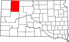
Location of Perkins County in South Dakota
This is a list of the National Register of Historic Places listings in Perkins County, South Dakota.
This is intended to be a complete list of the properties and districts on the National Register of Historic Places in Perkins County, South Dakota, United States. The locations of National Register properties and districts for which the latitude and longitude coordinates are included below, may be seen in a map.[1]
There are 19 properties and districts listed on the National Register in the county. Another property was once listed but has since been removed.
- This National Park Service list is complete through NPS recent listings posted December 2, 2016.[2]
Current listings
| [3] |
Name on the Register[4] |
Image |
Date listed[5] |
Location |
City or town |
Description |
|---|
| 1 |
Donald Beckon Ranch |
Upload image |
000000001987-04-10-0000April 10, 1987
(#87000551) |
6 miles southeast of Zeona
45°08′03″N 102°53′33″W / 45.134167°N 102.8925°W / 45.134167; -102.8925 (Donald Beckon Ranch) |
Zeona |
|
| 2 |
Bethany United Methodist Church |
Upload image |
000000001987-04-10-0000April 10, 1987
(#87000559) |
9.5 miles west of Lodgepole
45°48′17″N 102°49′13″W / 45.804722°N 102.820278°W / 45.804722; -102.820278 (Bethany United Methodist Church) |
Lodgepole |
|
| 3 |
Carr No. 60 School |
Upload image |
000000001987-04-10-0000April 10, 1987
(#87000560) |
12 miles southeast of Lodgepole
45°43′05″N 102°31′05″W / 45.718056°N 102.518056°W / 45.718056; -102.518056 (Carr No. 60 School) |
Lodgepole |
|
| 4 |
Anna Carr Homestead |
Upload image |
000000001978-01-20-0000January 20, 1978
(#78002566) |
Off Highway 20
45°31′36″N 102°28′10″W / 45.526667°N 102.469444°W / 45.526667; -102.469444 (Anna Carr Homestead) |
Bison |
|
| 5 |
Duck Creek Lutheran Church and Cemetery |
Upload image |
000000001987-04-10-0000April 10, 1987
(#87000561) |
7 miles southwest of Lodgepole along Duck Creek
45°46′33″N 102°46′37″W / 45.775833°N 102.776944°W / 45.775833; -102.776944 (Duck Creek Lutheran Church and Cemetery) |
Lodgepole |
|
| 6 |
Foster Ranch House |
Upload image |
000000001987-04-10-0000April 10, 1987
(#87000557) |
4 miles east of Highway 79
45°20′09″N 102°06′32″W / 45.335833°N 102.108889°W / 45.335833; -102.108889 (Foster Ranch House) |
Chance |
|
| 7 |
Golden Rule Department Store |
Upload image |
000000001976-12-12-0000December 12, 1976
(#76001752) |
201-203 Main St.
45°56′24″N 102°09′20″W / 45.94°N 102.155556°W / 45.94; -102.155556 (Golden Rule Department Store) |
Lemmon |
|
| 8 |
L.F. Harriman House |
Upload image |
000000001976-12-12-0000December 12, 1976
(#76001753) |
111 2nd Ave., W.
45°56′39″N 102°09′43″W / 45.944167°N 102.161944°W / 45.944167; -102.161944 (L.F. Harriman House) |
Lemmon |
|
| 9 |
Immanuel Lutheran Church |
Upload image |
000000001987-04-10-0000April 10, 1987
(#87000555) |
15 miles north of Mud Butte and U.S. Route 212 on gravel county road
45°11′38″N 102°55′04″W / 45.193889°N 102.917778°W / 45.193889; -102.917778 (Immanuel Lutheran Church) |
Zeona |
|
| 10 |
Lemmon Petrified Park |
|
000000001977-11-21-0000November 21, 1977
(#77001254) |
Off U.S. Route 12
45°56′15″N 102°09′04″W / 45.9375°N 102.151111°W / 45.9375; -102.151111 (Lemmon Petrified Park) |
Lemmon |
|
| 11 |
G.E. Lemmon House |
Upload image |
000000001976-12-12-0000December 12, 1976
(#76001754) |
507 3rd Ave., W.
45°56′21″N 102°09′43″W / 45.939167°N 102.161944°W / 45.939167; -102.161944 (G.E. Lemmon House) |
Lemmon |
|
| 12 |
Ole Quamman House |
Upload image |
000000002015-01-21-0000January 21, 2015
(#14001188) |
400 2nd Ave.
Coordinates missing |
Lemmon |
|
| 13 |
Richards Cabins |
Upload image |
000000002003-02-05-0000February 5, 2003
(#02001769) |
16901 Moreau R Rd.
45°09′40″N 102°40′14″W / 45.161111°N 102.670556°W / 45.161111; -102.670556 (Richards Cabins) |
Faith |
|
| 14 |
Rockford No. 40 School |
Upload image |
000000001987-04-10-0000April 10, 1987
(#87000549) |
15 miles northeast of Bison
45°52′09″N 102°21′17″W / 45.869167°N 102.354722°W / 45.869167; -102.354722 (Rockford No. 40 School) |
Bison |
|
| 15 |
Sittner Farm |
Upload image |
000000002008-02-19-0000February 19, 2008
(#08000055) |
RR T18N R15E S5&6
45°33′27″N 102°19′01″W / 45.5575°N 102.316944°W / 45.5575; -102.316944 (Sittner Farm) |
Meadow |
|
| 16 |
Sorum Cooperative Store |
Upload image |
000000001987-04-10-0000April 10, 1987
(#87000556) |
Main St.
45°54′22″N 102°55′15″W / 45.906111°N 102.920833°W / 45.906111; -102.920833 (Sorum Cooperative Store) |
Sorum |
|
| 17 |
Sorum Hotel |
Upload image |
000000001987-04-10-0000April 10, 1987
(#87000552) |
Main St.
45°27′13″N 102°56′02″W / 45.453611°N 102.933889°W / 45.453611; -102.933889 (Sorum Hotel) |
Sorum |
|
| 18 |
Spring Creek School |
Upload image |
000000001987-04-10-0000April 10, 1987
(#87000554) |
1 mile east of Zeona
45°11′36″N 102°54′04″W / 45.193333°N 102.901111°W / 45.193333; -102.901111 (Spring Creek School) |
Zeona |
|
| 19 |
Thomas J. Veal Ranch |
Upload image |
000000001987-04-10-0000April 10, 1987
(#87000558) |
7 miles southeast of junction of Highways 20 and 73
45°24′40″N 102°16′51″W / 45.411111°N 102.280833°W / 45.411111; -102.280833 (Thomas J. Veal Ranch) |
Chance |
|
| [3] |
Name on the Register |
Image |
Date listed | Date removed |
Location |
City or town |
Summary |
|---|
| 1 |
South Dakota Department of Transportation Bridge No. 53-101-196 |
Upload image |
000000001999-11-19-0000November 19, 1999
(#99001341) | 000000002008-03-26-0000March 26, 2008 |
Local Road over South Fork Grand River
|
Bison |
|
See also
References
- ↑ The latitude and longitude information provided in this table was derived originally from the National Register Information System, which has been found to be fairly accurate for about 99% of listings. For about 1% of NRIS original coordinates, experience has shown that one or both coordinates are typos or otherwise extremely far off; some corrections may have been made. A more subtle problem causes many locations to be off by up to 150 yards, depending on location in the country: most NRIS coordinates were derived from tracing out latitude and longitudes off of USGS topographical quadrant maps created under the North American Datum of 1927, which differs from the current, highly accurate WGS84 GPS system used by most on-line maps. Chicago is about right, but NRIS longitudes in Washington are higher by about 4.5 seconds, and are lower by about 2.0 seconds in Maine. Latitudes differ by about 1.0 second in Florida. Some locations in this table may have been corrected to current GPS standards.
- ↑ "National Register of Historic Places: Weekly List Actions". National Park Service, United States Department of the Interior. Retrieved on December 2, 2016.
- 1 2 Numbers represent an ordering by significant words. Various colorings, defined here, differentiate National Historic Landmarks and historic districts from other NRHP buildings, structures, sites or objects.
- ↑ National Park Service (2008-04-24). "National Register Information System". National Register of Historic Places. National Park Service.
- ↑ The eight-digit number below each date is the number assigned to each location in the National Register Information System database, which can be viewed by clicking the number.
|
|---|
|
| Topics | |
|---|
|
| Lists by states | |
|---|
|
| Lists by insular areas | |
|---|
|
| Lists by associated states | |
|---|
|
| Other areas | |
|---|
|
-
 Portal Portal
-
 WikiProject WikiProject
|
|
|---|
|
|
|
| City | | |
|---|
|
| Town | |
|---|
|
| Townships |
- Ada
- Anderson
- Antelope
- Barrett
- Beck-Highland
- Bison
- Burdick
- Cash
- Castle Butte
- Chaudoin
- Clark
- De Witt
- Duell
- Englewood
- Flat Creek
- Flint Rock
- Foster
- Fredlund
- Glendo
- Grand River
- Hall
- Horse Creek
- Liberty
- Lincoln
- Lodgepole
- Lone Tree
- Maltby
- Marshfield
- Meadow
- Moreau
- Plateau
- Rainbow
- Rockford
- Scotch Cap
- Sidney
- Strool
- Trail
- Vail
- Vickers
- Viking
- Vrooman
- Wells
- White Butte
- Wilson
|
|---|
|
| CDP | |
|---|
|
Other
unincorporated
communities | |
|---|
|
| Ghost towns | |
|---|
