Maupertuis Bay
| Maupertuis Bay | |
|---|---|
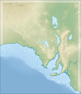 Maupertuis Bay Location in South Australia | |
| Location | Kangaroo Island, South Australia |
| Coordinates | 35°59′46″S 136°39′36″E / 35.996°S 136.66°ECoordinates: 35°59′46″S 136°39′36″E / 35.996°S 136.66°E[1] |
| Type | Bay |
| Primary inflows | Rocky River |
| Basin countries | Australia |
Maupertuis Bay (French: Baie Maupertuis) is a bay in the Australian state of South Australia located on the south-west of Kangaroo Island. The bay forms the mouth of Rocky River which rises from within a catchment located in both the Flinders Chase National Park and the Ravine des Casoars Wilderness Protection Area.[2]
Maupertuis Bay was named after mathematician and philosopher Pierre Louis Maupertuis by the French explorer Nicolas Baudin.[3]
On 24 April 1899, the Scottish barque Loch Sloy was shipwrecked off the coast from Maupertuis Bay[4] resulting in the death of all but three crew and passengers.
See also
References
- ↑ "Search result for " Maupertuis Bay (Bay)" (Record no. SA0043518) with the following layers selected - "Suburbs and Localities" and " Place names (gazetteer)"". Property Location Browser. Government of South Australia. Retrieved 13 September 2016.
- ↑ "Groundwater - surface water interactions on Kangaroo Island, Progress report 1: Rocky River shallow piezometer drilling program" (PDF). WaterConnect. Government of South Australia. p. 7. Retrieved 19 December 2015.
- ↑ "The discovery and exploration of Australia". australia for everyone. Retrieved 26 December 2015.
- ↑ "Wreck of the Loch Sloy". Sydney Morning Herald. 12 May 1899. Retrieved 26 December 2015.
| Major townships | |||||||||||||||
|---|---|---|---|---|---|---|---|---|---|---|---|---|---|---|---|
| Beaches | |||||||||||||||
| Coastal features |
| ||||||||||||||
| Protected areas |
| ||||||||||||||
| Islands adjacent to Kangaroo Island coast | |||||||||||||||
| Related and uncategorised | |||||||||||||||
| |||||||||||||||
Australian places named by French explorers in the 18th and 19th centuries | ||
|---|---|---|
| South Australia |
|  |
| Western Australia | ||
Only places with the name still in use in either the original or anglicised version are listed above. Many names have been anglicised; for these the original French name appears in brackets. | ||
This article is issued from Wikipedia - version of the 9/18/2016. The text is available under the Creative Commons Attribution/Share Alike but additional terms may apply for the media files.