List of Indiana state historical markers in LaPorte County
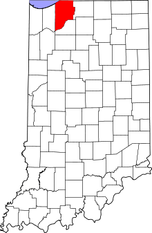
Location of LaPorte County in Indiana
This is a list of the Indiana state historical markers in LaPorte County.
This is intended to be a complete list of the official state historical markers placed in LaPorte County, Indiana, United States by the Indiana Historical Bureau. The locations of the historical markers and their latitude and longitude coordinates are included below when available, along with their names, years of placement, and topics as recorded by the Historical Bureau. There are 7 historical markers located in LaPorte County.[1]
Historical markers
| Marker title | Image | Year placed | Location | Topics |
|---|---|---|---|---|
| Civil War Camps[2] | 1962 | Junction of W. State Road 2 and Colfax Avenue in La Porte 41°36′1″N 86°44′19″W / 41.60028°N 86.73861°W |
Military | |
| Chicago-New York Electric Air Line Railroad[3] | 1995 | Junction of State Road 39 and County Road 250 south of La Porte 41°34′1″N 86°44′21.6″W / 41.56694°N 86.739333°W |
Transportation, Business, Industry, and Labor | |
| Camp Anderson[4] | 1996 | 2404 E. Michigan Boulevard in Michigan City 41°42′32.3″N 86°52′12″W / 41.708972°N 86.87000°W |
Military | |
| Indiana Territory Boundary Line[5] |  |
1999 | 213 Pine Lake Avenue in La Porte 41°37′0.6″N 86°43′58″W / 41.616833°N 86.73278°W |
Early Settlement and Exploration, Government Institutions |
| La Porte County Courthouse[6] |  |
2001 | 813 Lincolnway on the southeastern corner of the LaPorte County Courthouse lawn in La Porte 41°36′40″N 86°43′19″W / 41.61111°N 86.72194°W |
Government Institutions, Buildings and Architecture |
| La Porte's Carnegie Library[7] |  |
2002 | LaPorte County Public Library on the southwestern corner of the junction of 904 Indiana Avenue (U.S. Route 35) and Maple Avenue in La Porte 41°36′32″N 86°43′1.6″W / 41.60889°N 86.717111°W |
Carnegie Library, Buildings and Architecture |
| The Rumely Companies[8] |  |
2003 | Northwestern corner of the junction of Madison Street and Lincolnway in La Porte 41°36′36.5″N 86°43′25″W / 41.610139°N 86.72361°W |
Business, Industry, and Labor, Immigration and Ethnic Groups, Agriculture, Science, Medicine, and Inventions |
See also
- List of Indiana state historical markers
- National Register of Historic Places listings in LaPorte County, Indiana
References
- ↑ "Indiana Historical Markers by County". State of Indiana. Retrieved 2012-03-15.
- ↑ Civil War Camps, Indiana Historical Bureau, n.d. Accessed 2012-03-14.
- ↑ Chicago-New York Electric Air Line Railroad, Indiana Historical Bureau, n.d. Accessed 2012-03-14.
- ↑ Camp Anderson, Indiana Historical Bureau, n.d. Accessed 2012-03-14.
- ↑ Indiana Territory Boundary Line, Indiana Historical Bureau, n.d. Accessed 2012-03-14.
- ↑ La Porte County Courthouse, Indiana Historical Bureau, n.d. Accessed 2012-03-14.
- ↑ La Porte's Carnegie Library, Indiana Historical Bureau, n.d. Accessed 2012-03-14.
- ↑ The Rumely Companies, Indiana Historical Bureau, n.d. Accessed 2012-03-14.
External links
Municipalities and communities of LaPorte County, Indiana, United States | ||
|---|---|---|
| Cities | ||
| Towns | ||
| Townships | ||
| CDPs | ||
| Other unincorporated communities |
| |
| Footnotes | ‡This populated place also has portions in an adjacent county or counties | |
This article is issued from Wikipedia - version of the 8/9/2016. The text is available under the Creative Commons Attribution/Share Alike but additional terms may apply for the media files.