Fort Philip Long
|
Fort Philip Long | |
|
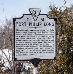
Fort Philip Long marker, February 2014 | |
  | |
| Location | Off VA 616 on Shenandoah River, near Stanley, Virginia |
|---|---|
| Coordinates | 38°36′20″N 78°33′44″W / 38.60556°N 78.56222°WCoordinates: 38°36′20″N 78°33′44″W / 38.60556°N 78.56222°W |
| Area | 900 acres (360 ha) |
| NRHP Reference # | 73002048[1] |
| VLR # | 069-0002 |
| Significant dates | |
| Added to NRHP | April 11, 1973 |
| Designated VLR | November 21, 1972[2] |
Fort Philip Long is a historic fort complex located on the Shenandoah River near Stanley, Page County, Virginia. It is a significant example of the fortifications undertaken by the families in the Massanutten country of Page County in the later half of the 18th century. It includes an 18th-century, 1 1/2-story, rubble limestone structure with a gable roof. It sits on an English basement and features a massive exterior asymmetrical stone chimney. The fort is situated about 100 yards from the stone dwelling. It consists of random rubble limestone walls that form a tall barrel vault pierced by loopholes. The fort may also be entered by means of a tunnel, sunk into the limestone, running from the basement of the stone house. Also on the property is a large brick three-bay square house built in 1856 and a stone slave quarter.[3]
It was listed on the National Register of Historic Places in 1973.[1]
References
- 1 2 National Park Service (2010-07-09). "National Register Information System". National Register of Historic Places. National Park Service.
- ↑ "Virginia Landmarks Register". Virginia Department of Historic Resources. Retrieved 5 June 2013.
- ↑ Virginia Historic Landmarks Commission Staff (October 1972). "National Register of Historic Places Inventory/Nomination: Fort Philip Long" (PDF). Virginia Department of Historic Resources. and Accompanying photo