Brown's Ferry vessel
|
BROWN'S FERRY VESSEL | |
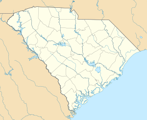  | |
| Nearest city | Columbia, South Carolina |
|---|---|
| Coordinates | 33°21′56″N 79°16′57″W / 33.36556°N 79.28250°WCoordinates: 33°21′56″N 79°16′57″W / 33.36556°N 79.28250°W |
| Area | 0.1 acres (0.040 ha) |
| Built | 1735 |
| Architectural style | Merchant Vessel |
| NRHP Reference # | 79002391[1] |
| Added to NRHP | May 18, 1979 |
The Brown's Ferry vessel is a shipwrecked colonial vessel. Based on an analysis of artifacts found on the wreck, it sank sometime between 1730 and 1740 in the Black River, near a place known as Brown's Ferry, which is in the general vicinity of Georgetown, South Carolina. The ship was apparently a merchant cargo vessel, and was not obviously associated with the ferry operation. At the time of its discovery, the wrecked vessel was judged to provide a unique view into the shipbuilding industry of the southern British colonies of North America. The ship was more than 50 feet (15 m) in length and 14 feet (4.3 m) wide. It had a 3-foot (0.91 m) hold, a draft of 2'10", and an estimated capacity of 30 tons. It was built of oak, pine, and cypress planking. She had a flat bottom and no keel. When she sank her principal cargo was a load of bricks.[2]
The vessel was excavated and raised in 1976,[2] and was listed on the National Register of Historic Places in 1979.[1] It is now on display at the Rice Museum in Georgetown.
See also
References
- 1 2 National Park Service (2010-07-09). "National Register Information System". National Register of Historic Places. National Park Service.
- 1 2 "NRHP nomination for Brown's Ferry vessel" (PDF). South Carolina SHPO. Retrieved 2014-08-29.
| Topics |   | |
|---|---|---|
| Lists by county |
| |
| Lists by city | ||
| Other lists | ||