Bremanger (village)
| Bremanger | |
|---|---|
| Village | |
|
View of the village (on the shoreline in the far background) | |
 Bremanger  Bremanger Location in Sogn og Fjordane county | |
| Coordinates: 61°50′22″N 04°59′22″E / 61.83944°N 4.98944°ECoordinates: 61°50′22″N 04°59′22″E / 61.83944°N 4.98944°E | |
| Country | Norway |
| Region | Western Norway |
| County | Sogn og Fjordane |
| District | Nordfjord |
| Municipality | Bremanger Municipality |
| Area[1] | |
| • Total | 0.6 km2 (0.2 sq mi) |
| Elevation[2] | 4 m (13 ft) |
| Population (2013)[1] | |
| • Total | 441 |
| • Density | 735/km2 (1,900/sq mi) |
| Time zone | CET (UTC+01:00) |
| • Summer (DST) | CEST (UTC+02:00) |
| Post Code | 6727 Bremanger |

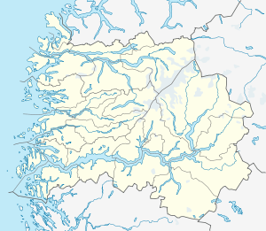
Bremanger is a village in Bremanger Municipality in Sogn og Fjordane county, Norway. The village is located along the Bremangerpollen bay on the western side of the Bremangerlandet island. The 0.6-square-kilometre (150-acre) village has a population (2013) of 441, giving the village a population density of 735 inhabitants per square kilometre (1,900/sq mi).[1][3]
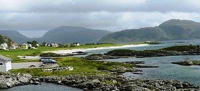
The village sits along the shore with steep mountains on one side and the ocean on the other. The lake Dalevatnet sits on the north side of the village. Bremanger Church is located in the village, serving the western part of the island. The village has been home to a church since the middle ages. On the western end of the village lies the Grotlesanden beach area, a picturesque white sand beach.
References
- 1 2 3 Statistisk sentralbyrå (1 January 2013). "Urban settlements. Population and area, by municipality.".
- ↑ "Bremanger" (in Norwegian). yr.no. Retrieved 2013-10-30.
- ↑ Store norske leksikon. "Bremanger tettsted i Bremanger kommune" (in Norwegian). Retrieved 2013-10-30.